Data Proves Valuable in Assessing the Damage
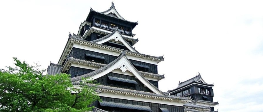
The ground in Kumamoto Prefecture began to quake early on April 16, 2016. Then, a sequence of earthquakes with magnitudes up to 7.0 rattled the land, destroying homes and buildings. When the tremors receded, Kumamoto Castle, rebuilt in 1960, had been severely damaged.
While the castle itself escaped the earthquake with minimal structural damage, it was soon revealed that two of the castle’s keep towers had partially collapsed. In addition, several of the keeps’ outside walls had also fallen, and many roof tiles crashed to the ground.
The first stage in restoration and repair is site documentation, but this can be a huge challenge when it comes to historic structures. The relative inaccessibility of the most damaged parts and the vast expanse of the Castle and gardens made assessing the state of the site and documenting damaged regions particularly difficult.
While engineers took countless images of the damage within the castle on each visit to the site, they discovered gaps in what they had collected when they returned to the office. Cameras would not be enough for Junichi Tashiro, Chief Examiner, Kumamoto Castle General Office.
3D Laser Scanning Services Reveal Extent of the Damage
After initial assessments revealed the depth of the damage, KKE experts realized that a different strategy was required, and they advocated deploying NavVis reality capture technology which involves the 3D scanning service for damage assessment right away.
Furthermore, the researchers anticipated that 3D laser scanning services might play a significant role in the repair process. KKE could now capture the damage within the keep with a 360-degree scanner and visualize the data as 3D panoramic photos and point clouds using 3D scanning services.
KKE’s team used NavVis mobile mapping technology to conduct two scans; viewing and sharing data via NavVis IndoorViewer. The initial scanning operation was completed in September 2016 and documented the damage before maintenance crews began removal work. When the interior destruction began in earnest in April 2017, KKE returned with a NavVis 3D scanning service to take another photo.
A site visit is easy to undertake with new construction or even as-built facilities. However, documenting challenging places requires time and money, and can even be dangerous. Inspecting sections that lack related images or drawings can be difficult. A 3D laser scan can reduce the need for frequent site visits and provide a fuller picture of visuals for better understanding.
The data collected with the NavVis 3D scanning service was very helpful in compiling the damage reports. Mr. Kakuta (KKE) commented that a digital twin of the castle keep before the 2016 earthquake would have made the rebuilding process more efficient.