As an architect, engineer, contractor, or facility manager, you understand how critical it is to have reliable data before making design or construction decisions. At Arrival 3D, we specialize in delivering high-precision 3D laser scanning, LiDAR capture, and Scan-to-BIM services that help you move projects forward with confidence.
With over 20 years of experience, our team supports professionals like you by capturing accurate existing conditions—so you can reduce change orders, avoid site revisits, and minimize costly delays. Whether you’re planning a renovation, managing assets, or coordinating a large-scale infrastructure build, we provide detailed point clouds, BIM LOD 500 models, 2D drawings, digital twins, and as-built documentation tailored to your scope.
We’ve partnered with clients across the AEC industry, as well as in manufacturing, oil and gas, healthcare, education, and aerospace. From substations and wind farms to historical preservation and university campuses, our work helps streamline coordination, improve safety, and boost project efficiency.
Based in Philadelphia, PA, and serving nationwide, Arrival 3D is here to support your next project with the accuracy, speed, and reliability you need.
Arrival helps you get the complete picture down to the last detail with comprehensive solutions which are designed to take the guesswork out of the project.

We provide reliable long-range 3D laser scanning to professionals across the United States suitable to each project's specific demands.
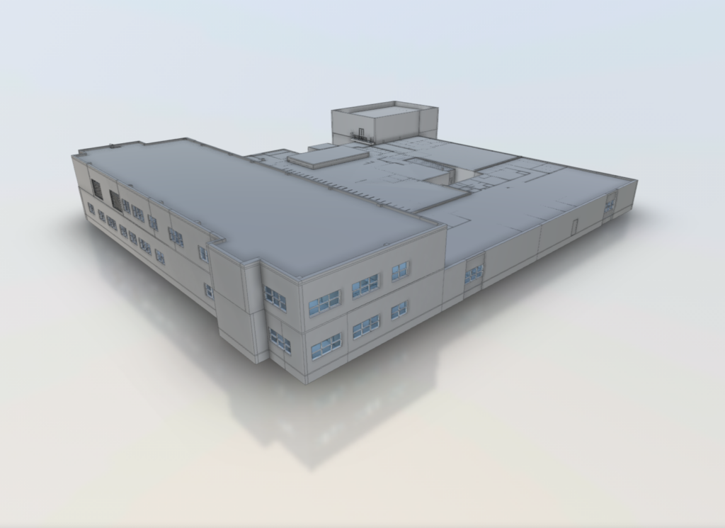
We provide precise digital reproductions of your facilities to improve as-built documentation, design collaboration and visualisation.
We help you save money and fulfil deadlines by decreasing errors, preventing rework and streamlining planning.
We do understand the local regulations, workflows and site conditions ensuring perfection and less headaches.
Let’s unlock your building project’s full potential with our top-tier 3D laser scanning services. By sharing the key details below, we can bring your vision to life while ensuring precision and efficiency at every stage!
Getting started is simple and it all starts with a discussion. We handle the technical side with precision and attention and here’s how the process works:
We’ll contact you to discuss your project’s goals, timing, and any existing documentation such as CAD files or as-builts to help us define the scope and plan the scan efficiently.
You give access information and safety regulations then we ensure our team is prepared to scan without affecting your production.
We use modern LiDAR technology to record every feature of your site with pinpoint accuracy.
We convert raw scan data into clean point clouds, BIM models, CAD drawings and floor plans according to your specifications.
We deliver your finished assets on time which is ready for integration into your design, construction or facility operations.


Arrival 3D is the leading provider of 3D laser scanning services in Philadelphia, Massachusetts, delivering unmatched accuracy and expertise on every project. Our highly trained Project Managers use state-of-the-art equipment, including the Leica Scan Station P-Series and Leica RTC360 3D laser scanners, capable of capturing up to 2 million data points per second with 2–4 millimeters of precision.
Each Project Manager undergoes the most comprehensive training program in the industry, including 80 hours of hands-on classroom instruction, 320 hours of field mentorship, and an additional 40 hours of specialized LiDAR training. This extensive preparation ensures our team has both the technical knowledge and field experience to provide accurate, dependable data for planning, design, and construction workflows.

We are trusted by industry leaders because we have proven ourselves throughout projects by focusing on desired results.

")
")
")

Arrival 3D’s Laser Scanning Services bring the following benefits to your project:
