High-Precision Aerial LiDAR Mapping for Large-Scale Projects
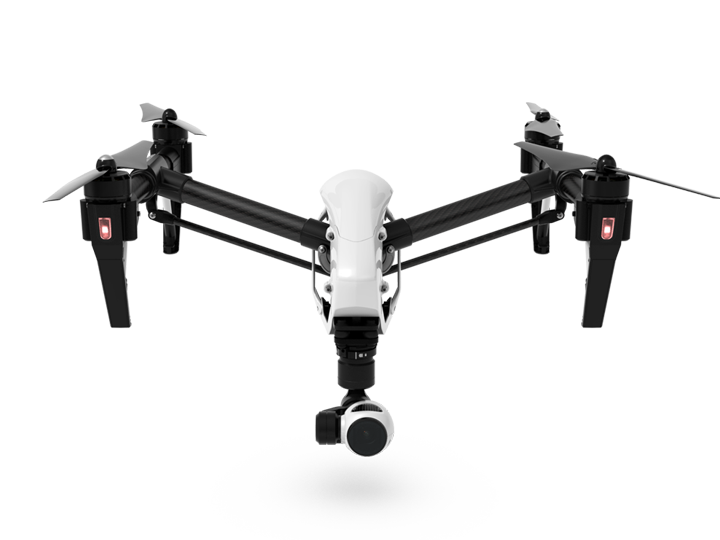
Aerial 3D Laser Scanning Services Using Drones
3D Mapping & Aerial Drones
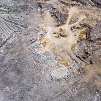
At Arrival 3D, we offer cutting-edge aerial 3D laser scanning services using drones, providing rapid, accurate, and cost-effective data collection for expansive or hard-to-reach areas. By combining high-resolution LiDAR sensors with drone-mounted platforms, we deliver geospatial data at scale—ideal for construction sites, land development, infrastructure inspection, and environmental monitoring.
Whether you’re mapping a utility corridor, assessing a remote industrial site, or conducting a topographic survey over hundreds of acres, our drone-based scanning solutions give you the data needed to plan with precision and confidence.
With just one flight from the drone, we can produce an impressive amount of data:
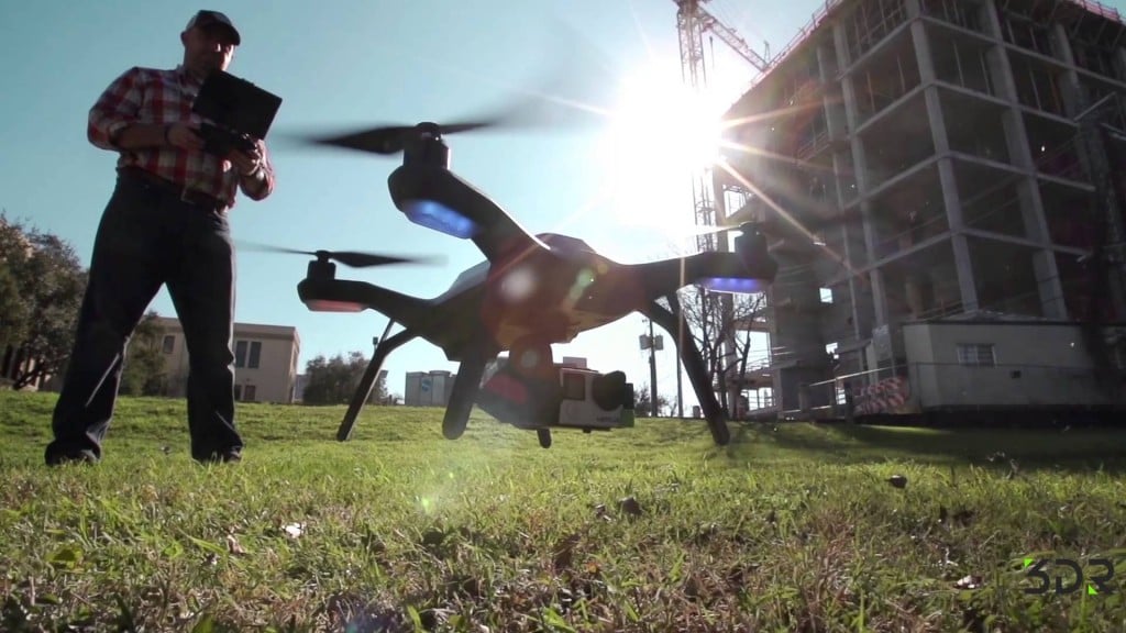
Aerial Accessibility: Drones enable scanning of hard-to-reach or hazardous areas safely and efficiently, without the need for scaffolding or lifts.
Time Efficiency: Drone-based scanning significantly reduces the time required to map large areas compared to traditional methods.
Large-Scale Coverage: Perfect for capturing data over expansive outdoor environments like construction sites, landscapes, and infrastructure projects.
Enhanced Perspective: Provides an aerial view that adds valuable context to the 3D models, offering insights that ground-based scanning alone might miss.
Versatility: Capable of rapid deployment in various conditions, making it adaptable to diverse project requirements and objectives.
Cost-Effectiveness: Reduces labor costs and minimizes disruptions by speeding up the data collection process.
High-Resolution Data: Captures detailed imagery and point clouds that enhance the accuracy of the resulting digital representations.
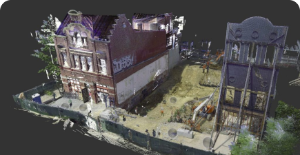
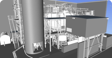
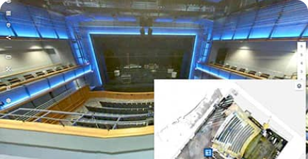
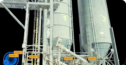
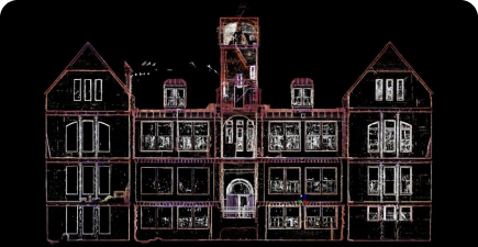
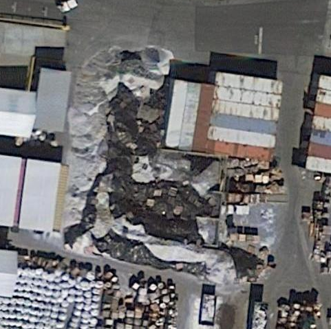
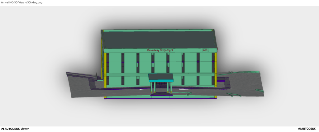
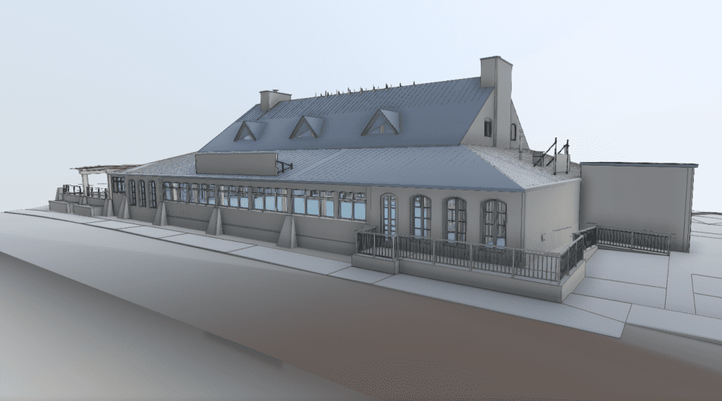
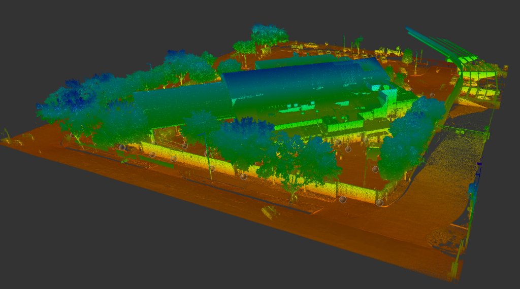
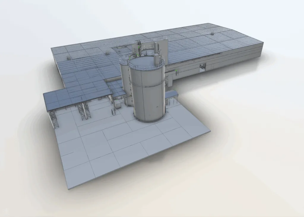
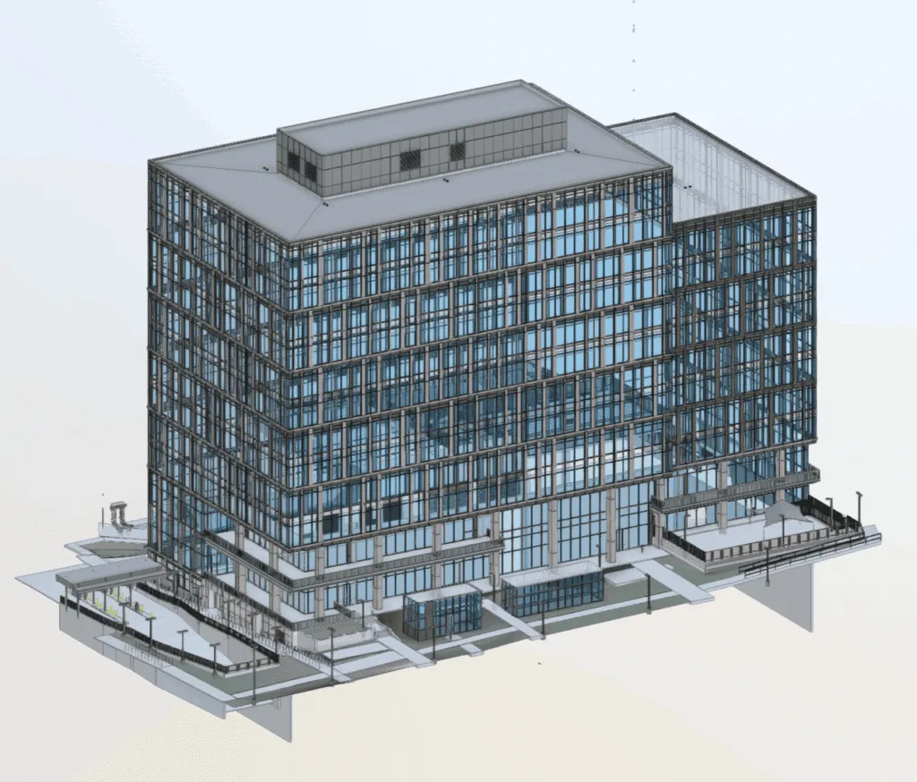
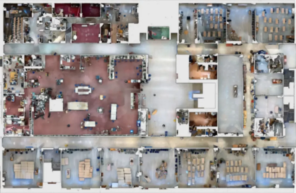
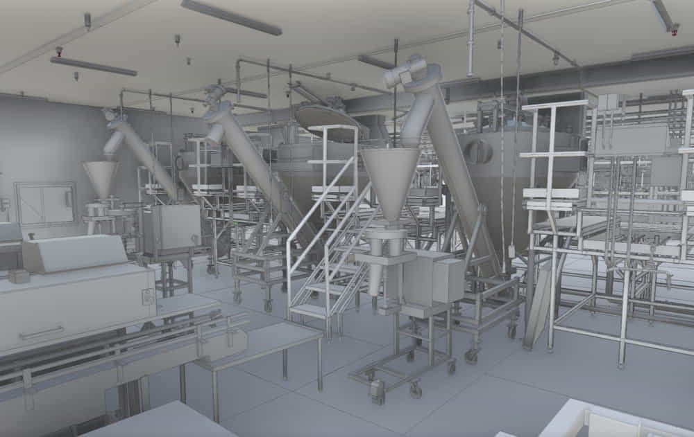
3D Scanning Samples
Our Latest Aerial 3D laser Scanning Projects
Commercial
3D Laser Scanning Project at The Territory in Duncan, Oklahoma
“My company has used Arrival on several occasions. Arrival came to our remote job site a couple times, bringing their equipment with them. I am enthusiastic about their capabilities and service.”
"I called Arrival 3D while working a unique project. They were very professional and knowledgeable. My contact was very thorough and patient with me in explaining the process. Their services were the first step of a very important project and they made me look good. I highly recommend this company."
“I have used Arrival 3D for many projects over the last several years. A great group to work with. I can always count on them to get the work completed on time and on budget.”
“I had Arrival 3D laser scan two properties that are going into the architectural design phase. They produced LOD 300 models for both project that were excellent. Scheduling was easy and the 3 week turnaround was fast. I look forward to using them on many more development projects.”
"Lanny and his team responded quickly and efficient to our request. They were on-time, clearly communicated with us whenever we had questions and ultimately delivered a great product. We really appreciate their effort and look forward to working with them in the future."
"Working with Lanny @ Arrival 3D was a great experience. He was extremely friendly and very responsive. The turn around time on his work was fantastic. In terms of pricing for the work, I would say that it was extremely reasonable, and the results were amazing. I did my research, and out of all the companies I researched Arrival offered the best services for the price."
FAQ
Connect with our professional team today! Fill out your information below, and let us tailor a 3D scanning solution specifically for your project’s unique needs.
What is aerial drone 3D scanning?
Aerial drone 3D scanning is a technology that uses drones equipped with LiDAR or photogrammetry sensors to capture precise 3D data of landscapes, buildings, and infrastructure for mapping and analysis.
What industries benefit from aerial drone 3D scanning?
Industries such as construction, engineering, real estate, mining, environmental monitoring, and infrastructure development benefit from drone-based 3D scanning services.
How accurate is drone 3D scanning?
Our high-resolution drone scanning solutions provide accuracy within centimeters, making them ideal for detailed mapping, inspections, and CAD modeling.
Is aerial drone scanning cost-effective?
Yes! Compared to traditional surveying methods, drone scanning reduces labor costs, equipment expenses, and time spent on manual measurements.
Can aerial scanning be used for large-scale projects?
Absolutely! Our drone scanning technology is scalable and can be applied to projects ranging from small construction sites to large industrial or agricultural lands.
How does aerial 3D scanning improve project efficiency?
By automating data collection, reducing survey time, and eliminating manual labor risks, aerial 3D scanning accelerates workflows and enhances accuracy.
Elevate Your Project’s Success
At Arrival 3D, we provide highly accurate digital representations of buildings for architects, builders, engineers, and developers. Our Scan to BIM and Asset Tagging solutions ensure precision, clarity, and efficiency, delivering point clouds, 2D CAD drawings, and Revit models for seamless project execution.