Detecting danger with 3D Laser Scanning services
It is always good to be ready for a disaster. Most of us buy insurance for that reason. If your car gets smashed, if your house burns down, or if someone breaks in and steals money out of your safe, insurance can it back for you. That works for money, but when it comes to guaranteeing safety, insurance is not enough. A house or a car is not a life. People are kept safe, not by buying an insurance policy, but by proactively looking for potential dangers and doing something about them. Natural disasters are one of those potential dangers. Many problems can happen when flooding comes after a long dry season. It is therefore necessary to look for faulty natural and manmade structures. This can be done using 3D laser scanning services.
Why wait till it’s too late?
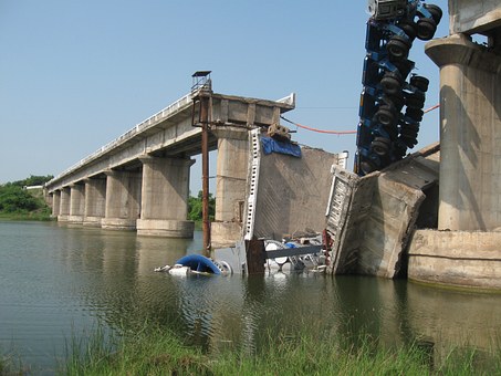
The truth is that most things fail because we assume that they are structurally sound. Would people drive over a bridge that they knew was going to collapse. In 2016, the May Avenue bridge in Oklahoma City collapsed on one mid-day. No one saw it coming. Maybe something could have been done. Maybe 3D laser scanning services could detected a problem before disaster strikes. Recently Spencer Dam collapsed after some flooding in Oklahoma. This is another example of looking reasons why a disaster after it was too late. 3D laser scanning services could have possibly given clues that would have shown the weakness of the structure before disaster hit.
Be proactive with 3D laser scanning services
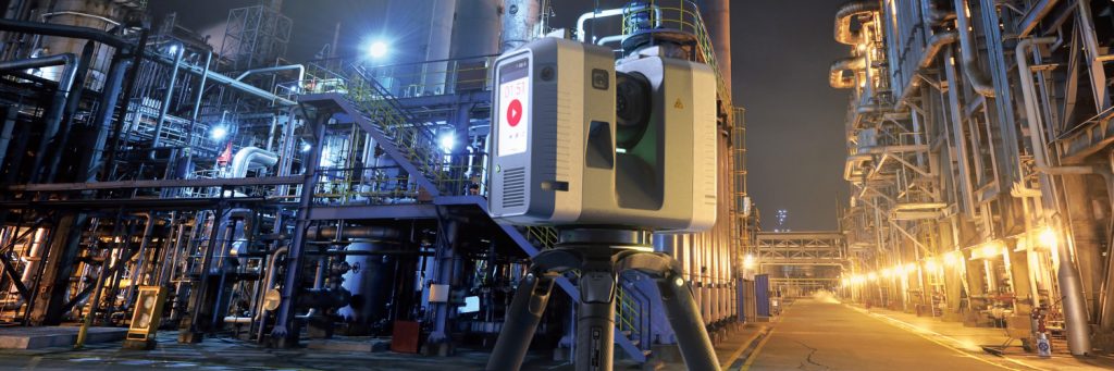
It is time to be proactive in protecting ourselves from tragedies caused by natural disasters now that we have technology that can help us do that. 3D laser scanning services is a powerful way to analyze natural and manmade structures. A 3D laser scanner works like a super-fast camera. It can take up to a hundred thousand shots every second. When I say shots, I means point of reference. The 3D laser scanner works by triangulating light waves reflecting off of an object back to a sensor on the scanner. Each measurement is recorded as a point in space. When all of those points are put together, they form a point cloud which is a digital representation of the object. A digital image of a large area with an accuracy of 2mm can be captured using a device, like a Leica P40 ScanStation. This allows engineers and scientists to collect data from bridges, cliffs, dams, shorelines, piers, and many other structures. Once that data is captured, it can be analyzed later to determine if there is a potential danger that needs addressed.
We should be using this technology to be more proactive about catching problems before they happen. Analyzing many scans over a period of time might just tell us what we need to know to save some lives if a flood were to hit. The problem is that most of us don’t think about it until it is too late. There is no reason for such an attitude when there is such an easy solution with 3D laser scanning services.