Infrastructure projects require accuracy, safety, and speed. From bridges and highways to rail corridors and public utilities, engineers and contractors need reliable existing conditions data to plan upgrades, repairs, and expansions.
Arrival 3D provides high-accuracy 3D laser scanning services for infrastructure nationwide, delivering precise point clouds, as-built documentation, and Scan-to-BIM models that support smarter planning and long-term asset management.
Accurate Reality Capture for Critical Infrastructure
Infrastructure environments are complex, large-scale, and often active during construction. Traditional surveys can be slow, unsafe, and incomplete.
Our LiDAR-based laser scanning captures:
Roads, bridges, tunnels, and corridors
Structural geometry and elevation details
Utilities and surrounding conditions
High-resolution digital documentation
This ensures infrastructure teams can design and build with confidence.

Laser scanning provides unmatched accuracy for public and civil projects.
Key Benefits Include:
✅ Rapid Data Capture Over Large Areas
Scan highways, rail lines, and bridge structures efficiently.
✅ Improve Safety in High-Risk Zones
Reduce time in traffic corridors, elevated structures, or active sites.
✅ Prevent Costly Construction Errors
Accurate as-builts minimize change orders and surprises.
✅ Support Renovation, Expansion, and Rehabilitation
Perfect for aging infrastructure modernization.
✅ Better Coordination Across Civil & MEP Teams
Integrates seamlessly with CAD and BIM workflows.
Arrival 3D delivers engineering-ready datasets for infrastructure planning and design.
Registered LiDAR Point Clouds (RCP / E57)
2D Civil Base Plans and As-Built Drawings (DWG/PDF)
Bridge and Tunnel Section Documentation
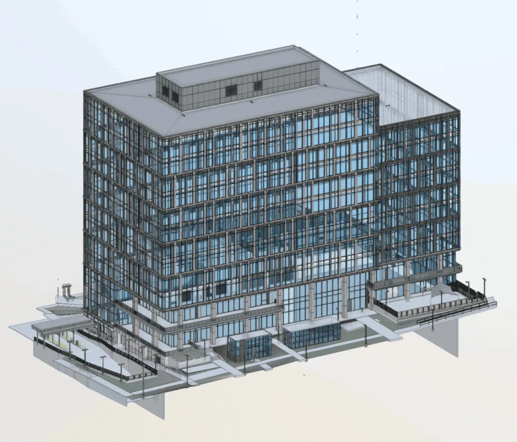
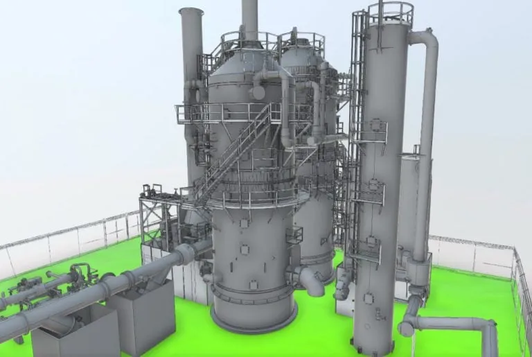
Scan-to-BIM Models for Infrastructure Assets
Utility and Corridor Mapping Support
Digital Twin Models for Lifecycle Management
Surface and Structural Deviation Analysis
Our Scan-to-BIM services transform laser scan data into intelligent models that infrastructure teams use for:
Bridge rehabilitation planning
Tunnel clearance analysis
Transportation facility upgrades
Utility corridor coordination
Long-term asset documentation
Arrival 3D produces models aligned with required LOD and project standards.


Arrival 3D is trusted across the U.S. for large-scale scanning and reality capture.
Nationwide Infrastructure Expertise:
Documented 10,000+ buildings and facilities since 2001
Rapid scheduling within 5–7 business days
Construction-grade LiDAR accuracy (4–6mm)
Dedicated in-house BIM + CAD modeling team
Secure delivery through SiteMap® cloud platform
Experience working in active civil and public environments
We support infrastructure teams from planning through construction.