Nationwide · All 50 U.S. States · 20+ Years Experience
Nationwide 3D laser scanning services delivering millimeter-accurate point clouds, Revit BIM models and CAD drawings for architecture, engineering, construction and industrial projects.
Arrival 3D provides nationwide 3D laser scanning services for buildings, structures and industrial facilities. Because reality capture and laser scanning is our sole focus, we assign Leica-certified technicians and PMP-certified project managers ensuring ±1 mm accuracy and complete deliverables within 10 business days.
We provide precise MEP laser scanning services, enhanced by 360° imaging and photogrammetry, to support reliable MEP coordination from laser scans. No matter the complexity, we deliver accurate, high-resolution scans that provide dependable digital documentation for your project.
The data we capture is delivered as point clouds, Revit models(LOD 100-500), CAD floor plans, sections, elevations, and interactive digital twins. Also, our asset tagging service streamlines design and engineering workflows, cut down costly site revisits, and enable better coordination across teams.
Intelligent BIM models created directly from point cloud data for clash detection, renovation planning, facility management and LOD 300–500 documentation.
Comprehensive existing-conditions deliverables including point clouds, annotated 2D drawings, and 360° imagery providing a verified record before design or construction begins.
Accurate 2D floor plans, reflected ceiling plans, sections, elevations and site drawings dimensioned directly from the point cloud.
Your scan model is connected to live IoT sensors, HVAC, power, occupancy, and structural for real-time facility monitoring, predictive maintenance, and remote management.
Full 3D documentation of piping, vessels, structural steel and equipment in power plants, refineries and factories with pre-shutdown scanning to enable off-site prefabrication.
Precise capture of mechanical, electrical, and plumbing systems above ceilings and in congested plant rooms. Every pipe, duct, and conduit located in 3D before your engineers design against it.
Aerial LiDAR and photogrammetry for rooftops, facades, bridges, large sites, and infrastructure inaccessible to ground-based scanners with georeferenced point clouds and orthophoto maps.
Complete exterior documentation of building facades, curtain wall systems, cladding panels, window reveals, and building envelope geometry to identify bowing, tilt, displacement, and other geometric deviations.
Millimeter-accurate capture of structural steel, concrete frames, columns, beams, and connection details for structural analysis, retrofit design, and deviation reporting, colour-coded tolerance maps.
Nationwide 3D laser scanning services delivering millimeter-accurate point clouds, Revit BIM models, and CAD drawings for architecture, engineering, construction, and industrial projects.
Nationwide 3D laser scanning services delivering millimeter-accurate point clouds, Revit BIM models and CAD drawings for architecture, engineering, construction and industrial projects.
Long-range laser scanner suitable for industrial plants, refineries, power stations, bridges and infrastructure projects capturing 1 million points per second with an accuracy of ±2-4 mm at distances up to 350 m.
Wearable mobile LiDAR system suitable for warehouses, factories, hospitals, retail locations and huge campuses capturing 3,000+ square feet per hour and producing point clouds and panoramic imagery.
Aerial reality capture technology suitable for rooftops, bridges, big sites and inaccessible settings creating point clouds and orthomosaic imagery with large coverage areas.
A transparent, repeatable process from first contact to final deliverable — every time.
We review project goals, deliverables, accuracy requirements, site logistics and timeline before scheduling the scan. Post this, fixed-price quotes are delivered within 48 hours.
Our Leica-certified personnel use annually calibrated terrestrial, mobile or aerial LiDAR equipment, depending on the site to collect millions of measurements. This results in a detailed digital record of the current site conditions.
Our Leica-certified personnel use annually calibrated terrestrial, mobile or aerial LiDAR equipment, depending on the site to collect millions of measurements. This results in a detailed digital record of the current site conditions. .
Our deliverables are shared within 10 business days of scanning through secure cloud transfer, hard drive delivery or direct upload to Autodesk BIM 360 / Autodesk Construction Cloud (ACC).
From a single-room renovation to a 50-site national programme, our 3D laser scanning services deliver value at every scale and in every sector.

True as-built conditions before design starts — no guesswork, no change orders.

Colour-coded deviation maps compare as-built structural elements against design tolerances ,every column, beam, and slab checked to ±1mm. Objective proof, not opinion.

Piping, equipment, and structural steel in refineries, power plants, and factories.

Compare existing conditions against design models to identify conflicts pre-construction.

Complete interior and exterior geometry for offices, hospitals, schools, and retail.

Archival-quality digital records of historic structures for restoration and cultural documentation.

BIM models enriched with asset data for CMMS integration and maintenance planning.

Rooftops, facades, large sites, and infrastructure are inaccessible to ground scanners.
Arrival 3D has completed projects in every major industry across all 50 states from single-site scans to 130-facility national programmes. Find your industry below.


Every format your team needs ready to open in your existing software on day one.
Choose Arrival 3D for 3D laser scanning services for their high-precision, millimeter-level accuracy and deep senior-level industry experience.
Every scanner is calibrated annually to Leica manufacturer specifications ensuring that data is captured reliably, verifiably and millimeter-accurate.
Projects are handled by Leica-certified technicians and PMP-certified project managers with 5 to 20+ years of experience ensuring the right data is captured on the first scan.
Our regional field teams assist projects across the United States with flexible scheduling to meet tight deadlines or off-hours requirements.
We have a proven track record of over 20 years across commercial, industrial, energy, infrastructure, manufacturing, healthcare and refinery projects.
Deliverables are available in as-built BIM models, 2D CAD floor plans, sections, elevations and interactive digital twins.


3D laser scanning services use LiDAR technology to emit millions of laser pulses per second that bounce off surfaces and return to the scanner. The round-trip travel time of each pulse is measured to calculate a precise X, Y, Z coordinate producing a dense, three-dimensional point cloud of the scanned environment. This point cloud is then processed into CAD drawings, BIM models, digital twins, or other deliverables your project requires. Also known as LiDAR scanning, reality capture, and high-definition surveying (HDS).
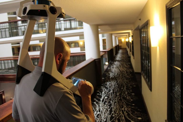
3D scanning technology scans the exact shape and proportion of the object or environment, hence providing an accurate digital 3D representation of the existing facility. The working is as follows:
How It Works:
Capturing Data:
A 3D scanner emits laser beams or structured light that reflects off surfaces. The time or angle of the reflected signal is measured to determine distances.
Creating a Point Cloud:
The scanner collects millions of individual measurements, known as a point cloud—a set of 3D data points that represent the surface geometry of the scanned object or space.
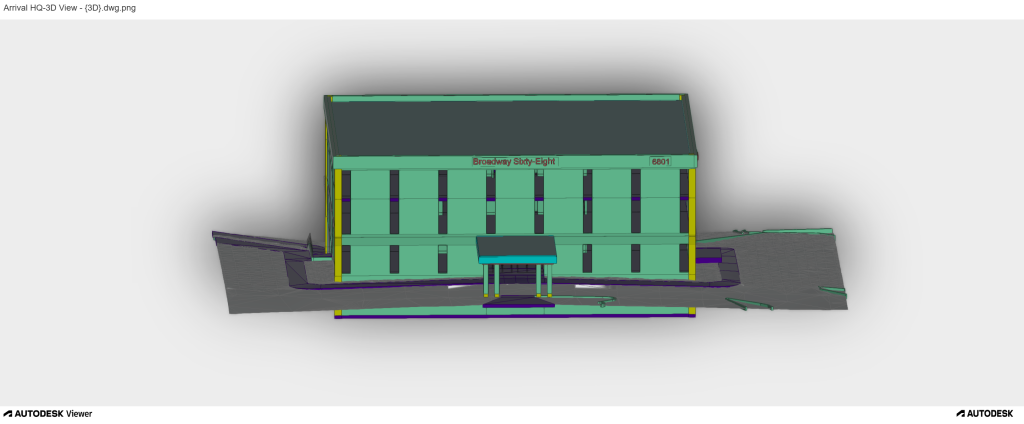
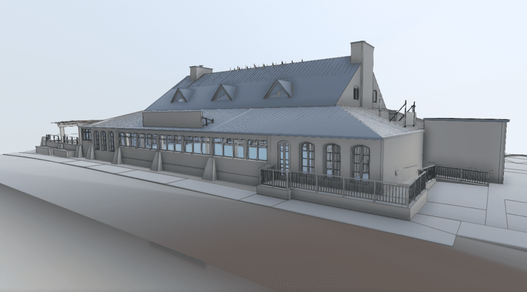
Modeling the Data:
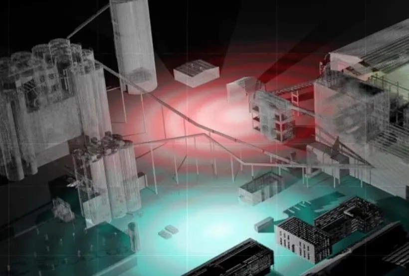
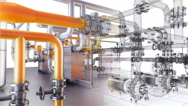
The point cloud is processed using specialized software to produce deliverables such as 2D CAD drawings, 3D models, BIM files, or digital twins, depending on the project’s requirements.
Where It’s Used:
3D scanning is used in architecture, engineering, construction, manufacturing, historical preservation, oil and gas, and other sectors for tasks like renovation planning, as-built documentation, and site analysis.
Download Our Free 3D Laser Scanning Checklist
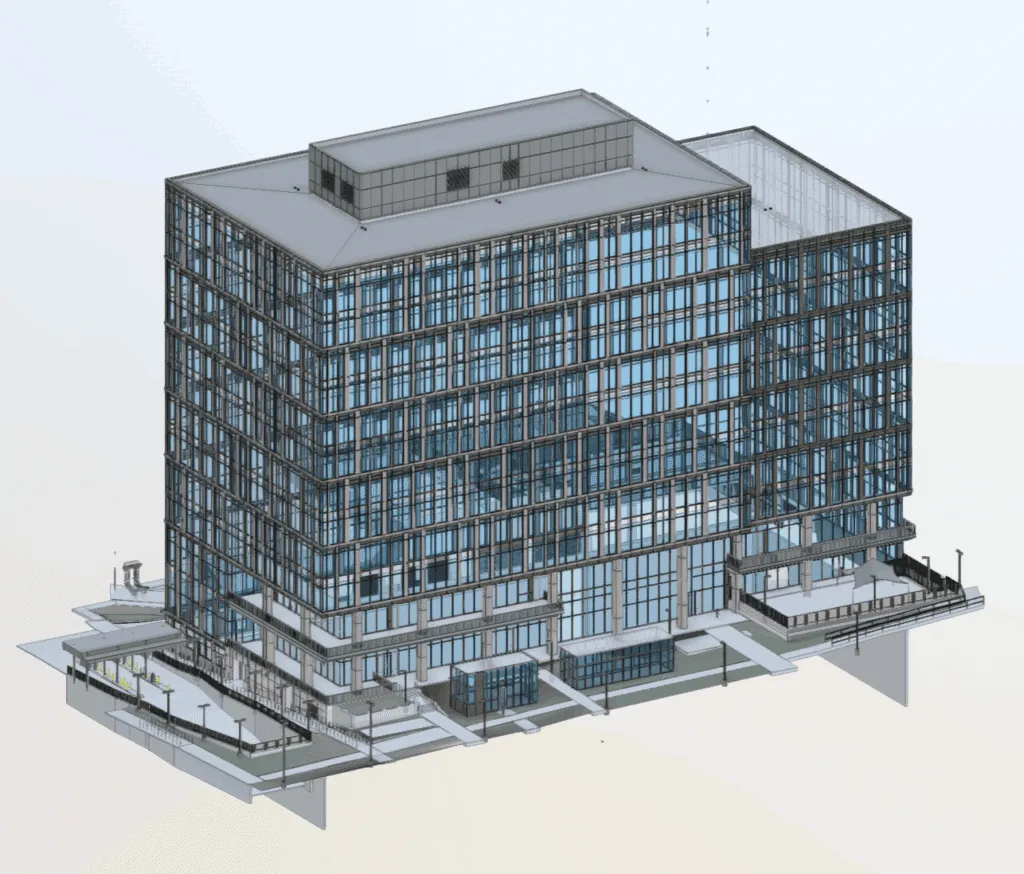
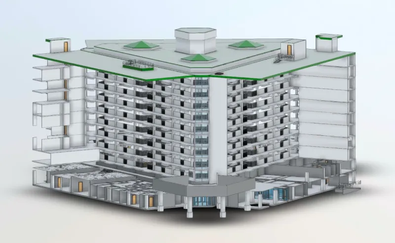
Nothing captures true as-built conditions like 3D laser scanning. By documenting existing conditions with LiDAR scanning technology, project teams gain:
Accurate baseline data for design and construction.
Faster project timelines with fewer delays and errors.
Clear communication between stakeholders with precise visuals.
Digital transformation of facilities through BIM models and digital twins.
Arrival 3D delivers ±1mm to ±6mm accuracy depending on scanner type and scan distance. Our Leica RTC360 provides ±1.9mm accuracy at 10m range. This is 5–10 times more precise than manual tape measurement (±10–25mm) and more consistent than traditional total station surveys, especially for complex 3D geometry like MEP systems and curved structures. All scanners are factory-calibrated annually.
On-site scanning of a typical 10,000–50,000 sq ft commercial building takes 1–3 days. Larger or more complex sites may require additional time. Complete deliverables, including point cloud registration, BIM modeling, and QA/QC review are typically ready within 10 business days of scan completion. Expedited delivery is available for time-sensitive projects. A project-specific schedule is provided at the quote stage.
Click here to learn how Arrival 3D completed 200 scans in one day for a power plant and produced a 3D BIM model that the engineering team used for planning, fabrication, and clash detection.
3D laser scanning projects typically cost between $1,500 and $80,000+, depending on facility size, complexity, accessibility and outputs.
If you need details regarding the cost of your project, please contact the Arrival 3D expert team. We will provide pricing based on your project scope and required deliverables.
We deliver industry-standard formats such as:
✅ Point Clouds: Autodesk Recap, E57, PTS, LAS and many more
✅ CAD Models: 3D Revit, AutoCAD, STEP, IGES, DWG, Solidworks and more
✅ Mesh Models: STL, OBJ, FBX
Yes. Arrival 3D provides 3D laser scanning services in all 50 U.S. states. We maintain regional crews in multiple metro areas and can mobilize nationally for single-site and multi-site portfolio programs. There is no travel surcharge for most projects within the contiguous United States. International projects are also available contact us for details.
| Criteria | 3D Laser Scanning Services | Manual Measurement | Total Station Survey |
|---|---|---|---|
| Accuracy | ±1–6 mm | ±10–25 mm | ±3–10 mm |
| Data Density | Tens of millions of points | Selective points only | Hundreds of points |
| Field Time (10k sq ft) | 4–8 hours | 2–5 days | 1–3 days |
| Site Disruption | Minimal — non-contact | High — constant access required | Moderate |
| Captures MEP Systems | Yes — completely | Selective only | No |
| BIM-Ready Output | Yes — direct workflow | Requires full re-measurement | Partial only |
| Hazardous Area Access | Scan from safe distance | Physical access required | Physical access required |
| Return Site Visits | Rarely needed | Frequent — data gaps common | Occasional |
| Cost (Large Projects) | Lower total cost of documentation | Higher — time × crew × revisits | Moderate |