We deploy professional laser scanners to your building or facility and deliver accurate 2D floor plans, elevations, and sections in DWG and PDF — ready for your design team the moment we deliver.
A horizontal section cut through a building, showing the layout of rooms, walls, doors, and windows from a top-down view.
A top-down view of a building’s roof, showing slopes, ridges, valleys, drainage, materials, and any roof-mounted elements (e.g., HVAC units, skylights).
A horizontal view of the ceiling, including light fixtures, ventilation, ceiling heights, and decorative elements.
A vertical view of a building’s exterior, showing facade details, materials, windows, doors, and height measurements.
A vertical cut-through of a building showing internal structures, floors, walls, and construction details.
A simplified schematic of the site plan showing utilities and services such as electrical, plumbing, drainage, and communication lines.
One technician. One site visit. One unified workflow from laser scanner to your design team’s inbox.
Our technician deploys to your site with Leica professional-grade scanners. One operator covers tens of thousands of square feet in a single day capturing all geometry with 1mm accuracy.
Individual scans are aligned, trimmed, and checked for accuracy. We verify complete coverage before leaving site — no gaps, no return trips needed.
We slice the point cloud at the relevant heights to extract linework, or export from a Revit model for LOD 200+ accuracy. Clean DWG and PDF files ready for your design team.
Drawings delivered in DWG, DXF, and PDF at your required scale. Most projects delivered within 2–3 weeks. Rush turnaround available on request.
Manufacturing plants, processing facilities, and industrial environments are constantly modified equipment moves, production lines expand, utilities get rerouted. Original drawings almost never keep up.
We scan the actual current state of your facility and produce updated as-built 2D drawings that reflect what is really there including P&ID schematic documentation for piping and process systems.
Plant layout updates & expansion planning: Document what’s there before you design what’s next.
P&ID documentation from existing systemsPiping and process schematics from scan data
Equipment layout and clearance drawingsPrecise placement of machinery, conveyors, and automation lines
Active-facility scanning — zero production disruptionWe work around your shift schedule and safety protocols
Architects & Designers – Existing conditions drawings for renovation and addition projects. No measuring tape, no manual errors just accurate geometry ready for your Revit or AutoCAD workflow.
General Contractors – Verify existing conditions before construction begins. Catch conflicts between drawings and reality before your crew is on-site — not after work has started.
Facility Managers: Current floor plans for space planning, code compliance, and maintenance. Especially valuable when the facility has changed and the original drawings no longer match reality.
Real Estate Developers: Due diligence documentation and tenant improvement drawings from a measured building survey. One day on-site. Complete drawings within three weeks.
MEP Engineers: Reflected ceiling plans, above-ceiling utility documentation, and MEP coordination drawings from scan data capturing what’s actually above the tile, not what should be.
Industrial Operators: P&ID drawings, plant layout updates, and as-built documentation for manufacturing facilities and processing plants that have evolved far beyond their original drawings.
There are two methods for obtaining plan drawings from 3D laser scan point clouds. The first is to utilize slices from the point cloud as a reference to draw CAD linework over. This can be an economical way to quickly obtain CAD drawings from 3D scanning. Point clouds can be trimmed and sectioned in every direction, making it possible to obtain any 2D perspective desired.
The second way to obtain 2D drawings from the 3D laser scanning process is to first create a 3D CAD model using the scan-to-BIM process. Scan to bim models in software such as Autodesk Revit can be used to export plan and elevation views. Because the geometry is already defined in 3D, exporting 2D drawings requires little extra effort.
Plants and industrial environments are always changing. They must in order to keep working right. Expansion, improvement, and updates are just what is necessary for any commercial endeavor to remain in business. But almost universally, the ability to maintain a set of 2D or 3D drawings that reflect the as-built condition of the plant is difficult, which is why it often doesn’t get done.
3D laser scanning provides a tool for updating as-built drawings. It is not an “easy button”, but it is a methodical, organized and efficient process for capturing the state of things and creating freshly updated CAD drawings.
Tell us your building size, location, and what drawings you need. We respond with a detailed quote within one business day, no obligation.
📍 Get the data you need to build with confidence!
Nationwide coverage · View states we serve · Typical response: same business day
Scan-to-Plan is one part of what we offer. Explore related services that may better fit your project scope.

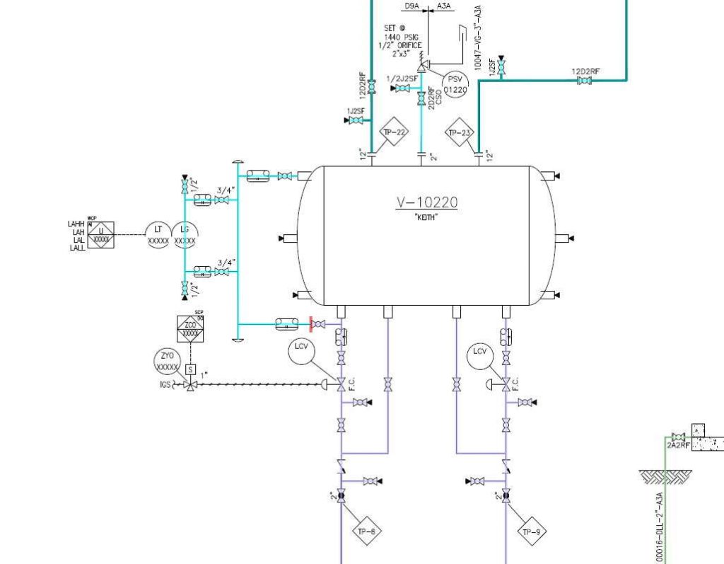
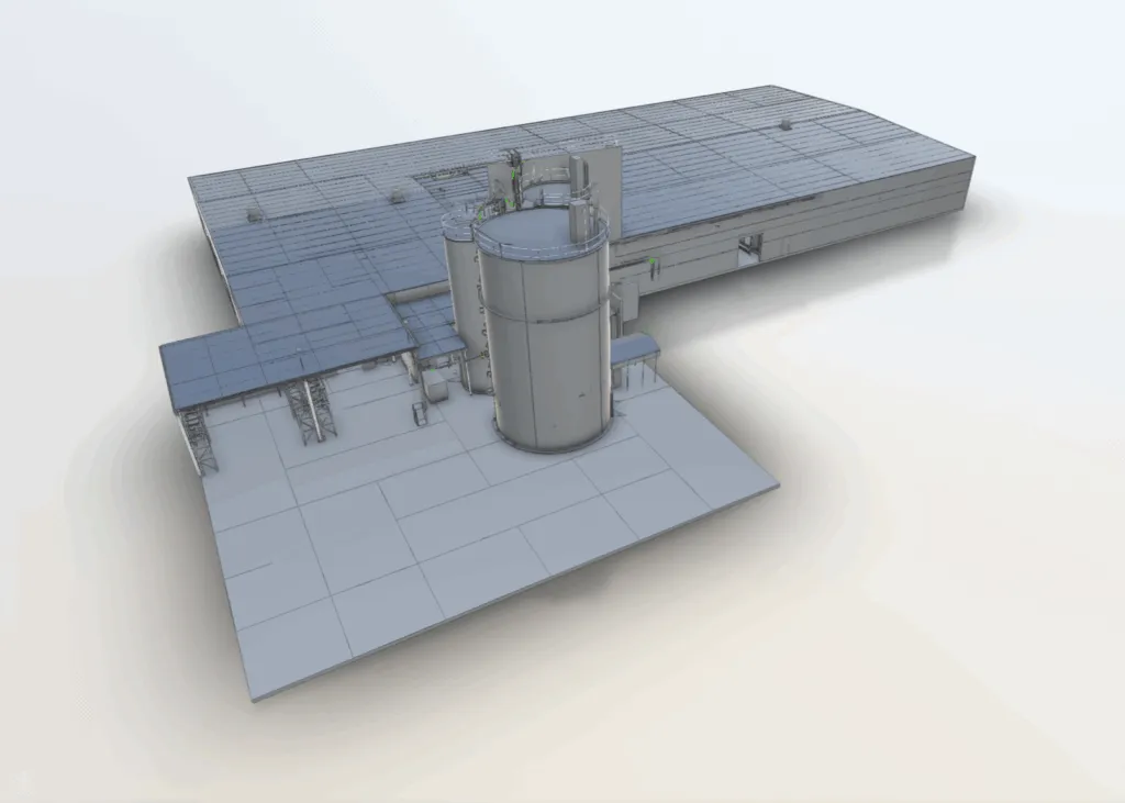
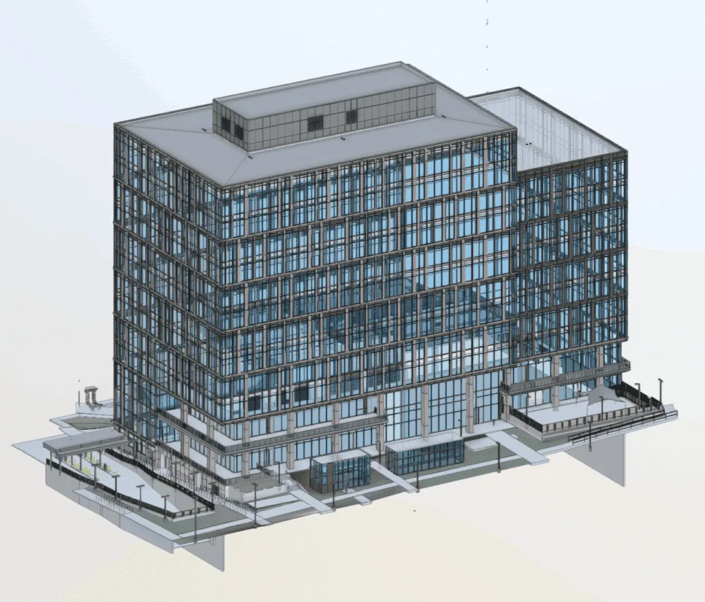
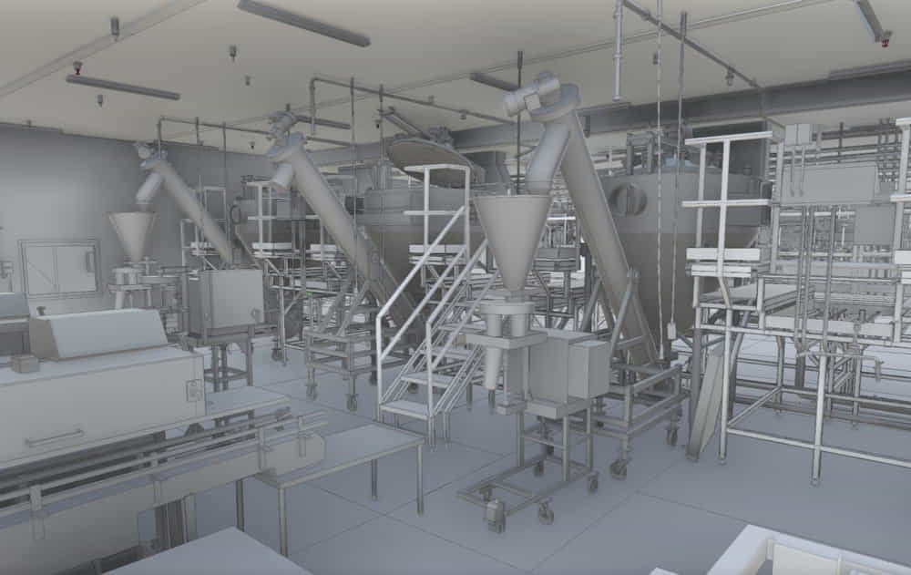
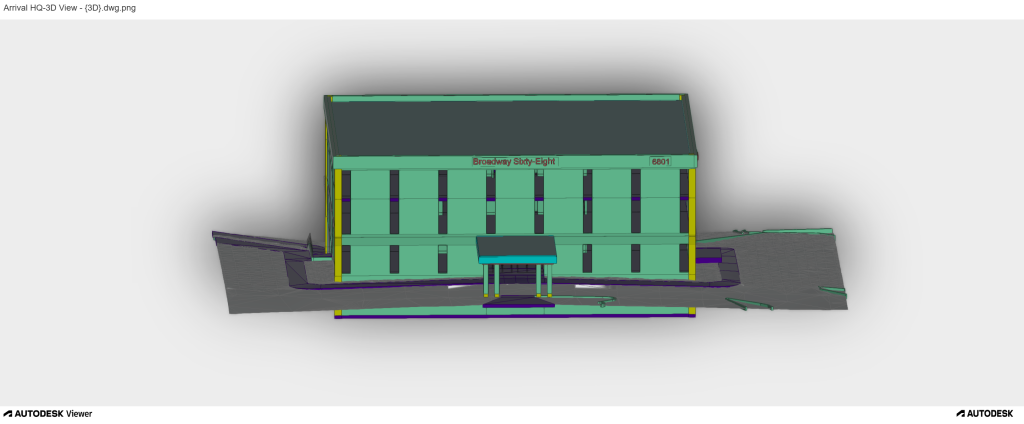
Full 3D Revit models from laser scan data. LOD 100-500. For project requiring paramertic geometry, clash detection or MEP coordination.

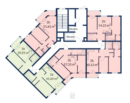
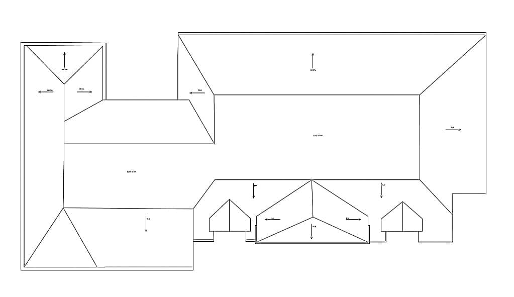
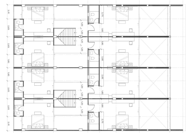
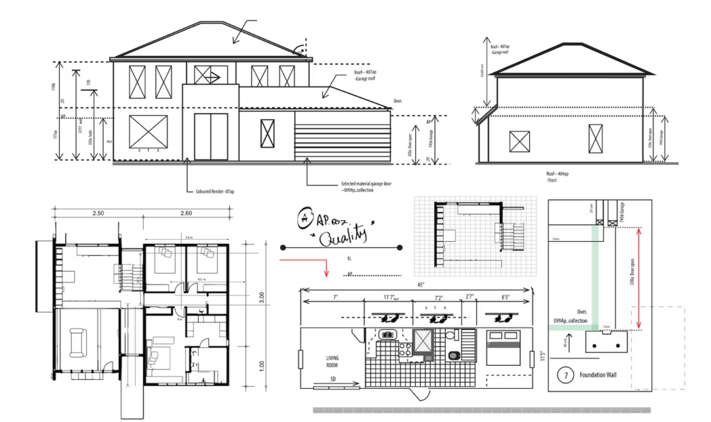
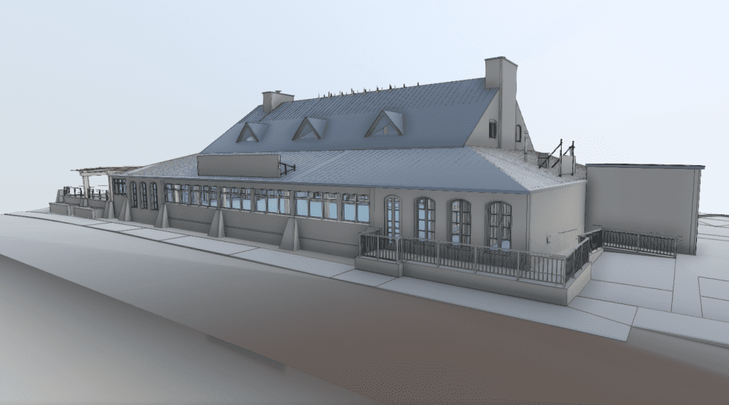
Certilied as-built drawings including point clouds, 2D CAD and 3D models. Complex existing conditions documentation for renovation and construction.

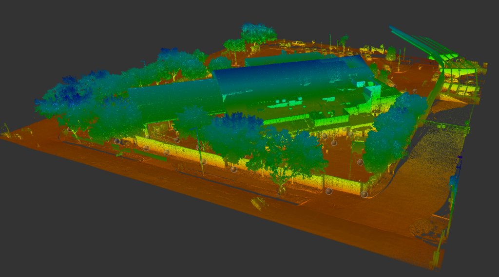
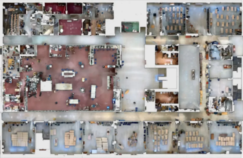
High-density point cloud capture for plants, refineries, warehouse and complex industrial facilities. Leica ScanStation and NavVis VLX mobile scanning.