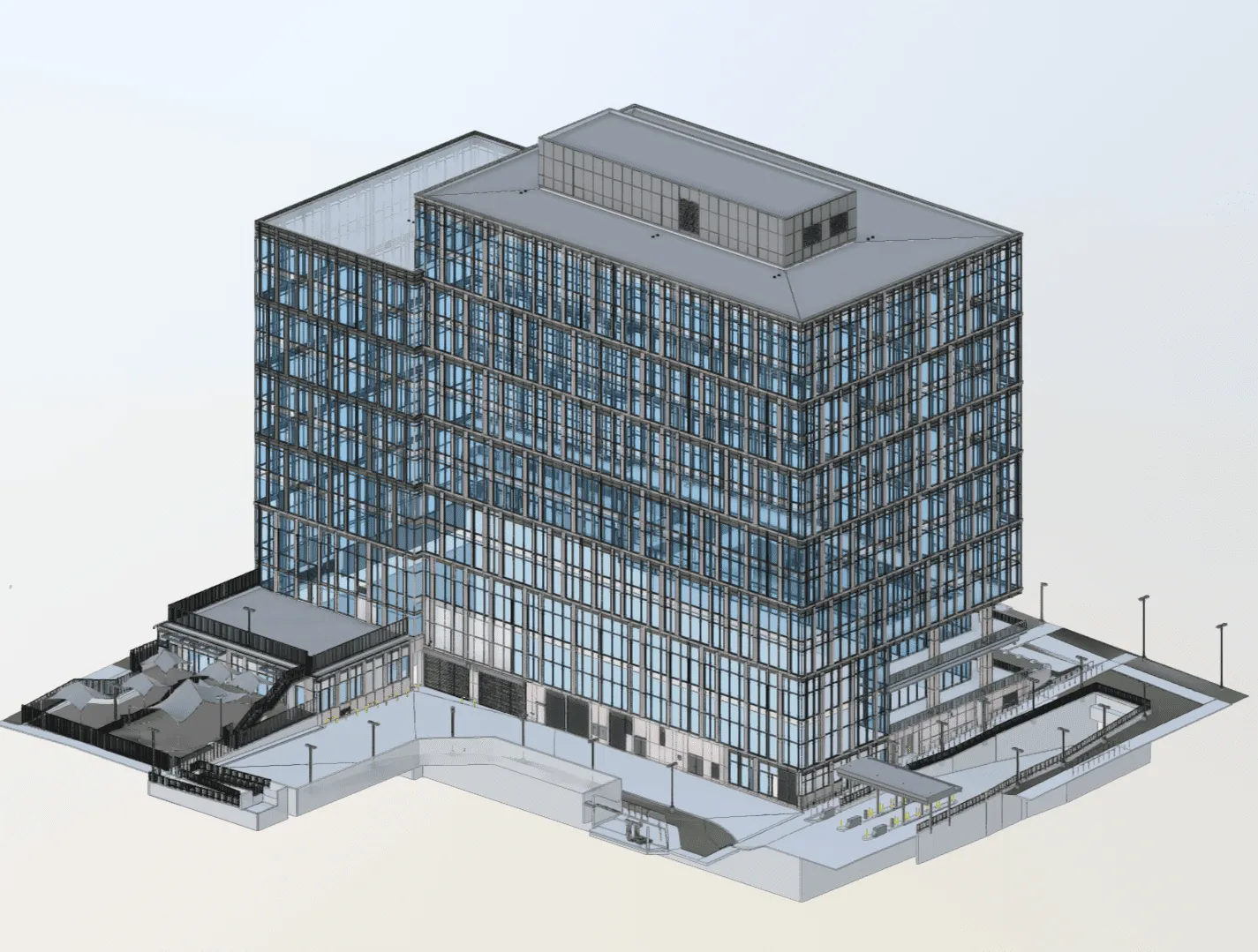
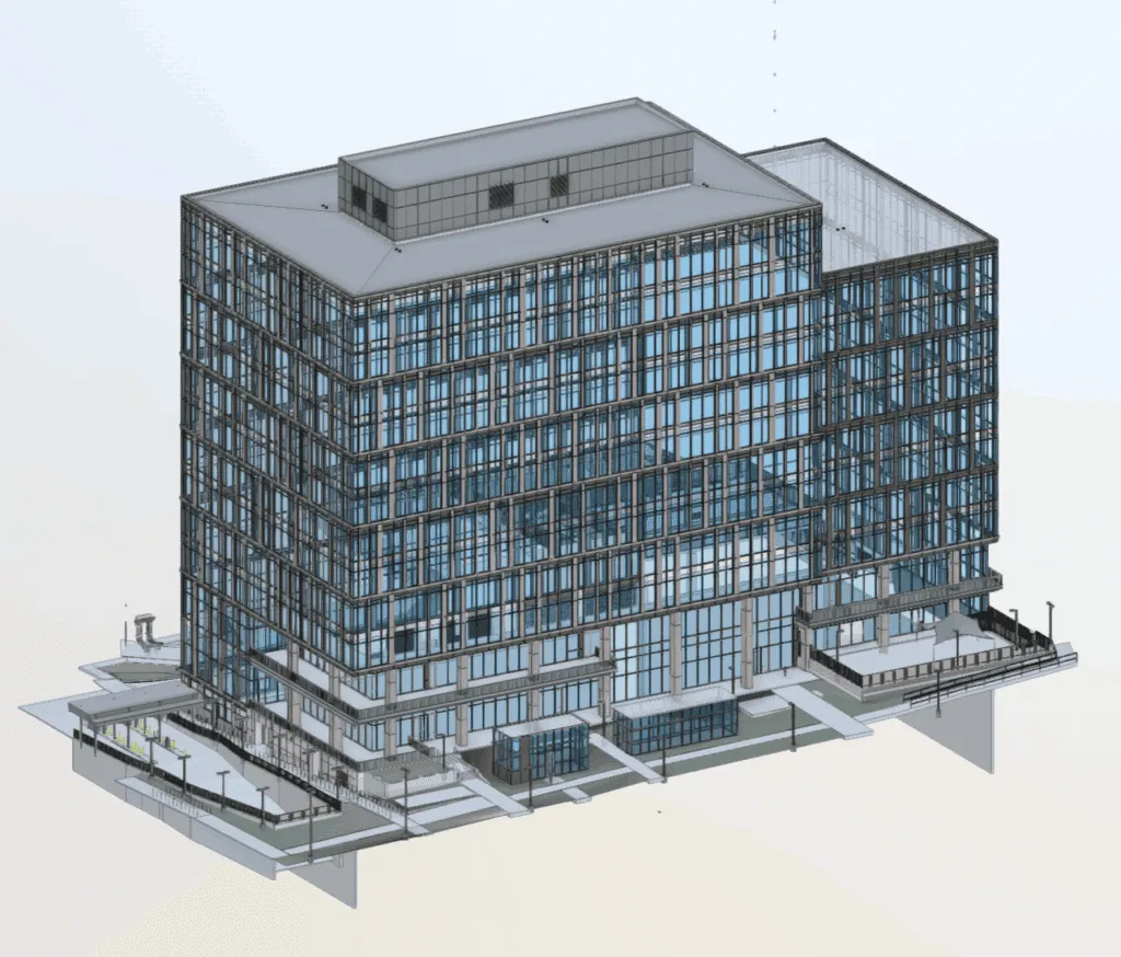
Case Study - 3D Laser Scanning & BIM Modeling – Austin Government Office
Project Highlights
Project Name:
A 12-story, state-government office facility
Location:
Austin, Texas
Objective:
Produce an accurate as-built 3D Revit model for smarter facility management
Project Size:
416,000 sq. ft.
Deliverables:
Digital twin with floor-by-floor as-built models, point clouds, detailed MEP documentation, and asset tagging
Category:
Government Facilities
Technology Used:
Leica RTC360, Leica BLK360, Leica Total Station, 3D scanners, elevator tripods, Cyclone Registration 360, Autodesk Revit
Project Overview
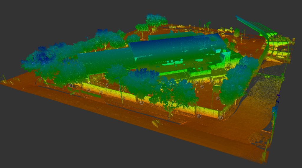
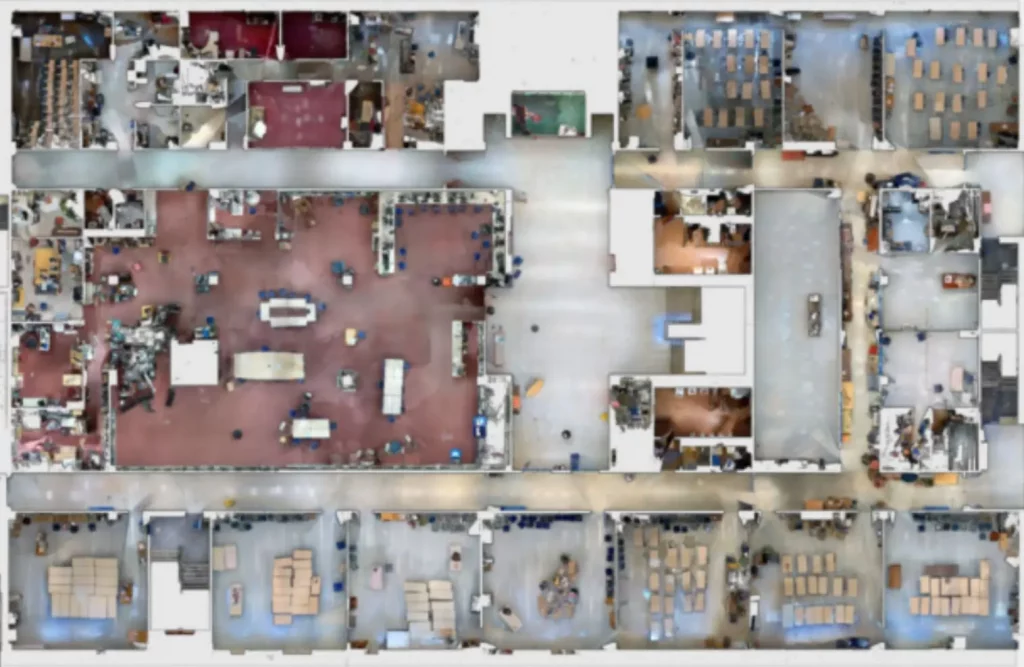
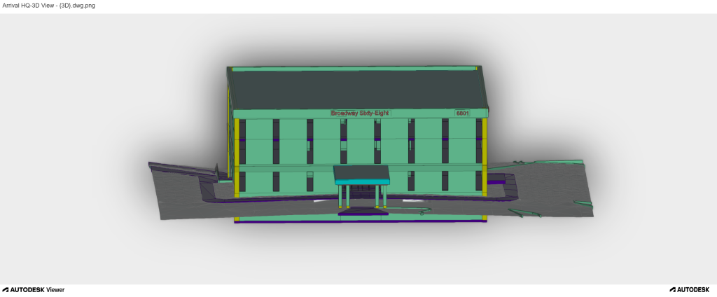
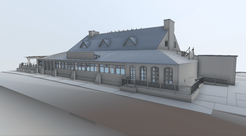
The government office building project in Austin, TX includes comprehensive laser scanning and BIM modeling services for a 12-story building. The project was commissionedexpected to digitalize 416,000 square feet of constructed area. This digitization resulted in the production of color 3D point clouds, panoramic images and as-built Autodesk Revit models that were made available to facility management personnel and other stakeholders.
Client Overview
The client is a government agency whose purpose is to operate and maintain government buildings in Texas. The project was focused on modernization of their management systems by incorporating accurate as-built 3D modeling into their Archibus facility management software workflow.
Process and Execution
➡️ Scanner Setting: Set up Leica RTC360 in medium resolution mode with color on to capture data in a variety of different locations such best in indoor, outdoors and in dark or confined areas.
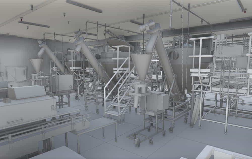
➡️ 3D Data Collection: Conducted floor-by-floor laser scanning of the entire facility, which also includes restricted zones during off-hours. Special attention given to above-ceiling and below-ceiling spaces, mechanical rooms and the roof and exterior 5 to ensure a complete as-built record.
➡️Data Processing: Registered the scan data using Cyclone Registration 360 and align to the building coordinates. Clean unwanted points from the point cloud data. Create a LOD 300 Revit Model segmented by floor and enriched with asset metadata.
Challenges and Solution
➡️ Access Issues: Limited access to above-ceiling and MEP zones and infrastructure in critical areas. Sensitive areas required special scheduling with escorts. Areas in use required us to scan at odd hours to avoid disrupting anyone.
➡️ Solution: The team scheduled off-hour scanning sessions and worked closely with the customer to coordinate scheduling and scan at times convenient to them. Specialized tripods and scanners were used to access difficult spaces.
➡️ Asset Identification: Ensuring that the correct asset tag is present, and collecting additional asset information where needed.
➡️ Solution: Collaborated closely with on-site facility management teams for correct placement of barcode labels, and making sure they satisfy requirements.
Results and Benefits
➡️ Saving Time and Money: The project provided extensive and accurate capture of the building, revealing many differences between the design and actual construction.
➡️ Better Facility Management Design Development: It allowed for facility managers to have highly accurate floorplan and area data, and provides visual representation for asset locations. Easier maintenance, improved space planning, and decision-making on the part of the client.
➡️ Future Benefits: It provides a means for Autodesk Tandem digital twin systems to interface with their Archibus facility management system as well as their Revit engineering drawings.
Highlights
Project Gallery
Solution
Key Insights
The government office building scanning project in Austin, TX showed how 3D laser scanning used together with BIM can scan a large number floors and rooms, distilling massive quantities of information into forms that are easy for people to process and work with. This application of 3D technology will provide facility managers the ability to easier plan and engineer spaces for many years into the future. Among the many lessons learned was the importance of organization when dealing with such big spaces. Another lesson learned was to agree on file naming and methods of scanning well in advance.
The model was built in 3D Autodesk Revit, a highly compatible 3D format that is the favorite of architects and engineers a like. But it also has the ability to carry asset and tagging information into a facility management database, making it easier for the facility management team to locate, track and manage critical equipment. The cooperation with onsite teams was organized early to guarantee proper data recording and unproblematic access to confined areas. This strategy mitigated risk in the future, reduced re-work and aided with smart decision making.