At Arrival 3D, we deliver industry-leading 3D building scanning services tailored for architecture, engineering, and construction professionals. Using advanced terrestrial LiDAR and reality capture technology, we provide highly accurate as-built documentation, point clouds, and Scan to BIM models for buildings of all sizes and types. Whether you’re planning a renovation, retrofitting an existing structure, or managing facility data, our building scanning solutions ensure precise measurements and fast turnaround—helping you reduce costly rework and streamline your project from design to delivery.
3D laser scanning for buildings captures a precise 2D representation of elevation changes across every surface delivered as a millimeter-accurate bird’s-eye point cloud using LiDAR technology. Arrival3D powers pre & post-pour analysis, structural verification, facade inspection, MEP coordination, and scan-to-BIM workflows all from one site visit.
From foundation to facade, Arrival3D’s building laser scanning services cover every system and surface, delivering data your team can actually use.
Capture every column, beam, slab, and load-bearing wall at ±2mm accuracy. Verify structural geometry against design intent before and after every construction milestone.
1. Column, beam & slab position verification
2. Slab flatness & level analysis
3. Clash detection before costly rework
4. Revit & AutoCAD-ready delivery
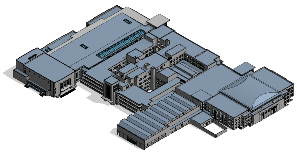
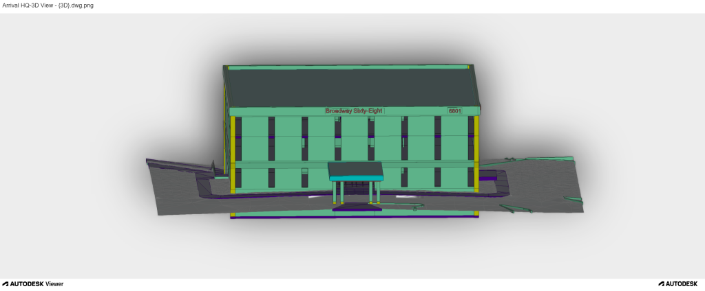
Transform point cloud data into intelligent BIM models for construction coordination, clash detection, and facility management—delivered at LOD 100 through LOD 500.
1. LOD 100–500 Revit models
2. As-built documentation
3. Digital twin creation
4. Navisworks clash detection
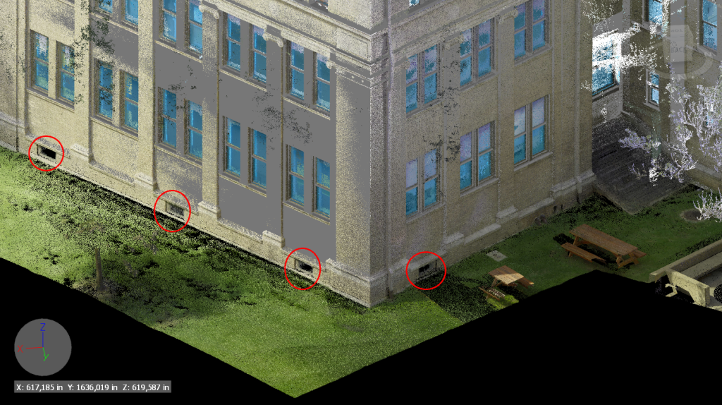
MEP every mechanical, electrical, and plumbing run as-built. Design new systems knowing exactly what's already installed—eliminating coordination conflicts before they become change orders.
1. Existing condition documentation
2. Clearance verification for new systems
3. Retrofit & renovation support
Structural model coordination
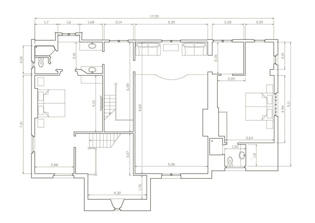
Document every surface of your building exterior—cladding alignment, window reveals, setbacks, and elevation deviations—with complete coverage and no missed areas.
1. Cladding & curtain wall alignment
2. Window reveal & setback depth mapping
3. Surface deviation color reports
4. Non-contact heritage building surveys
Verify rebar and formwork before the pour. Document exactly what was built after. Catch errors when correction is still fast—before concrete becomes permanent.
1. Rebar & formwork verification
2. Post-pour elevation deviation map
3. Certified as-built record
4. Updated BIM for next phase
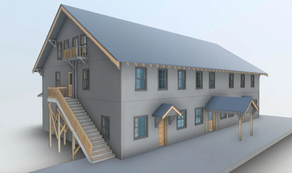
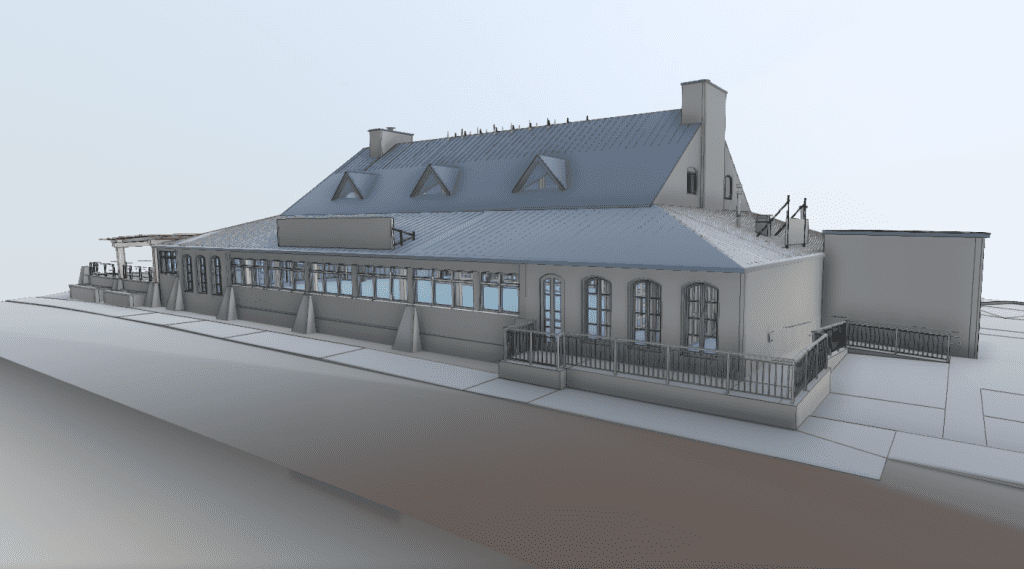
Non-contact 3D scanning documents heritage buildings and complex existing conditions with no risk to fragile materials—creating permanent digital records for restoration and adaptive reuse.
1. Non-contact, non-destructive capture
2. Full exterior & interior documentation
3. Adaptive reuse as-built models
Traditional measurement methods can be time-consuming, labor-intensive, and prone to human error. Our 3D laser scanning process replaces manual tools with millimeter-accurate data that’s fast, reliable, and repeatable. We help you capture the full geometry of a building—inside and out—in just a few hours.
Key Benefits:
Capture accurate as-built measurements in a fraction of the time
Generate 2D floor plans, 3D models, and BIM-ready files
Minimize project risk by reducing change orders and site revisits
Eliminate costly rework due to measurement errors
Easily integrate scan data into design and construction software (Revit, AutoCAD, Navisworks, etc.)
Our 3D building scanning solutions cater to a wide range of industries, including:
Our services are tailored to a wide range of use cases:
Renovation & Retrofit Projects – Get precise measurements of existing structures before making changes
Scan to BIM – Create intelligent models of your building for construction coordination and clash detection
Facility Management – Maintain up-to-date digital twins for ongoing maintenance, upgrades, and asset tracking
Historical Preservation – Digitally preserve and document heritage sites without disturbing the structure
Construction Verification – Compare scan data to design models to ensure field accuracy
Depending on your project needs, we deliver:
Raw Point Clouds (E57, LAS, RCP, etc.)
2D Floor Plans, Elevations & Sections
3D Revit BIM Models (LOD 100 to LOD 500)
AutoCAD Drawings (DWG, DXF)
Mesh & Surface Models (STL, OBJ)
Digital Twin Integration