

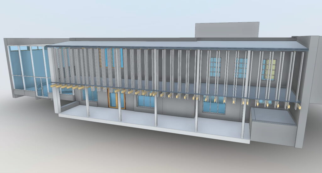


Obtaining an as-built Revit model is easy using 3D laser scanning. Just tell us how much detail you need, and our scanning and modeling teams will get to work. Whether it is LOD200, LOD300 or LOD400, you’ll get a highly accurate representation of existing conditions that you can use to develop your project design and engineering models. Let us be your “easy button” for creating as-built Revit models.

No one is better than Arrival3D at creating as-built 3D models of industrial environments. You can benefit from the high speed and accurate point clouds that our 3D scanners produce, allowing us to capture large areas of your plant in a day. From the scan, our experienced team of of CAD modelers extracts piping, conduit, structure, valves, pumps, vessels and anything else you need with high productivity. This modeling can be done at any level of detail you choose so that you can receive a 3D model that thoroughly documents existing conditions.

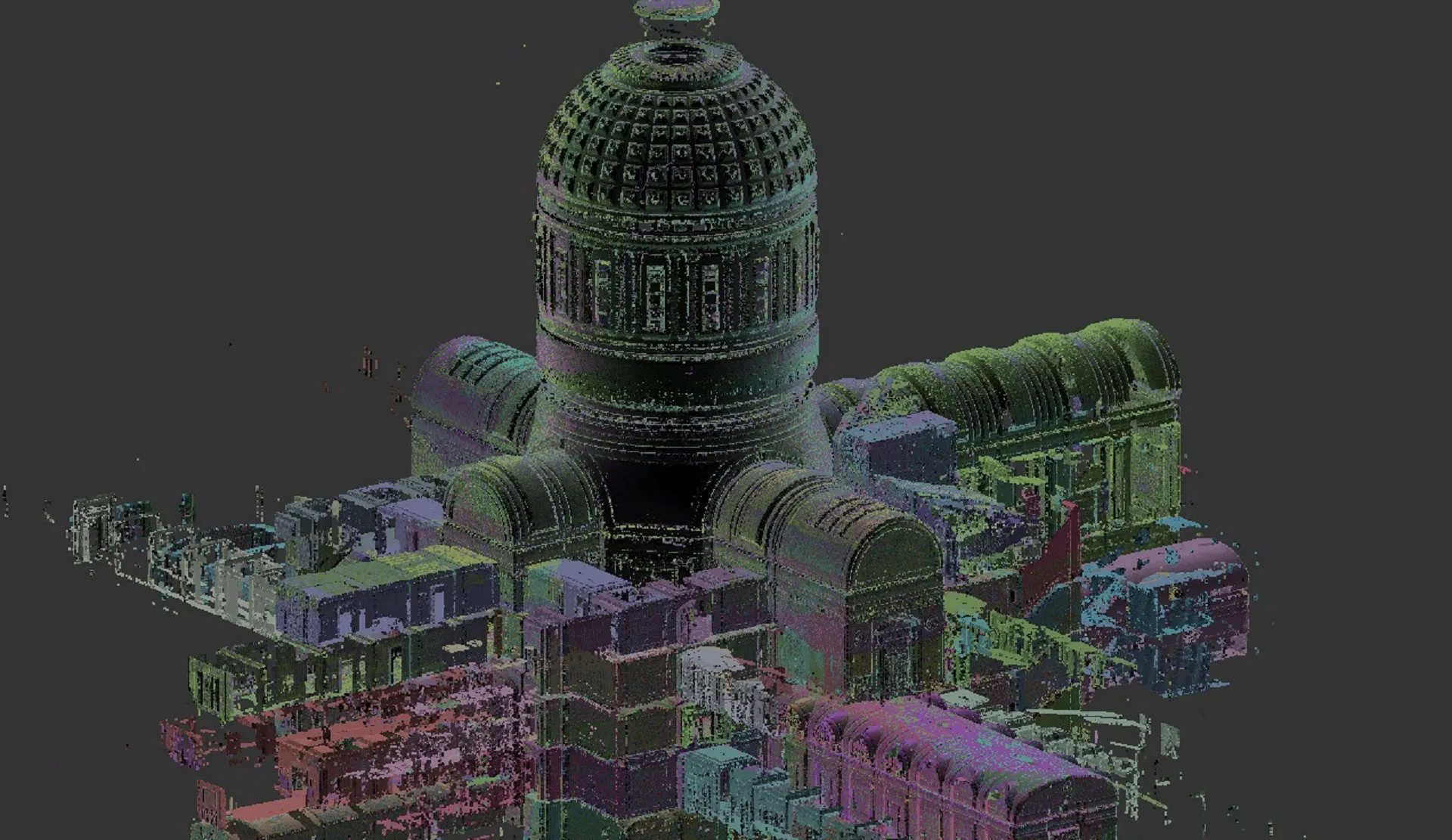
You can utilize our scanning services to obtain just the raw point clouds. There are a variety of options to choose from when obtaining raw point clouds from us: Full color or intensity only Registered or not Aligned to a particular coordinate system Unified or not Formats available include Autodesk ReCap (RCP and RCS), PTS, PTX, E57, XYZ, POD and more.

High-compatibility models can be generated for use in AutoCAD and other CAD programs. If your as-built drawings are out of date or non-existent, 3D scanning can be used to to update them or re-create them completely. CAD models created from 3D scans can be provided in a variety of formats. You choose the items you want to see in the CAD model, and to what level of detail. CAD modeling can be done of the entire plant or just a small area based on project needs. View these CAD models using free viewers such as Autodesk TruView.
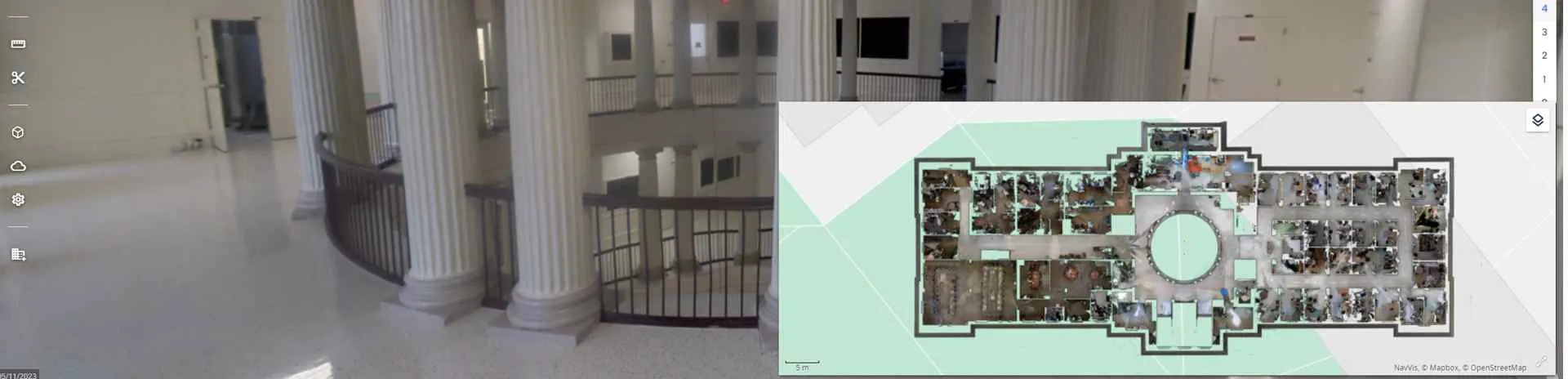
In addition to capturing point clouds, our scanners utilize on-board HDR color cameras to capture 360 degree panoramic images. You can view these images using free software, including Autodesk Recap or Leica Truview. The panoramic images are great for when you want high resolution imagery from every scan location.

Floorplans and elevation drawings can be generated from 3D scan data. Our customers have used scanning to quickly create floorplans for space planning or obtaining building permits. What would otherwise be a very time consuming and difficult task because an easy matter when you outsource it to us. We provide the generic line drawings after which you can finish it according to your drafting style.
A 3D scan of your facility can be converted into an interactive 3D asset management system for tracking facility information. This 3D digital twin can also be used to generate realistic immersive virtual reality environments.

Highly detailed 3D laser scanning data can be converted into STL mesh files for import into your favorite CAD or surfacing software. Here we captured a tree that the customer was planning to move to a different location. 3D scanning services helped them capture this tree with incredible detail and allowed them to reposition it in software for their design.
Wind turbine towers sometimes get damaged due to a storm, fire or other type of failure. Using 3D laser scanning, we can measure the tower safely from the ground and answer many questions including: Are there any dents? If so, where are they and how deep are they? Is the tower bending or leaning?

While floors often appear flat to the naked eye, the 3D laser scan tells a different story. Frequently, floors are designed to have some slope for drainage purposes. Our customers have contacted us to scan a newly poured concrete floor to inspect whether it was installed to the specified flatness. Other times, floors that are being re-purposed need to be inspected to see what their shape is.

A tank or vessel may deviation from its ideal shape, whether it be cylindrical or spherical. Tank and vessel inspections utilize 3D laser scanners to capture highly precise point clouds that can then be compared to the ideally designed shape.
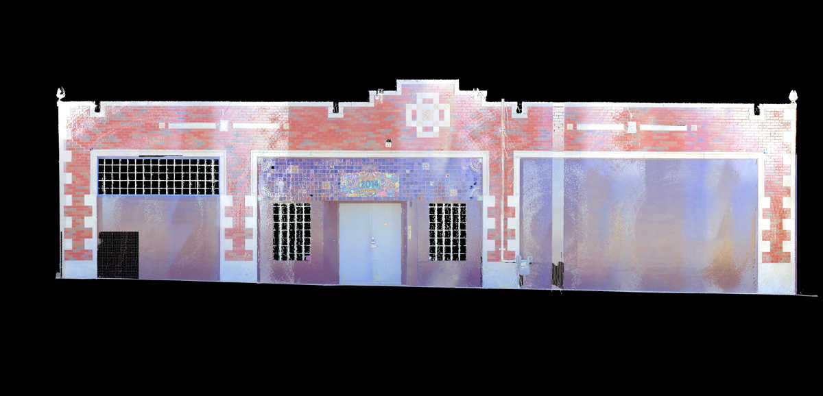
Orthographic images, or ortho-images for short, are views of a 3D scan that have been properly scaled in CAD so that they are dimensionally accurate. They can serve as background templates for drawing over to create 2D CAD drawings. A slice of the scan point cloud can be taken from any perspective and turned into an ortho-image.

Nothing gets attention like a video. Fly-through videos and 3D animations can be created created from your scanned point clouds and 3D models according to your needs. When combined with 3D scanning, animations can be created with highly accurate dimensions for a high level of realism.
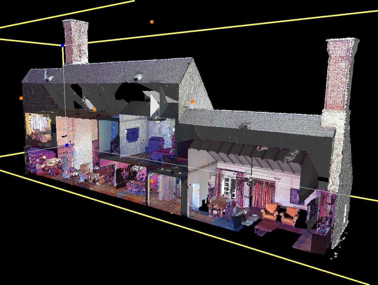
Cutaway views of scans can make interesting visuals for situations where you need to depict something in a unique way. These can even be utilized to create floorplan and elevation views that can be traced over in CAD to generate drawings. Point cloud sections are a very efficient way to get dimensional information from a scan without the cost of CAD modeling.
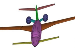
3D laser scanners can capture objects such as aircraft, ships, heavy equipment, cars and trucks. We can convert these scans into neutral CAD formats such as STP, IGES, X_T and more. We can also create parametric, feature-based Solidworks models for highly editable files. If your project is manufacturing-oriented, your fabricator will thank you for the high quality modeling techniques we use.