3D Laser Scanning for Industrial Facility Documentation
Project Highlights
Project Name:
Industrial Facility Digital Twin Project
Location:
Paducah, KY
Objective:
Capture precise 3D scans for facility upgrades, safety compliance, and automation
Project Size:
Large-Scale Facility
LOD:
350
Category:
Industrial Infrastructure
Technology Used:
Leica RTC360, TruView Virtual, Autodesk Revit
Project overview
Client Overview
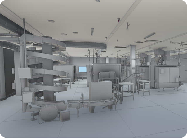
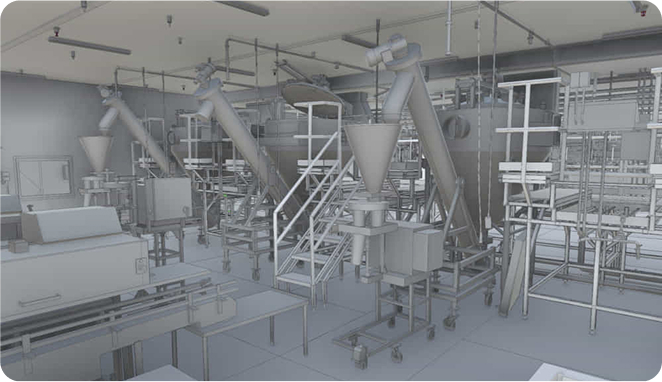
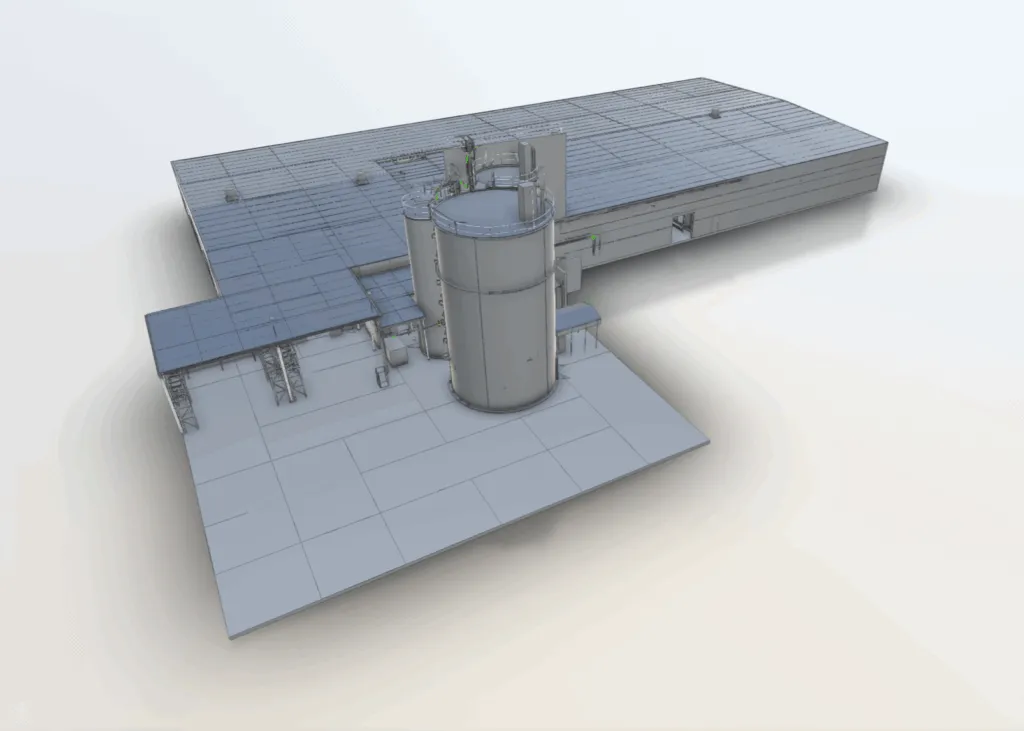
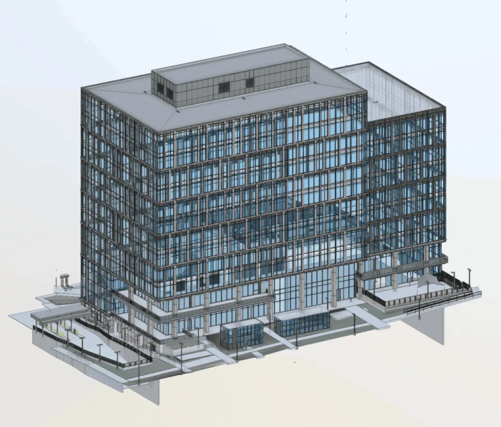
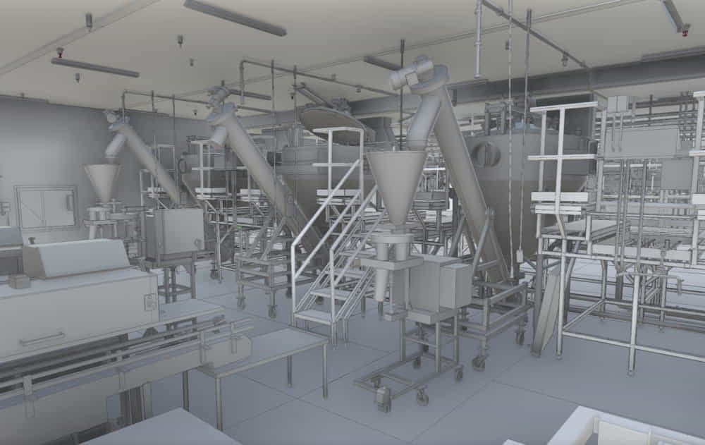
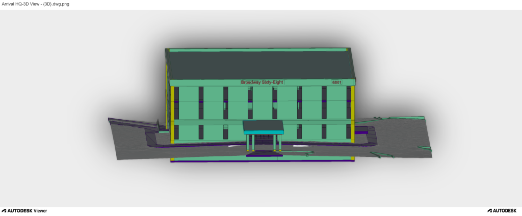
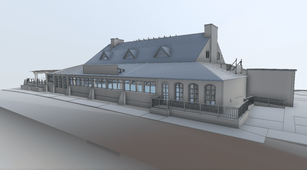
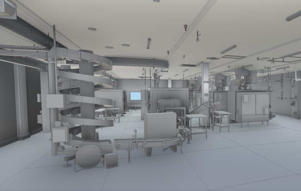
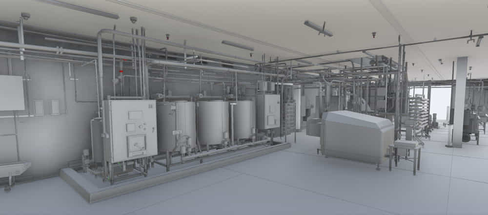
An industrial facility required a precise 3D scan and digital model of the existing infrastructure to enable facility planning, automation, and system integration. Since the structure consisted of complex machinery, custom automation, and intricate layouts, a high-accuracy long-range scanning solution was required to provide detailed as-built documentation.
Creating a digital reference was essential for structural upgrades, safety compliance, and future expansions. Therefore, high-precision laser scanning and reality capture solutions were used to enable Scan to BIM modeling and geospatial mapping.
Project Highlights
High-Accuracy 3D Laser Scanning Implemented
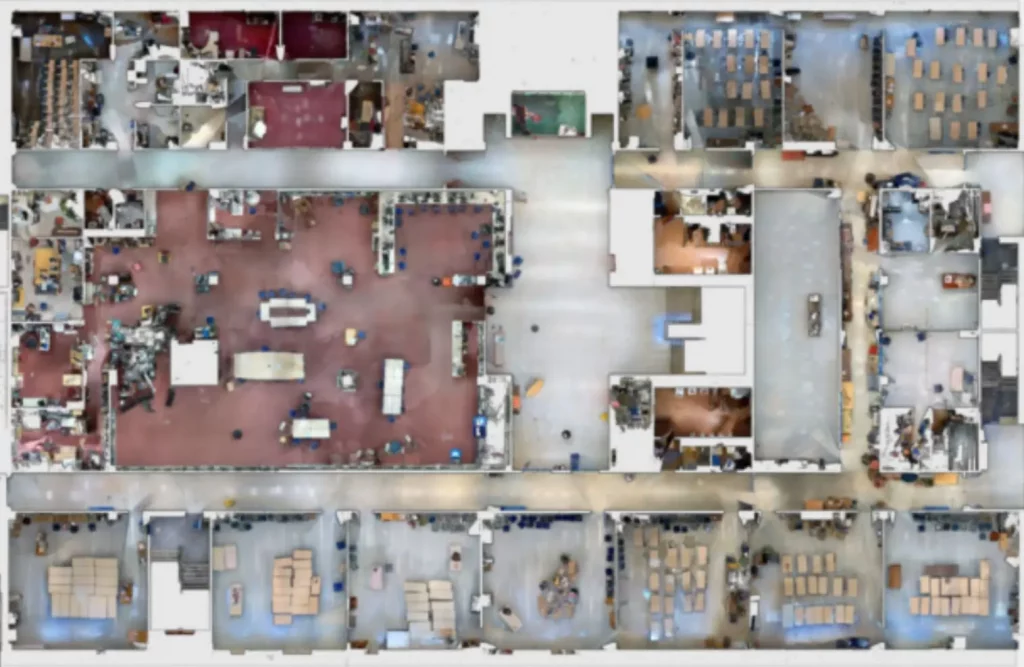
15,000+ High-Resolution Images Captured
22 Billion Data Points Processed for LOD 350-Level Accuracy
9 Fully Detailed 3D Models Delivered
Seamless Scan to BIM Workflow Enabled
Process & Execution
Initial
Scanning
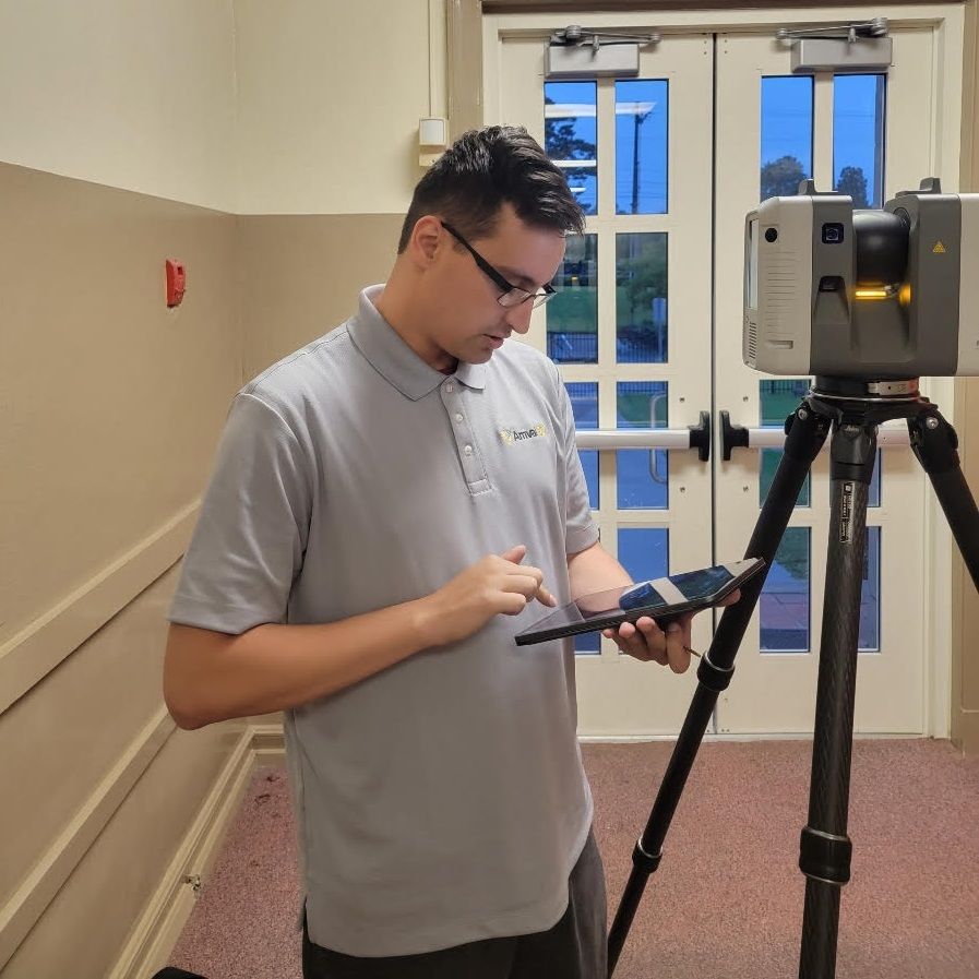
The process began with Terrestrial Long-Range Scanning using the Leica RTC360 laser scanner, a high-precision laser scanning tool that captured the facility’s exact dimensions, structural layout, and spatial details.
Data Processing &
Registration
After scanning, the collected data was processed in TruView Virtual and converted into a detailed 3D model using Revit, ensuring highly accurate digital representation.
Final Validation & Integration
Using an LOD 350 model, every aspect of the facility was reviewed for accuracy and alignment, making it ready for seamless integration into automation and expansion plans.
Challenges
Complex Machinery & Geometry – Required high-precision 3D laser mapping to capture intricate custom automation layouts.
Limited Accessibility in Certain Areas – Remote 3D Scanning Services were deployed to capture hard-to-reach zones with absolute accuracy.
High-Resolution Data Requirements – Integrated ultra-precise laser scanning technology to ensure high accuracy without unnecessary processing overhead.
Large-Scale Facility Complexity – Developed As-Built Documentation to ensure every structural detail was properly mapped.
Future-Proofing Needs – Digital Twin Building Scanning was implemented to ensure accuracy in renovations and expansions.
Solutions
How the Result Was Achieved
Site Preparation – Reflective surfaces were adjusted for optimal laser scanning accuracy.
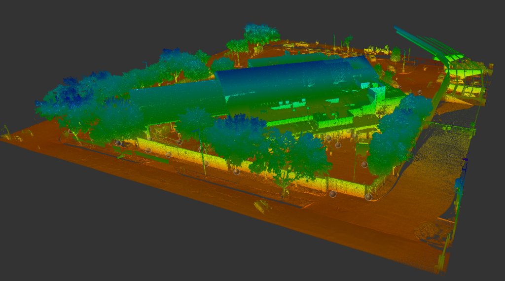
Long-Range 3D Laser Scanning – Multiple scans were conducted across the facility to create a detailed point cloud.
Scan Registration & Processing – Data was processed to generate a detailed, accurate 3D point cloud in Autodesk ReCap format.
Scan to BIM Workflow – From the scan, an as-built 3D Autodesk Revit model was created, serving as a reference for automation upgrades, safety planning, and future expansions.
Results & Benefits
Accurate Measurements – Eliminated manual errors and ensured measurement consistency.
Seamless Facility Integration – Enabled smooth collaboration for system automation and structural modifications.
Cost & Time Savings – Reduced risks of construction errors and last-minute design changes.
Clash Detection & Risk Reduction – Integrated Clash Detection Scanning to identify early-stage conflicts and potential design issues.


