Never before have this many options been available for engineers to quickly scan a plant, building warehouse, mechanical room etc. and receive files that are directly usable to begin working with. We provide scans that are optimized and ready for importing into CAD packages to use as an as-built reference. If you have not started using 3D scanning in your project workflow, now is the time to start. We work with first-time customers all of the time and are glad to help answer any questions you may have about where to get started. It is easier and less expensive that you may think.
The extreme portability of our 3D laser scanners allow reality capture of just about any scenario. Here is just a sample of the many environments we have scanned:
Homes Large & Small
Historic Buildings
Gas Plants
Arenas and Stadiums
Cement Plants & Quarries
High Rise Buildings
Chemical Plants
Piping & Conduit
Theater
Roads & Bridges
Historical & Government Structures
Steel Structures
What can you get from long range 3D laser scanning services?
Several options are available to suit your needs and budget:
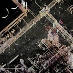
Option #1: raw Scan point cloud Files
Here, you get the raw point cloud files straight out of the scanner. This is the “do-it-yourself” option without having to obtain a scanner and do the work.
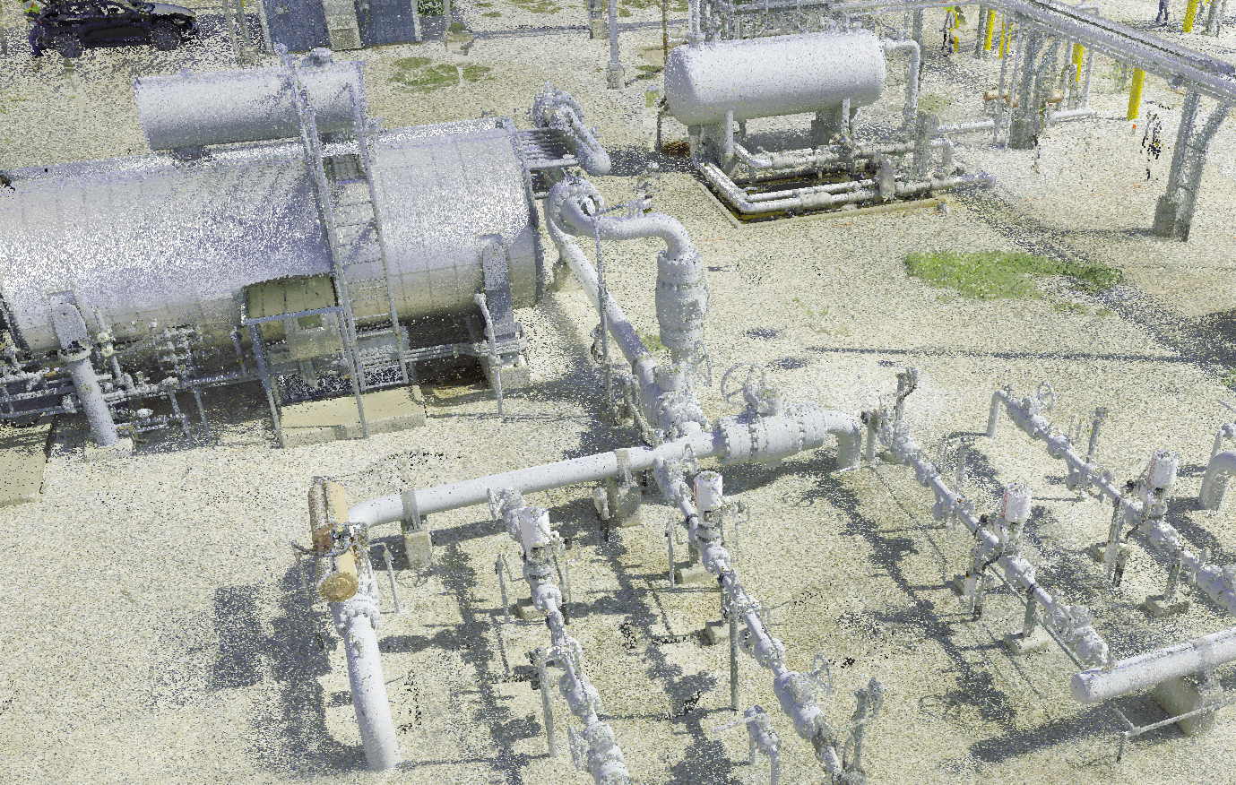
Option #2: Registered point cloud
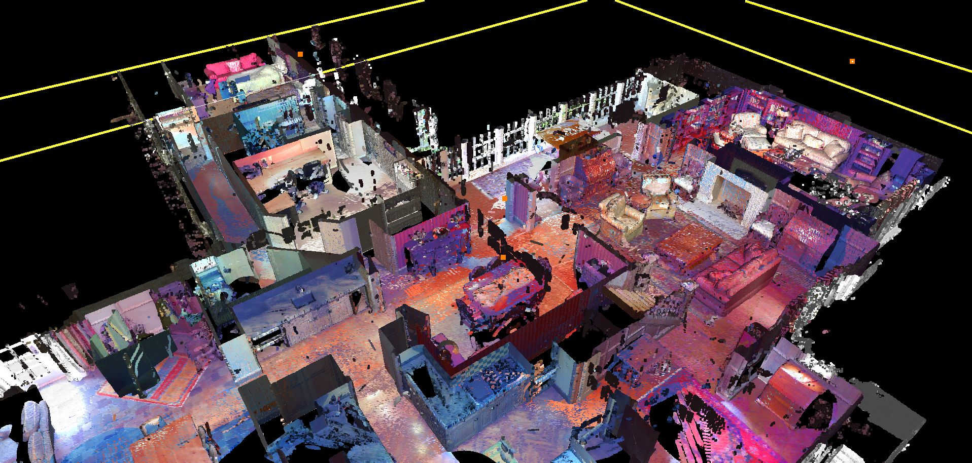
Here, you get a point cloud project that is fully registered. We carefully align the many scans taken, proviing you full color point clouds that are viewable in free or low-cost software such as Autodesk Recap where you can take spot measurements and view panoramic images. You can also import the point clouds CAD software such as Autodesk Revit and Navisworks.
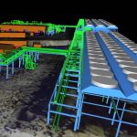
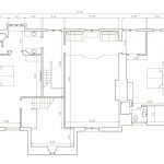
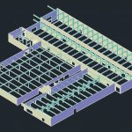
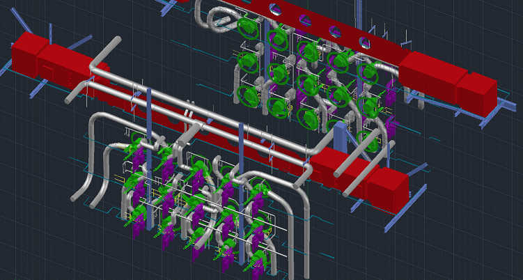
Option #3: As-built CAD model
Here, we do all of the heavy lifting for you and you get a CAD model that can be opened directly within your CAD program such as AutoCAD, Revit, Navisworks, Solidworks and more. In addition, you also get the registered scan point cloud so you have the raw data for viewing, further processing and future use.
additional output options
There are a number of things that we can do for you in addition to the standard 3D laser scanning and CAD:
Custom Alignment
If you need your scan or CAD model to be aligned to a plant coordinate system, specific survey monument points, state plane coordinates, or even aligned to a CAD drawing, we can make it happen.
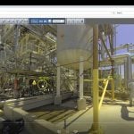
Panoramic images
Put yourself in the plant using beautiful, full color HD images that can be included with your 3D scan. They allow you to visit the facility from your desk, have a look around and explore the plant layout. You can even take spot measurements directly from the photos, check elevations, mark locations and leave comments for your colleagues. Free viewer included.
2D Plan and elevation drawings
2D drawings are a low-cost, natural byproduct of creating a 3D model using Revit. We can provide these as add-ons to your 3D CAD model. They are available in DWG, DXF or PDF format.
Unified point clouds
Often the biggest headache and worry about working with 3D laser scans is the sheer size of the data. Large scans will bog down even the most powerful desktop workstations, let alone the typical computers that engineers have to work with. To help with this problem we can deliver the point cloud as a unified one, where all of the scans have been combined into one and the point spacing has been optimized to provide the minimum level of detail while minimizing file size.
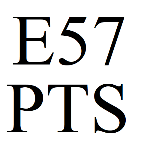
Export to generic standard formats
There are many different 3D laser scanner manufacturers, and they all use their own proprietary formats. But thankfully, for a small fee these scans can be converted into generic, neutral formats that can be imported into your favorite software. These formats include E57, PTS, XYZ and others.
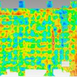
flatness or other inspection reports
You can compare the scan to perfect geometry and receive color map inspection reports such as floor flatness reports, tank roundness, tower straightness,
as-built or design-intent CAD modeling
In a perfect world, everything is flat, straight and plumb. But in reality, everything built is wavy, crooked and not quite level, to some small degree. The scanner picks up all of these flaws, so when receiving a CAD model from us, you can choose whether the model should reflect these flaws, making it an “as-built” model rather than a “design intent” model.
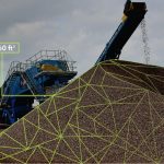
Volume Calculation
We can measure volumes of stockpiles, dike capacity, interior room air volume or any other custom volume or surface area calculation.
Why utilize long range 3D scanning services?
Common reasons include:
Installation of new piping around what is already there
Analyzing tower or tank straightness
As a substitute for hand measurement
Documenting a site before demolition
Fitting new glass into an old structure
Create shop drawings, floorplans and elevations
Taking inventory of stockpile volumes
Determining clearance for new equipment installation
Creating visualizations for proposals and presentations
Besides getting a CAD model, what else can you do with a long range 3D scan point cloud?
3D laser scanning can help you finish your project quickly and accurately. But having a 3D point cloud may provide additional benefits beyond the immediate project need.
Perform Clash Detection against CAD models or other scans
Take spot measurements
Remove equipment or move around on the shop floor
Provide an as-built reference to contractors for bidding
Create fly-through videos and animations
Obtain ortho-photos (dimensionally accurate images)
Get spherical images from scan locations
Detect misalignment or subtle elevation changes
point clouds - valuable assets in themselves
One of the best uses of a point cloud is just to keep it on file for the records. Then you have a snapshot in time of not just what the facility looked like, but an actual digital 3D replica that you can pull out when you need and explore, as if going back in time. Who knows what questions will come up that could be answered by having such a resource, and at relatively low cost. It can be used over and over again for engineering purposes and is truly a re-usable asset.
Do you want to learn how to scan?
Great news! We are always happy to share knowledge and information about 3D scanning with our customers. Our on-site techs have no problem with you looking over their shoulder while they explain what they are doing and why. We recognize that many of our customers wish to do their own scanning at some point. What better way to learn than to have it done professionally first so you can see how the pros do it. It used to be that long range 3D laser scanning industry was somewhat difficult to get into. The software and equipment was incredibly expensive. But times are changing, and while there is still a moderate investment required to get into 3D scanning, it is a lot cheaper and easier now. So we figure the information is out there and if you don’t get it from us, it will be someone else.
more examples of Long Range 3D Laser Scanning
Here are some more examples of projects that we have worked on:
Airplane
Boat
Power Plant
interested in Long range 3D laser scanning services?
call 866-687-7784 or email [email protected] to get started with reverse engineering services.


")