Introduction: Digital Accuracy for a High-Stakes Industry
The oil and gas industry operates under high risk, tight timelines, and exacting standards. From upstream exploration to downstream processing, one thing is clear: precision matters. That’s why more companies are turning to 3D laser scanning—also known as LiDAR scanning—to capture, model, and optimize their complex assets with unmatched accuracy.
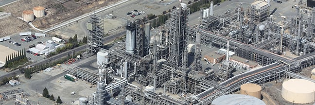
At Arrival 3D, we specialize in delivering reliable, high-resolution 3D scanning services for refineries, offshore platforms, pipelines, storage terminals, and more.
3D laser scanning uses high-speed LiDAR to capture millions of measurement points—called a point cloud—that represent the exact shape, size, and spatial relationships of physical environments. In oil and gas, this enables:
-
As-built documentation
-
Facility design validation
-
Asset tracking and tagging
-
Maintenance planning
-
Remote inspections
Arrival 3D uses top-tier equipment like the Leica RTC360, ScanStation P-Series, and BLK360 to handle environments ranging from tight pipe racks to wide-span offshore decks.
Why 3D Scanning Is Critical in Oil & Gas?
1. Complex Facilities Need Exact Data
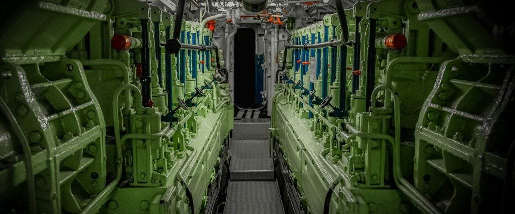
Oil and gas sites are dense with piping, platforms, flare stacks, and tanks. Manual measurements often fall short. 3D scanning delivers detailed digital replicas with millimeter accuracy—no shutdowns needed.
2. Supports Faster Upgrades & Retrofits
With reliable as-built data, engineers and designers can plan modifications off-site, minimizing field rework and delays.
3. Improves Safety & Compliance
Scanning allows for remote measurements of hazardous areas, reducing human exposure and helping meet OSHA, API, and MSHA safety standards.
4. Speeds Up Turnaround Planning
In planned shutdowns, time is money. 3D scanning helps teams pre-plan routes, material staging, and clash detection with confidence.
5. Lowering Costs Through Proactive Asset Management
By creating accurate digital records of infrastructure, operators can proactively identify wear, corrosion, or misalignment before it becomes a costly problem. 3D scanning enables better maintenance planning, reduces unplanned downtime, and extends asset life cycles.
6. Economic and Environmental Impact of 3D Laser Scanning
By eliminating the need for physical prototypes, reducing rework, and improving operational efficiency, 3D scanning cuts costs and lowers the carbon footprint. Fewer site visits, reduced material waste, and more informed planning all contribute to sustainability in oil and gas operations.

Key Applications in the Oil & Gas Sector
As-Built Documentation
Capture existing site conditions for pipelines, pressure vessels, and storage tanks. Perfect for legacy facilities with outdated blueprints.
Design & Construction Validation
Verify that installed components match 3D models or P&IDs before commissioning.
Offshore Platform Scanning
Survey entire rigs or FPSOs with minimal disruption. Helps in asset integrity assessments, inspections, and renovations.
Equipment & Flare Stack Modeling
Scan complex assets like exchangers, towers, and flare stacks—even at height—with drone-mounted or ground-based LiDAR.
Maintenance & Shutdown Projects
Support turnaround planning with precise layouts for scaffolding, valve replacements, and confined space entry.
Pipeline Mapping & Inspection
Document flowlines, risers, and pipelines in 3D to check for deformation, corrosion, or clearance issues.
How 3D Scanning Compares to Traditional Methods
| Feature | Traditional Surveying | 3D Laser Scanning |
|---|---|---|
| Accuracy | ±1–2 inches | ±2–3 millimeters |
| Speed | Slow, manual | Fast (up to 2M points/sec) |
| Safety | Requires access to hot zones | Remote or contactless |
| Deliverables | 2D drawings only | Point cloud + 3D models |
| Cost-Effectiveness | More rework, longer timelines | Better planning, less waste |
Arrival 3D brings over 20 years of expertise in reality capture for the oil and gas industry. Whether you’re planning a retrofit, preparing for a shutdown, or mapping offshore infrastructure, our team is ready to deliver the accuracy you need—on time and on budget.
Frequently Asked Question’s
➡️ What is 3D laser scanning used for in the oil and gas industry?
3D laser scanning is used to capture highly accurate, real-world data of oil and gas facilities, including refineries, offshore platforms, and pipelines. It helps with as-built documentation, design verification, turnaround planning, and equipment inspection—reducing errors, improving safety, and enabling faster project execution.
➡️ How accurate is 3D laser scanning for oil and gas projects?
Modern 3D laser scanners deliver sub-centimeter accuracy—typically within ±2 to 3 millimeters. This high precision makes laser scanning ideal for critical oil and gas applications where exact measurements are essential for piping retrofits, structural analysis, and compliance documentation.
➡️ Is 3D scanning safe for live oil and gas facilities?
Yes. 3D laser scanning is a non-contact, non-invasive process that can be performed while a facility is fully operational. Scanners can capture hazardous or hard-to-access areas from a distance, reducing the need for scaffolding, manual measurement, or shutdowns.
➡️ What are the deliverables of a 3D scanning project?
Common deliverables include point cloud data, 2D CAD drawings, 3D BIM models, and interactive viewers like TruView. Formats include .e57, .rcs, .dwg, .rvt, and more—compatible with software such as AutoCAD, Revit, Navisworks, and SolidWorks.
➡️ How much does 3D laser scanning cost for oil and gas sites?
The cost of 3D laser scanning varies based on project size, location, complexity, and deliverables. Typical oil and gas projects range from $5,000 to $30,000+, depending on whether you’re scanning a single unit or a full facility.
➡️ Can 3D scans be used for digital twins in oil and gas?
Absolutely. 3D scan data can be converted into digital twin models that allow real-time monitoring, predictive maintenance, and better asset management. These digital replicas enhance operational efficiency across the oil and gas value chain.