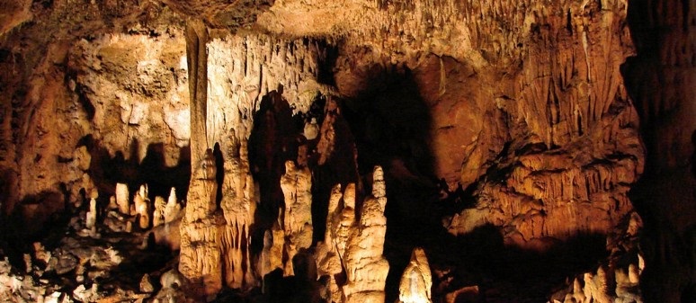
Cave Was Originally Discovered in 1806
When 3D laser scanning services are used to map out a place, it is not just 3D data created but also 3D models that allow people to explore new places. 3D scanned maps are accurate and provide detailed information about what goes on in an area. This has made them very popular among professionals who need them for their work. As the professionals of tomorrow, students need to learn how to use 3D scanners.
This year, students at James Madison University in Virginia have used 3D scanners to create a map of Grand Caverns cave. It’s the first time 3D scanning has been done at this cave, making it even more exciting. The students worked with a professional to use a ZEB Horizon scanner from GeoSLAM to scan the cave with lasers, then create a map. 3D scanning services are transforming the way people create 3D maps of the real world, and they will be important for years to come.
Grand Caverns is a beautiful cave that is also quite big. It was discovered in 1806 by two boys and is home to many animals, including bats and salamanders. It also has many beautiful formations, such as stalactites and stalagmites. Grand Caverns is worth a visit if you are in the area. Thanks to the students ‘ hard work, you can now view it in 3D online.
How 3D LASER scanning SERVICES work
To create a 3D map of an area, a 3D laser scan is used. These scanners use lasers to scan the area and collect data. This data is then turned into 3D models that anyone can explore. The scanner collects data with accuracy within 10mm for the entire cave, making it very accurate. It shines lasers in all directions and records the time it takes for the laser to bounce back. 3D scanning services are not just used to map caves, either. They can be used to map anything from small objects to large areas.
Will 3D scanning maps be used more in the future?
3D scanning services are transforming the way people create 3D maps of the real world, and they will be important for years to come. 3D scans combine photography and 3D modeling into one cohesive map that is easy to understand. They can also show a lot more detail than traditional photographs or drawings. As a result, it gives professionals an edge when presenting data. 3D scanning services are becoming more and more popular, and they will likely be used even more in the future.