Plan with Confidence. Cut Costs. Reduce Rework. Avoid Delays.
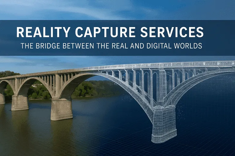
At Arrival 3D, we provide nationwide 3D laser scanning services across the United States, converting real-world structures into accurate digital assets. With more than 20 years of experience in reality capture and LiDAR Scanning, our team brings state-of-the-art laser scanning equipment such as Leica RTC360, P-Series, NavVis VLX, and drone-based LiDAR systems directly to your site.
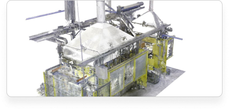
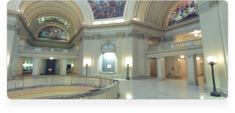
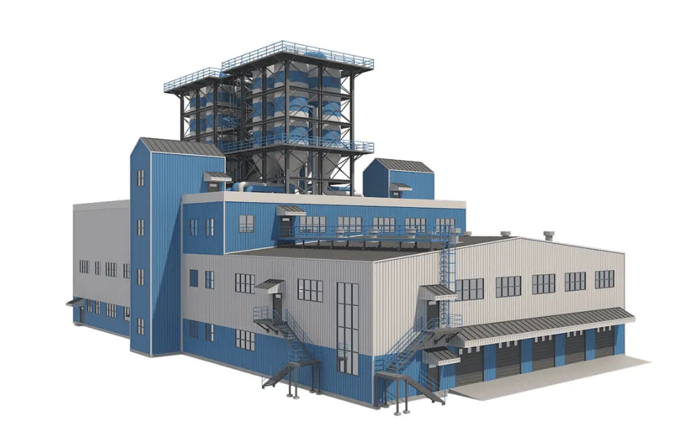
Our expertise covers a wide range of facilities, from industrial plants, refineries, and manufacturing sites to commercial buildings, hospitals, universities, government infrastructure, bridges, roads, and heritage landmarks. For complex sites, we enhance the capture process with digital 360 imaging photogrammetry which helps record areas with rich visual detail and texture. No matter the complexity, we provide accurate, high-resolution scans that give you reliable digital documentation of your project.
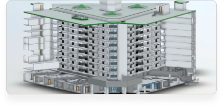
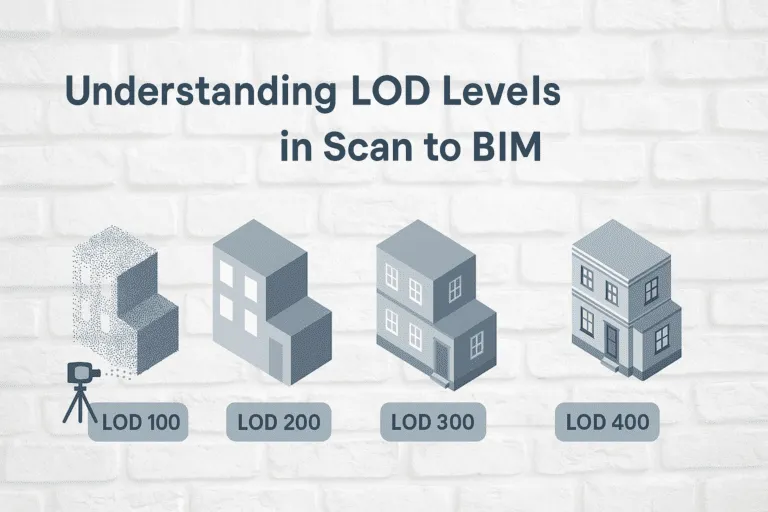
The data we capture is delivered as point clouds, Revit models(LOD 100-500), CAD floor plans, sections, elevations, and interactive digital twins. These assets streamline design and engineering workflows, cut down costly site revisits, and enable better coordination across teams.
By partnering with Arrival 3D, you gain access to comprehensive 3D scanning solutions that reduce risk, lower costs, and accelerate project timelines. We proudly cover all regions of the United States, turning real-world environments into precise, future-ready digital assets for smarter planning and decision-making.
Precise 3D scanning for accurate as-built documentation, BIM models, and project planning.
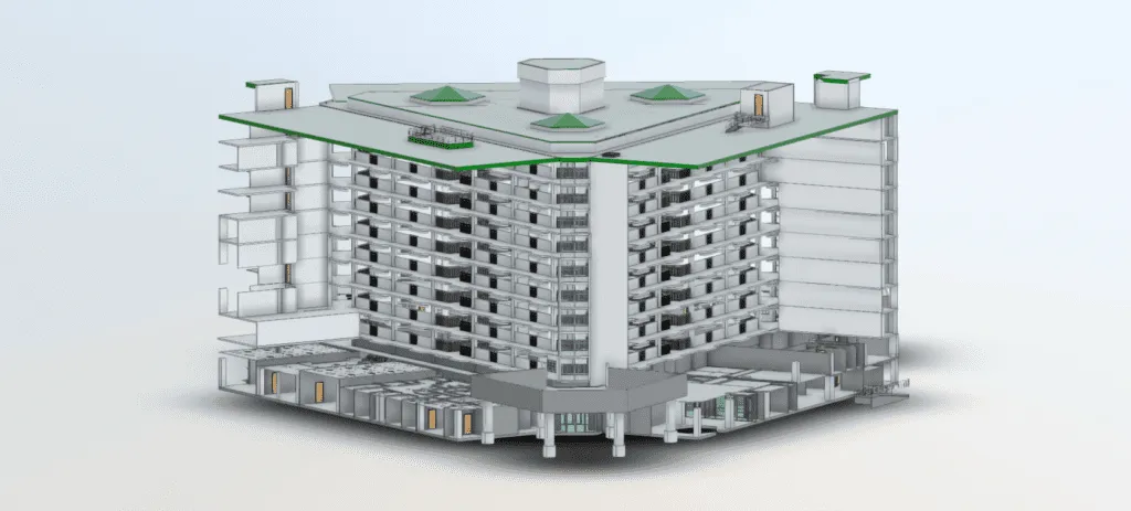
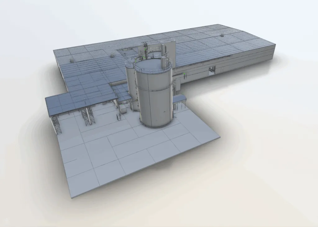
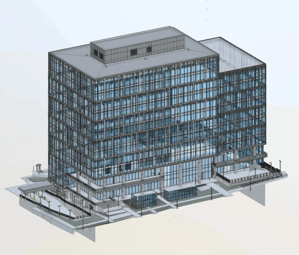
Convert point cloud data directly into intelligent 3D BIM models for Architecture, Engineering & Construction projects, enabling clash detection, quantity take-offs, and accurate design.
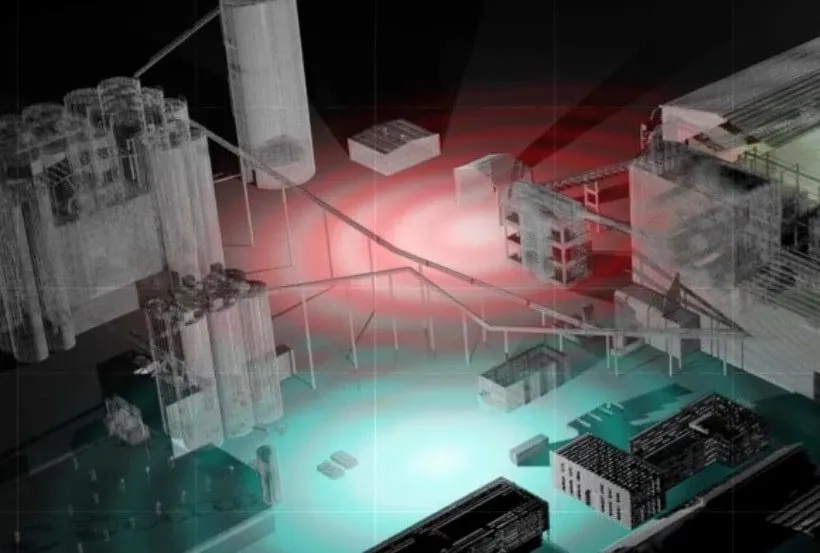
Develop comprehensive digital twins for facilities, assets, and infrastructure, enabling online collaborative walk-through environments with data integration
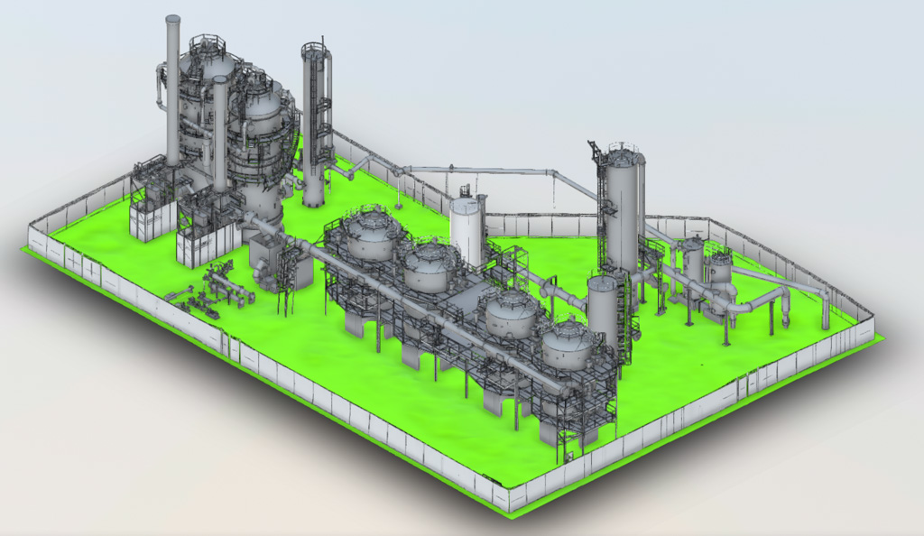
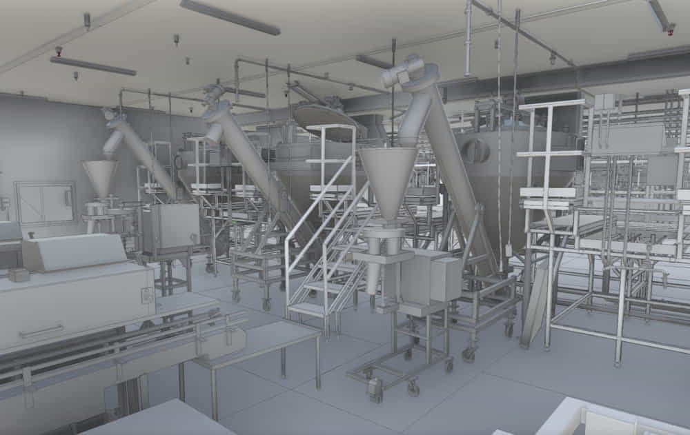
Update as-built records of power plants, oil & gas refineries, factories and other industrial facilities for next-level engineering and planning

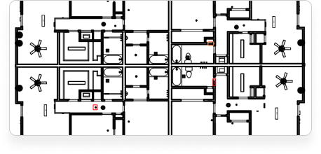
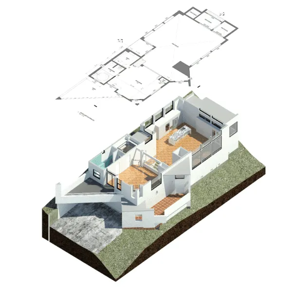
Scan your building and receive usable 2D CAD drawings such as floorplans, elevations, sections and site plans in standard formats such as PDF and AutoCAD
Provide 3D Revit models that are optimized for facility management and containing appropriate parametric information to interface with your database
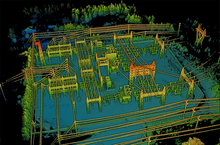
Quickly capture large or difficult-to-reach areas using drones and receive point clouds, color topo maps, site drawings or as-built 3D models

Utilize 3D reality capture to get precise and detailed 2D/3D drawings for architecture, engineering, and construction projects.
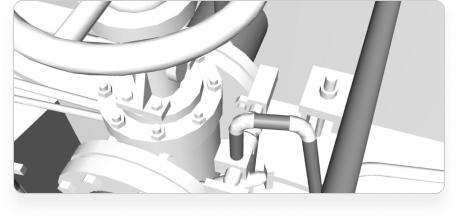
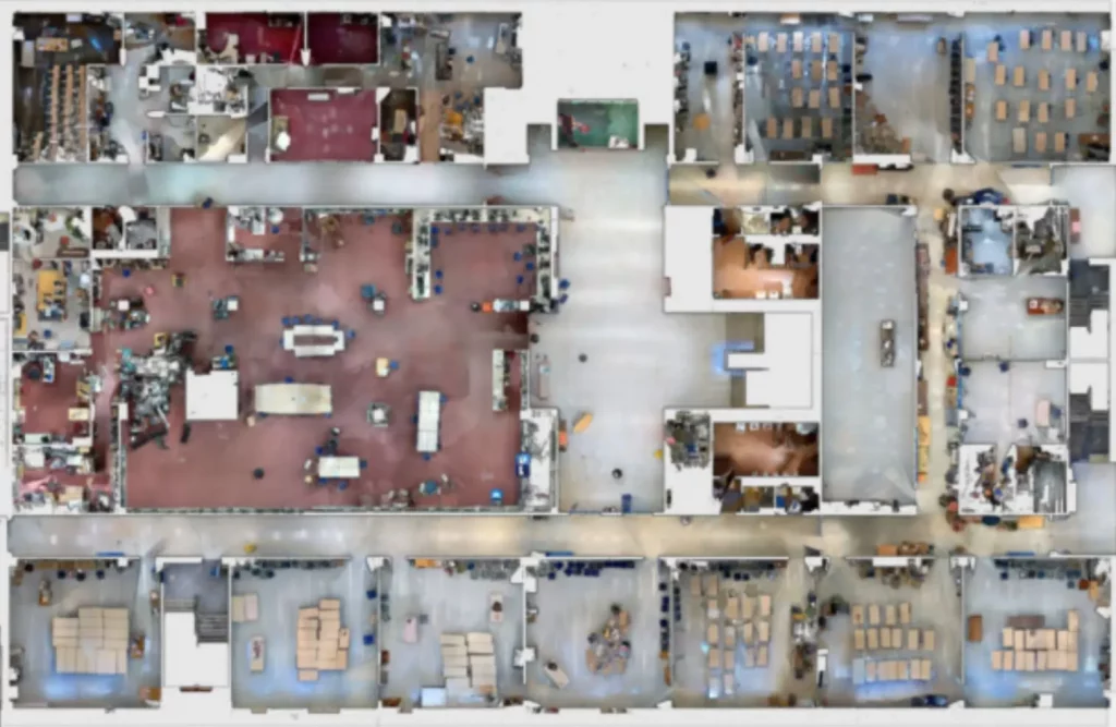
Capture highly detailed and precise as-built 3D models of your building or facility along with color panoramic photos of the site for thorough as-built documentation
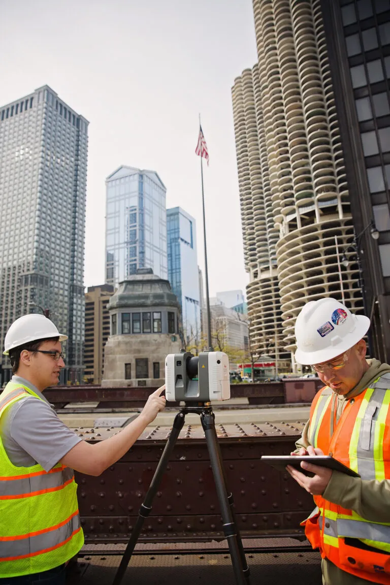
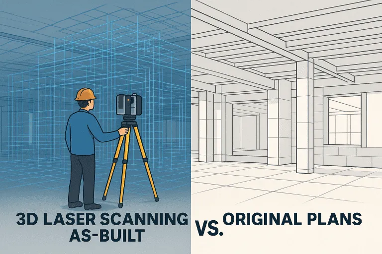
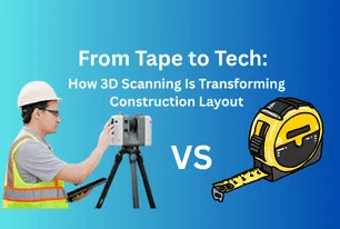
Engineers, architects, construction managers, surveyors, and facility managers across the world trust on 3D laser scanning technology also known as LiDAR scanning, reality capture, and high-definition surveying (HDS) to capture site conditions with millimeter-level precision. By eliminating manual tape measurements or traditional total station surveys, this advanced surveying method captures millions of data points in seconds, producing as-built documentation, point clouds and digital models. Whether for renovation, retrofit, restoration, or space repurposing, our expert 3d surveying services deliver reliable point clouds, CAD drawings, BIM models and digital twins that streamline projects and support smarter decision-making.
Our experienced field technicians use aerial drones, terrestrial tripod scanners and mobile LiDAR system to capture built environments and landscapes in full 3D details. 3D laser Scanning is non-intrusive, fast and contactless, projects can be scanned without site shutdowns or disruptions. Hazardous or hard-to-reach areas such as industrial equipment, refinery piping, high ceilings, or structural voids can be safely documented from a distance, making this process far safer than manual measurement or traditional surveying methods. With scanning speeds that drastically reduce field time, our reality capture services are both cost-effective and highly efficient.
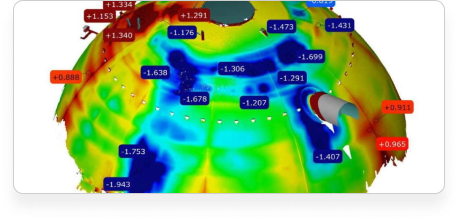
We provide ready-to-use digital 3D models deliverables tailored to your workflows. We generate native CAD and BIM models in platforms like Autodesk Revit, AutoCAD, Navisworks and SolidWorks, as well as neutral file formats such as STEP, Parasolid or polygon meshes. Beyond 3D modeling, we deliver 2D drawing packages including floor plans, sections, elevations, and site maps. Our services also support color panoramic imagery, virtual walk-throughs, online digital twins, and color-coded deviation analysis reports, enabling you to visualize, analyze, and share accurate data instantly. These outputs empower teams to design, plan, fabricate, and manage facilities with confidence.
We spend the necessary time to LISTEN, learning your project needs, discussing requirements, and scheduling the scan

Our expert technicians deploy the most suitable LiDAR technology to meticulously capture millions of data points on your site.

Raw point cloud data undergoes rigorous processing, cleaning, and registration using advanced industry-leading software.

We deliver precise 3D models, 2D CAD drawings & as-built documentation in your preferred format (Revit, AutoCAD, Navisworks) ready for immediate use.


Architecture

Engineering


Construction
Architecture
Engineering

Power Generation
Government & Municipal

Historical Preservation

Retail

Real Estate

Waste Management

Infrastructure

Manufacturing

Education

Aerospace & Defense

Health & Pharmaceutical

Telecom

Marine

Transportation

Entertainment

Mining

Water Treatment
Construction
Architecture
Engineering
Power Generation
Government & Municipal
Historical Preservation
Retail
Real Estate
Waste Management
Infrastructure
Manufacturing
Education
Aerospace & Defense
Health & Pharmaceutical
Telecom
Marine
Transportation
Entertainment
Mining
Water Treatment
Arrival 3D is a dedicated 3D laser scanning services provider with a singular mission: to deliver accurate, high-quality scanning solutions better than anyone else in the industry.
We deliver industry-standard formats such as:
✅ Point Clouds: Autodesk Recap, E57, PTS, LAS and many more
✅ CAD Models: 3D Revit, AutoCAD, STEP, IGES, DWG, Solidworks and more
✅ Mesh Models: STL, OBJ, FBX
Yes, we provide 3D scanning, modeling, and related services across all 50 states, including:
3D scanning is a method of capturing the exact shape and dimensions of physical objects or environments and converting them into detailed digital models. It’s commonly used to document buildings, industrial sites, equipment, and other structures with high precision.
How It Works:
Capturing Data:
A 3D scanner emits laser beams or structured light that reflects off surfaces. The time or angle of the reflected signal is measured to determine distances.
Creating a Point Cloud:
The scanner collects millions of individual measurements, known as a point cloud—a set of 3D data points that represent the surface geometry of the scanned object or space.
Modeling the Data:
The point cloud is processed using specialized software to produce deliverables such as 2D CAD drawings, 3D models, BIM files, or digital twins, depending on the project’s requirements.
Where It’s Used:
3D scanning is used in architecture, engineering, construction, manufacturing, historical preservation, oil and gas, and other sectors for tasks like renovation planning, as-built documentation, and site analysis.
Download Our Free 3D Laser Scanning Checklist
Nothing captures true as-built conditions like 3D laser scanning. By documenting existing conditions with LiDAR scanning technology, project teams gain:
Accurate baseline data for design and construction.
Faster project timelines with fewer delays and errors.
Clear communication between stakeholders with precise visuals.
Digital transformation of facilities through BIM models and digital twins.
Pricing depends on factors like project size, complexity, scanning technology, and data processing requirements. Contact us for a custom quote based on your needs.
Satisfaction Guaranteed!
If we fail to deliver the result that we promised, and we can’t make it right, you don’t pay.
What is the cost of 3D laser scanning per square foot?
The cost typically ranges from $0.05 to $1.00 per square foot, depending on the level of detail, project complexity, and deliverables like point clouds, CAD, or BIM models.
Our 3D scanning technology delivers high-precision results with typical accuracy ranging from ±1 mm to ±6 mm, depending on the scanner used and site conditions. We utilize the highly precise, Swiss-made Leica RTC360 and other survey grade instruments. We follow rigorous QA/QC processes to ensure reliable and repeatable accuracy. Whether you need as-built documentation, BIM models, or CAD drawings, we tailor the scan resolution and setup to meet your project’s specific tolerance requirements.
We know you have a choice when you scan. Our 3D laser scanning services rise above our competitors when you consider that we offer:
We utilize a diverse fleet of cutting-edge LiDAR scanning equipment to suit the unique demands of each project: