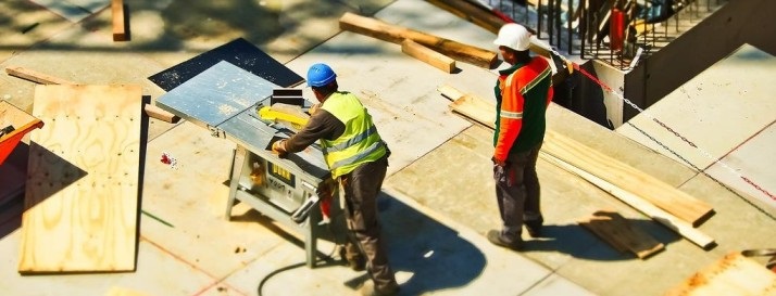
Various industries such as AEC (Architecture, Engineering, and Construction), Healthcare, and Weather Forecasting, are rapidly adopting 3D mapping technology because of this precision, and less time associated with the scanning process. The continuous technological advancements in 3D mapping have enabled spatial data more efficient, accessible, and precise for various uses.
According to MarketsandMarkets report, the 3D scanners market will grow to USD 1.5 billion by 2028, at a CAGR of 6.9%.
Emerging new trends such as Artificial Intelligence (AI), Machine Learning (ML), Augmented Reality (AR), Virtual Reality (VR), 3D scanning automation, and mobile 3D scanning are making the markets grow further.
What is 3D Mapping and Why is it important?
What is 3D Mapping?
The creation of three-dimensional environmental representations occurs through the use of sophisticated scanning systems including LiDAR technology and photogrammetry methods as well as both drones and 3D laser scanners. Digital models deliver precise spatial data that allows users to conduct virtual analysis and interaction with real-world locations.
The method captures accurate depth measurements and structural details which enables industries to produce realistic maps of buildings and natural or manmade objects
Why is 3D Mapping important?
- Enhanced Accuracy & Detail – Two-dimensional maps do not provide sufficient depth or detailed spatial information. The accurate physical world representation offered by 3D mapping supports essential tasks in engineering alongside architecture and urban planning sectors.
- Better Decision-Making – The construction, mining, and agriculture industries depend on 3D maps to enhance their site analysis capabilities while improving risk assessment and resource management practices. Precise 3D data enables well-informed choices that save both time and expenses.
- Advancements in Autonomous Technology – Real-time 3D maps enable self-driving cars as well as drones and robotic systems to navigate environments and detect objects while gaining environmental awareness which improves automation capabilities and safety measures.
- Disaster Management & Environmental Monitoring – The use of 3D mapping technology enables predictions of natural disasters while monitoring climate change and helps to organize emergency responses for floods, wildfires and earthquakes.
- Improved Urban Planning & Smart Cities – City planners and governments utilize dynamic 3D mapping tools to construct smart cities and manage traffic systems while planning infrastructure developments.
- Real Estate & Virtual Tours – The real estate sector utilizes 3D scanning technology to produce virtual property tours which enable buyers to remotely inspect homes and commercial spaces.
Read More About – How Laser Scanning helps Wildfire Restoration
Let Us Explore the Most Important Emerging Trends in 3D Scanning Solutions and Services
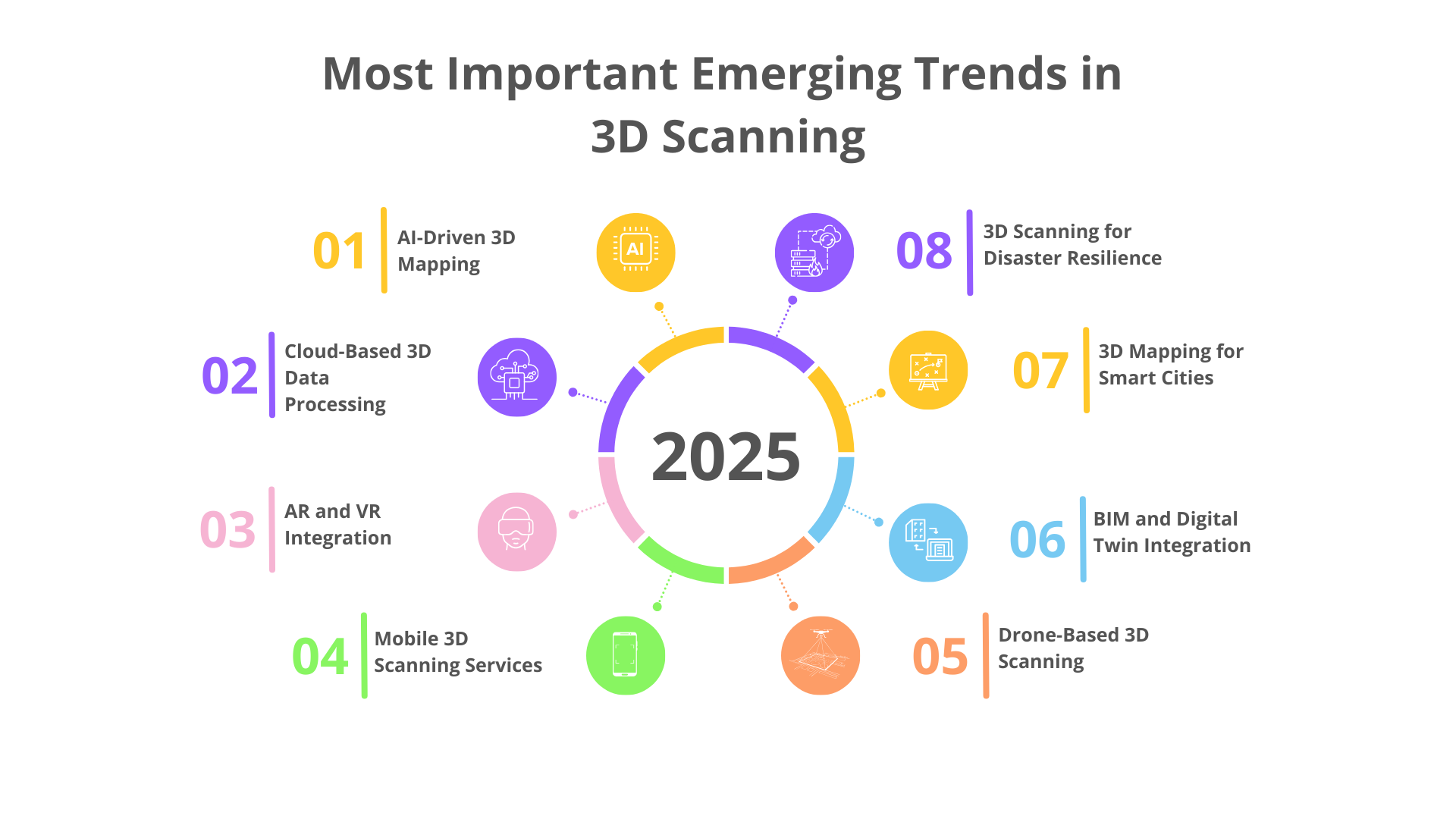
1. AI-Driven 3D Mapping
The recent Artificial Intelligence (AI) advancements are expanding the capabilities of LiDAR scanner for construction. AI can help in aligning multiple scans from different locations and angles into a single point cloud data, without the need of calibrating it in software. After acquiring the point cloud data, AI also helps in classifying and identifying various objects in the scan like walls, doors, windows, furniture, etc with the help of its intelligent technology. This helps in reducing the manual effort of creating a BIM model and automatically creates an as-built model from the point cloud data. AI and Machine Learning (ML) help in point cloud to BIM modeling process easier with automation. In the future, we can directly create an as-built BIM model in real time during scanning itself.
2. Cloud-Based 3D Data Processing
Cloud-based 3D data processing refers to the method of handling the point cloud data acquired from the scanning on remote servers in the cloud. While cloud computing is the streamlining of the 3D mapping workflows by enabling real-time data processing and storage. With cloud storage, multiple persons who are the stakeholders of the project can access and work on the 3D models created from the acquired point cloud in a single interface. It will improve the efficiency of the BIM process in the AEC sector.
3. AR and VR Integration
Augmented Reality (AR) and Virtual Reality (VR) allow users to interact with the laser-scanned data realistically. In different places, various individuals can access the scan data at the same time with the help of AR and VR technology. This helps in collaboration between the teams, and design discussions. The scanned data converted into interactive 3D BIM models can help in creating training simulations for renovations and remodeling. It helps the team to understand the project in an immersive way, by knowing the details on real real-life scale before the construction begins.
4. Mobile 3D Scanning Services
Now most smartphones are embedded with downloadable applications for 3D laser scanning. The procedure of smartphone laser scanning is simple. If in the case of an object, you have to walk around the object with your mobile 3D scanner and get the point cloud data. In case of a space like a room, you have to walk around and scan all the walls, floor, and ceilings by moving around your phone appropriately. iPhone’s LiDAR technology has now become a low-cost solution for building documentation. Polycam, is an Android and iPhone based application that supports LiDAR and photogrammetry.
5. Drone-Based 3D Scanning
Take Your Mapping to New Heights with Arrival 3D Drone Scanning Services! Our drone-based solutions offer accurate and cost-effective surveying for large-scale projects. Contact us for a consultation.
Drones equipped with high-resolution cameras and LiDAR sensors are becoming essential tools for large-scale 3D mapping. These unmanned aerial vehicles (UAVs) are being used for topographic surveys, environmental monitoring, and disaster management, providing a cost-effective and efficient way to scan vast areas quickly.
6. BIM and Digital Twin Integration
Building Information Modeling (BIM) is now extensively using 3D laser scanning technology for renovation, remodeling, heritage conservation, and facility management projects. Digital Twins are intelligent BIM models of an existing building or an object that simulates how the space or the object works, using Artificial Intelligence (AI), Machine Learning (ML), and Internet of Things (IoT). By using the real-time data received by Digital Twins, facility managers can make decisions about the operations and management of a building. Digital twins of cities also help in smart city management.
7. 3D Scanning Automation
Simplifying the scanning to point cloud conversion process to increase productivity and reduce manual labor is known as 3D scanning automation. Robots equipped with scanning devices can document hazardous buildings with no human intervention. With the advent of AI and ML, automatic identification of architectural, structural, and MEP components are possible now by softwares. This can enable real time Scan to BIM process in future. Which considerably will reduce the as built documentation time in the future.
8. 3D Mapping for Smart Cities
By embedding Internet of Things (IoT) sensors in smart cities, city planners can create a dynamic digital twin of the city, which can aid in understanding traffic patterns, infrastructure, structural health, disaster preparedness, and the environment to make city management and planning decisions. This technology is at the forefront of developing smarter, more livable cities by monitoring structural health, simplifying subsurface utility mapping, and improving public safety.
9. 3D Scanning for Disaster Resilience
3D laser scanning and GIS have become now inevitable for the prediction of disasters and post-disaster management. This technology has been used throughout the world for geospatial scanning with aerial 3D mapping drones and GIS satellites for analyzing and simulating worst-case scenarios for floods, wildfires, earthquakes, and hurricanes. This will help in better people management during disasters and help in making evacuation plans. These disaster simulation models can help in planning infrastructures that can control these disasters and their effects.
Conclusion
The evolution and innovation in 3D mapping and scanning technology have enabled efficiency and advancement in various industries including the AEC (architecture, Engineering, and Construction) industry. Architects, civil engineers, conservation architects, and facility managers can now leverage this innovative technology to improve their design, construction, operations, and management processes. New trends like automation and immersive visualization driven by AI, ML, and IoT will make 3D mapping, not just an option, but an important part of the process of design and construction in the future. Emerging trends like smartphone 3D laser scanning have enabled the normal public also use this technology by themselves for smaller projects. Thus, the trends are making the 3D scanning process much more accessible, cheaper, and efficient.
If you are an architect, engineer, or facility manager who wants to integrate 3D mapping into your projects, stay ahead by adopting the emerging trends in 3D laser scanning.
Arrival 3D’s experienced and certified surveyors will ensure efficient and accurate 3D laser scanning and Scan to BIM process by integrating the latest technologies for the best as-built documentation. Contact us and get a free consultation.