What Perseverance Has Taught Us
3D laser scanning services have been making headlines recently for their revolution in the business industry. However, not often seen is how the technology is being used by the government, particularly regarding space exploration.
We observed just over one year since NASA’s Perseverance arrived safely on Mars at the end of February. Its infamous launch (dubbed ‘seven minutes of terror’) was not nearly the first of attempts at completing the 471-million km journey from Earth – and with the budget mounting exponentially from past failures – many eagerly awaited what fruits a successful landing would bear.
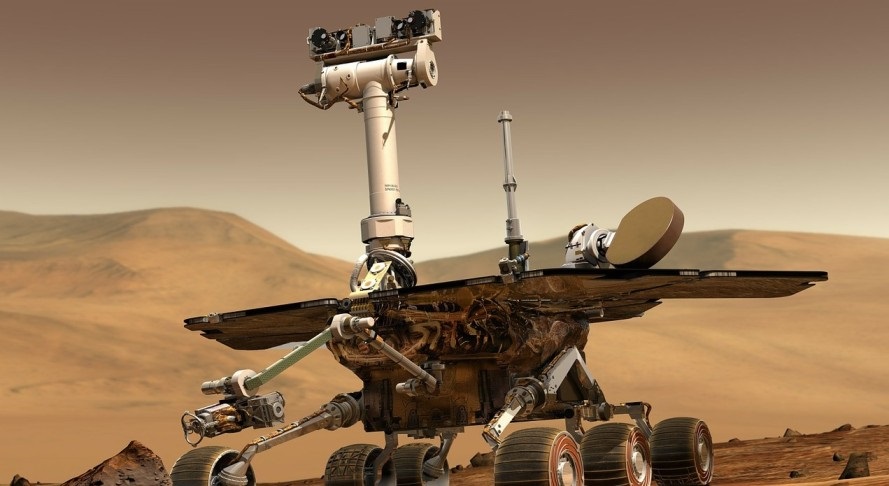
Perseverance boasts 23 cameras in total. A composite of 3D scanning services technology generates images, including; nine engineering cameras, seven science cameras, and seven more for atmospheric travel. At the time of this writing, over 100,000 images of Mars have been transmitted by the “photographic team,” They are already helping us understand how geographic elements formed the landscape.
Martian drone helicopter Ingenuity, too, joined Perseverance as yet another ingenious application of 3D scanning services for off-world exploration. It is equipped with a mere two cameras: one forward-facing stereoscopic color camera and one downward-facing black and white camera for navigation. Using only these cameras, Ingenuity can still create a high-quality 3D mapping of Mars’ topography.
Raw images taken by the 3D scanning services of both machines provide were made public in an online gallery by NASA. Researchers suggest these laser scan images will even offer clues to help search for microbial life, a huge step in discerning sustainable atmospheric conditions for humans.
And what of 3D laser scanning services? How do they relate to this?
Scanning technology is used to adjust and integrate several data images into one composite – in a manner somewhat similar to the panoramic feature included in IOS camera functionality. Perhaps the most iconic of the images mentioned above is Perseverance’s “selfie” with Ingenuity, which comprises 62 individual images stitched together post-transmission.
As a result, NASA experts can capture data that serves as the individual building blocks of a final, more dynamic product.
It is thanks to products such as these that NASA scientists have been able to identify potential boons and dangers. According to Professor Sanjeev Gupta (co-lead researcher): “These [images] have an impact on the strategy for the selection of rocks for sampling. The finest grained material at the bottom of the delta probably contains our best bet for finding evidence of organics and biosignatures. The boulders at the top will enable us to sample old pieces of crustal rocks.”
Having looked over the images thus far, NASA researchers have already been able to identify areas likely to hold water and humid temperatures – further directing their search for viable sources of life. Rock depictions sent back for analysis have even led scientists to suggest parts of the terrain that may comprise molten lava – and thus advisably avoidable.