3D Laser Scanning Services in Seattle, Washington

Precision Reality Capture for Seattle & the PNW

As an architect, engineer, contractor, or facility manager, you understand how critical it is to have reliable data before making design or construction decisions. At Arrival 3D, we specialize in delivering high-precision 3D laser scanning, LiDAR capture, and Scan-to-BIM services that help you move projects forward with confidence.

With over 20 years of experience, our team supports professionals like you by capturing accurate existing conditions—so you can reduce change orders, avoid site revisits, and minimize costly delays. Whether you’re planning a renovation, managing assets, or coordinating a large-scale infrastructure build, we provide detailed point clouds, BIM LOD 500 models, 2D drawings, digital twins, and as-built documentation tailored to your scope.

We’ve partnered with clients across the AEC industry, as well as in manufacturing, oil and gas, healthcare, education, and aerospace. From substations and wind farms to historical preservation and university campuses, our work helps streamline coordination, improve safety, and boost project efficiency.

Based in Seattle and serving nationwide, Arrival 3D is here to support your next project with the accuracy, speed, and reliability you need.

Let Us Scan Your Project

3D Laser Scanning Services for the Pacific Northwest

Every service uses the same Leica professional equipment and the same rigorous QC process from a single-floor office renovation in Capitol Hill to a Boeing hangar in Everett.

As-Built Documentation

Certified as-built drawings and 3D models capturing existing conditions with sub-inch accuracy. For renovation, permitting, facility management, and code compliance. 2D CAD (DWG), Revit BIM, and point clouds delivered.
Scan-to-BIM

Fully parametric Revit models from laser scan data — LOD 100 to LOD 500. Clash detection, MEP coordination, and facility management. Compatible with AutoCAD, Revit, and Navisworks workflows.
Scan-to-Plan (2D Drawings)

Floor plans, elevations, sections, and reflected ceiling plans produced directly from 3D scan data. DWG and PDF at your required scale. The fastest path from existing conditions to production-ready drawings.

Industrial & Facility Scanning

High-density point cloud capture for manufacturing plants, data centers, lab environments, and industrial facilities. NavVis VLX mobile scanning covers large floor plates rapidly with zero production disruption.

Aerospace & Large Object

Precision scanning for aerospace structures, hangars, tooling jigs, and large-scale components too large for a lab. Boeing-scale work is within our capability: sub-inch accuracy on any object, any size.

Drone / UAV Scanning

FAA Part 107 compliant aerial LiDAR and photogrammetry for rooftops, infrastructure, cell towers, and hard-to-access areas. Orthomosaics, topographic mapping, and aerial point clouds delivered.
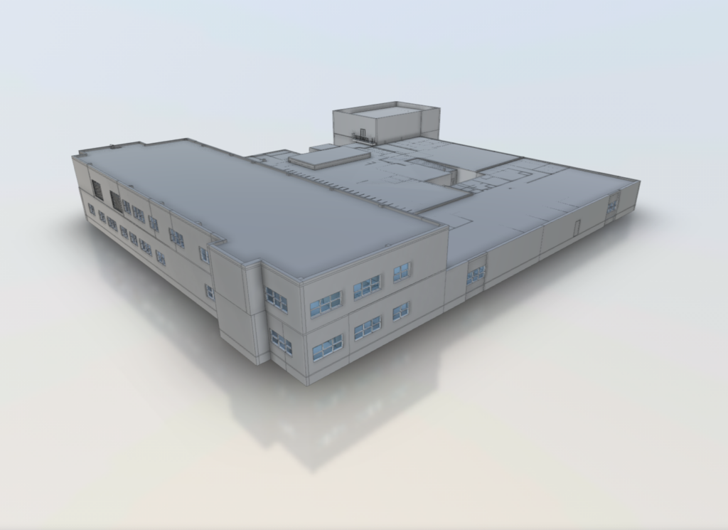
Veterinary Medical Diagnostic Laboratory Full model

What we need from you?

To give you an accurate quote and plan your project efficiently, the following details help us understand your scope right away.

  • Project Scope: Outline your goals, deliverables, and requirements.
  • Site Access: Provide entry details and safety protocols.
  • Documentation: Share existing as-built drawings or CAD files.
  • Timeline: Confirm deadlines, milestones, and scheduling constraints.
  • Contact Info: Designate your primary point-of-contact.
  • Special Needs: Mention any additional or unique project requirements.

How We Work With You

  1. Project Consultation and Planning

We’ll contact you to discuss your project’s goals, timing, and any existing documentation such as CAD files or as-builts to help us define the scope and plan the scan efficiently.

  1. Site Access and Preparation

You give access information and safety regulations then we ensure our team is prepared to scan without affecting your production.

  1. High-precision 3D scanning

We use modern LiDAR technology to record every feature of your site with pinpoint accuracy.

  1. Data Processing and Modeling.

We convert raw scan data into clean point clouds, BIM models, CAD drawings and floor plans according to your specifications.

  1. Delivery and Implementation

We deliver your finished assets on time which is ready for integration into your design, construction or facility operations.

Detailed Staircase Measurements

Advantages of choosing Arrival 3D

Nationwide Expertise

We provide reliable long-range 3D laser scanning to professionals across the United States suitable to each project's specific demands.

Precision Digital Twins

We provide precise digital reproductions of your facilities to improve as-built documentation, design collaboration and visualisation.

Cost-Effective Workflows

We help you save money and fulfil deadlines by decreasing errors, preventing rework and streamlining planning.

Local expertise

We do understand the local regulations, workflows and site conditions ensuring perfection and less headaches.

Arizona Mining Documentation

Arrival 3D Project Managers

Arrival 3D is the leading provider of 3D laser scanning services in Seattle, delivering unmatched accuracy and expertise on every project. Our highly trained Project Managers use state-of-the-art equipment, including the Leica Scan Station P-Series and Leica RTC360 3D laser scanners, capable of capturing up to 2 million data points per second with 2–4 millimeters of precision. 

Each Project Manager undergoes the most comprehensive training program in the industry, including 80 hours of hands-on classroom instruction, 320 hours of field mentorship, and an additional 40 hours of specialized LiDAR training. This extensive preparation ensures our team has both the technical knowledge and field experience to provide accurate, dependable data for planning, design, and construction workflows.

What You Receive

Deliverables in Every Format You Need

We tailor outputs to your software environment and project scope. Tell us what you need we deliver in the formats your team already works with.

2D CAD Drawings

Floor plans, elevations, sections, and reflected ceiling plans are production-ready at your required scale.

DWG, DXF, PDF

3D BIM Models

Parametric Revit models LOD 100–500. Clash detection and MEP coordination ready.  

RVT, IFC,

Point Clouds

Registered, cleaned scan data for AutoCAD, Revit, Navisworks, and all major platforms.

E57, RCP, RCS, LAS
Digital Twins

Interactive 3D replicas for long-term facility management, asset tracking, and remote operations.

BIM360, TANDEM
MEP Documentation

Above-ceiling scanning, MEP coordination drawings, and clash detection for all building systems.

DWG, RVT, NWD
Deviation Reports

Color deviation maps comparing scan data to design CAD identify out-of-tolerance areas.

PDF, BCF

Aerial / Drone Data

Aerial point clouds and orthomosaics for rooftops, large sites, cell towers. FAA Part 107 compliant.

LAS, TIF, E57

3D Mesh Models

Textured mesh models for visualization, simulation, digital twin platforms, and virtual tours.

OBJ, FBX, STL

Our Achievements at a glance 

We are trusted by industry leaders because we have proven ourselves throughout projects by focusing on desired results.

Arrival 3D
Projects completed
0
Arrival 3D
satisfied clients
0 +
Arrival 3D
years of experience
0 +
Arrival 3D
Cost Savings
0 %

Our 3D Laser/lidar Scanning Projects in Seattle, Washington

Industries Served

Industries We Serve in Seattle, Washington?

Arrival 3D brings industry-specific experience, safety protocols, and certified equipment to every sector in los Angeles .

Architecture & Construction

Oil, Gas & Energy

Industrial & Manufacturing

Healthcare & Medical

Education & Universities

Commercial Real Estate

Historic Preservation

Aerospace & Defense

Telecom & Infrastructure

Roads, Bridges & Civil

Pharmaceutical & Labs

Retail & Hospitality

Water & Wastewater

Renewable Energy

Government & Civic