High-Accuracy Digital Modeling for Architecture, Engineering & Construction ( AEC )
High-Accuracy Reality Capture Solutions for Construction & Facilities
Arrival 3D makes digital reality capture services accessible and accurate nationwide across the USA. Whether you need 3D laser scanning for educational buildings, residential properties, industrial facilities, or commercial mapping projects, our LiDAR scanning technology and digital reality modeling provide high-precision as-built data for any structure.
With 20+ years of experience, cutting-edge 3D scanners (Leica RTC360, BLK360, P-Series, NavVis VLX), and a team of skilled technicians, we guarantee dependable survey-grade accuracy.
We deliver scalable reality capture solutions nationwide using laser scanning, LiDAR, mobile mapping, and photogrammetry designed for both active construction sites and operational facilities.
Why Choose Reality Capture Over Traditional Surveying?
High Accuracy → Capture millions of data points with millimeter precision, eliminating errors from manual measurements. Perfect for renovations, restorations, and retrofits.
High Speed → Complete scans of large facilities in hours, reducing labor costs, minimizing repeat site visits, and accelerating project timelines.
Ready-to-Use Formats → Data delivered in Autodesk Revit, AutoCAD, Navisworks, SolidWorks, and other CAD platforms. Includes colorized point clouds, panoramic imagery, and virtual tours.
Accuracy
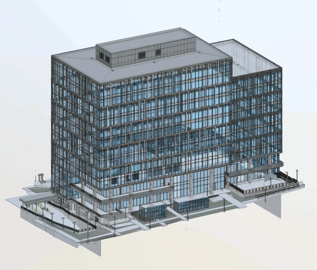
Our Reality Capture Capabilities
Reality capture services involve collecting precise spatial and visual data from physical spaces and converting it into usable digital formats such as point clouds, 3D models, and as-built documentation.
This process creates a verified digital record of existing conditions, making reality capture for existing conditions far more accurate and reliable than traditional drawings or manual surveys.
Our approach combines:
Laser scanning reality capture
LiDAR reality capture services
High-resolution imagery to produce complete, measurable datasets.
Our Reality Capture Capabilities
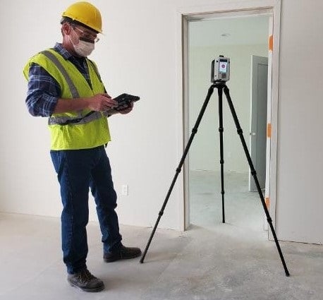
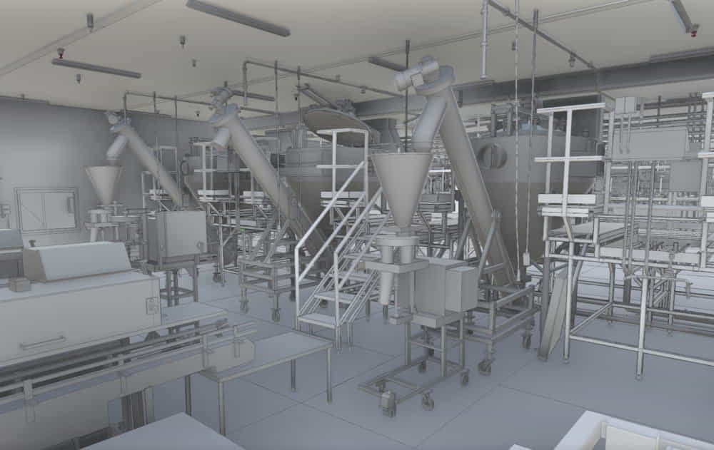
Laser Scanning & LiDAR Reality Capture
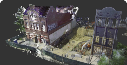
We perform laser scanning reality capture using industry-grade terrestrial and mobile scanners to generate dense, accurate point clouds. Our LiDAR reality capture services are ideal for large, complex environments where precision and speed matter.
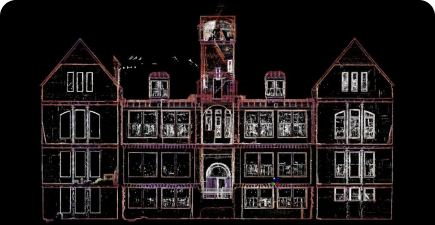
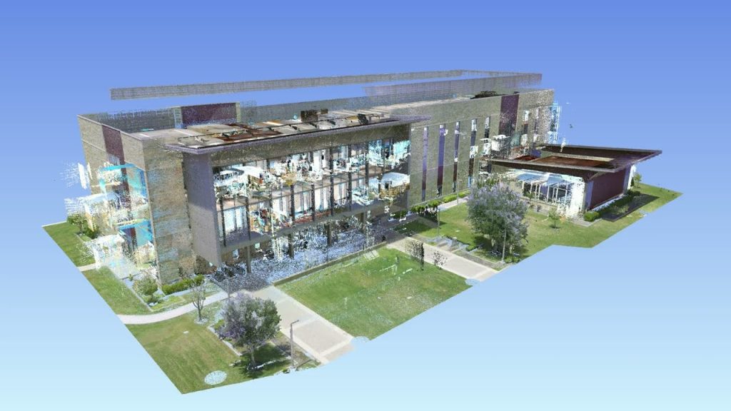
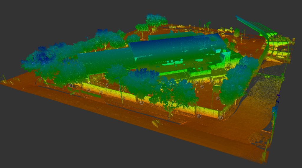
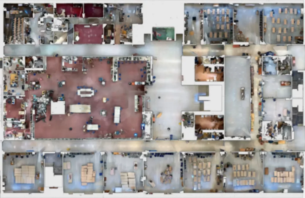
Point Cloud Reality Capture
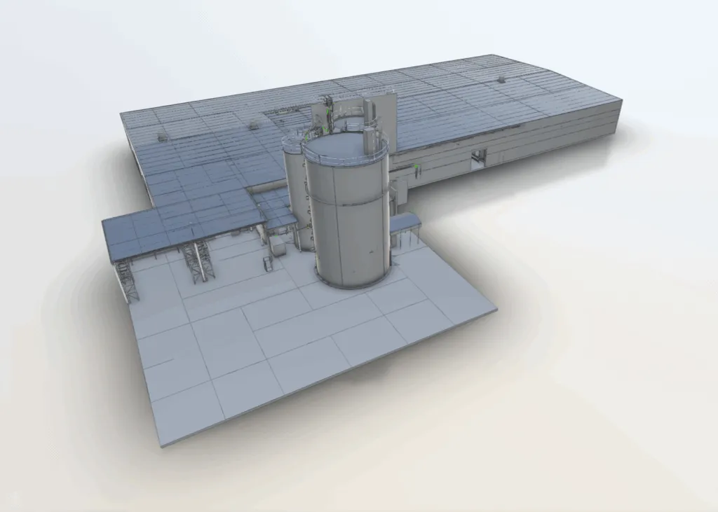
Our team processes and registers scan data into clean, structured point clouds. This point cloud reality capture workflow ensures the data is ready for BIM, CAD, and downstream engineering applications.
Reality Capture for Construction
We support contractors and design teams with reality capture for construction, enabling:
Accurate existing conditions documentation
Clash detection and coordination
Progress verification
Renovation and retrofit planning
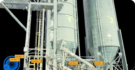
Reality Capture for Facilities
Our reality capture for facilities services help owners and operators maintain accurate spatial records of occupied buildings, campuses, and industrial sites—without disrupting operations.
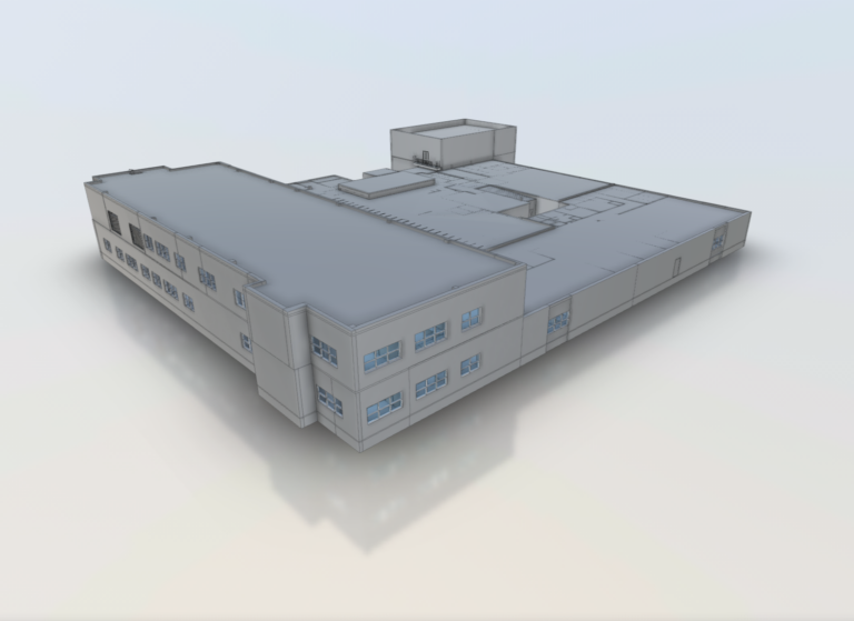
Reality Capture for Asset Documentation & Lifecycle Use
Accurate spatial data is essential for long-term asset management. Our reality capture for asset documentation supports:
Facility planning and space validation
Equipment and asset location verification
Renovation and expansion planning
Capital improvement programs
By capturing measurable, up-to-date conditions, our reality capture company helps reduce uncertainty and improve decision-making throughout the asset lifecycle.
Our reality capture solutions are used across multiple industries, including:
Commercial and corporate facilities
Construction and infrastructure projects
Industrial plants and manufacturing sites
Healthcare and education campuses
Government and public facilities
Each project is tailored to the client’s technical requirements and deliverable needs.
What Are Reality Capture Services?
Reality capture services involve collecting precise spatial and visual data from physical spaces and converting it into usable digital formats such as point clouds, 3D models, and as-built documentation.
This process creates a verified digital record of existing conditions, making reality capture for existing conditions far more accurate and reliable than traditional drawings or manual surveys.
Our approach combines:
Laser scanning reality capture
LiDAR reality capture services
High-resolution imagery to produce complete, measurable datasets.
Testimonials
What our customers saying
“My company has used Arrival on several occasions. Arrival came to our remote job site a couple times, bringing their equipment with them. I am enthusiastic about their capabilities and service.”
"I called Arrival 3D while working a unique project. They were very professional and knowledgeable. My contact was very thorough and patient with me in explaining the process. Their services were the first step of a very important project and they made me look good. I highly recommend this company."
“I have used Arrival 3D for many projects over the last several years. A great group to work with. I can always count on them to get the work completed on time and on budget.”
“I had Arrival 3D laser scan two properties that are going into the architectural design phase. They produced LOD 300 models for both project that were excellent. Scheduling was easy and the 3 week turnaround was fast. I look forward to using them on many more development projects.”
"Lanny and his team responded quickly and efficient to our request. They were on-time, clearly communicated with us whenever we had questions and ultimately delivered a great product. We really appreciate their effort and look forward to working with them in the future."
"Working with Lanny @ Arrival 3D was a great experience. He was extremely friendly and very responsive. The turn around time on his work was fantastic. In terms of pricing for the work, I would say that it was extremely reasonable, and the results were amazing. I did my research, and out of all the companies I researched Arrival offered the best services for the price."