Arrival 3D LiDAR Services quickly and accurately document buildings and infrastructure with Leica laser scanners to deliver LiDAR point clouds, 2D CAD & 3D Models.
3D LiDAR Scanning Services – Laser Precision for Real-World Challenges
In the world of design, construction and infrastructure, speed is important, but accuracy is even more important. And today, this is not a luxury—it has become a basic need.
At ARRIVAL3D, we provide you 3D LiDAR Scanning Services—which captures exact spatial data for your project through advanced laser technology. This not only makes your work faster and smarter, but also reduces the chances of errors to almost zero.
Whether you are an architect, civil engineer, construction planner or running a plant—LiDAR scanning gives you the same site data without any disruption that helps you take confident decisions in design and execution.
What Is LiDAR Scanning?
LiDAR (Light Detection and Ranging) is a laser-based measurement system that captures distances, surfaces, and shapes with millimeter accuracy. By emitting laser pulses and measuring their return times, LiDAR creates a highly accurate 3D point cloud of any environment.
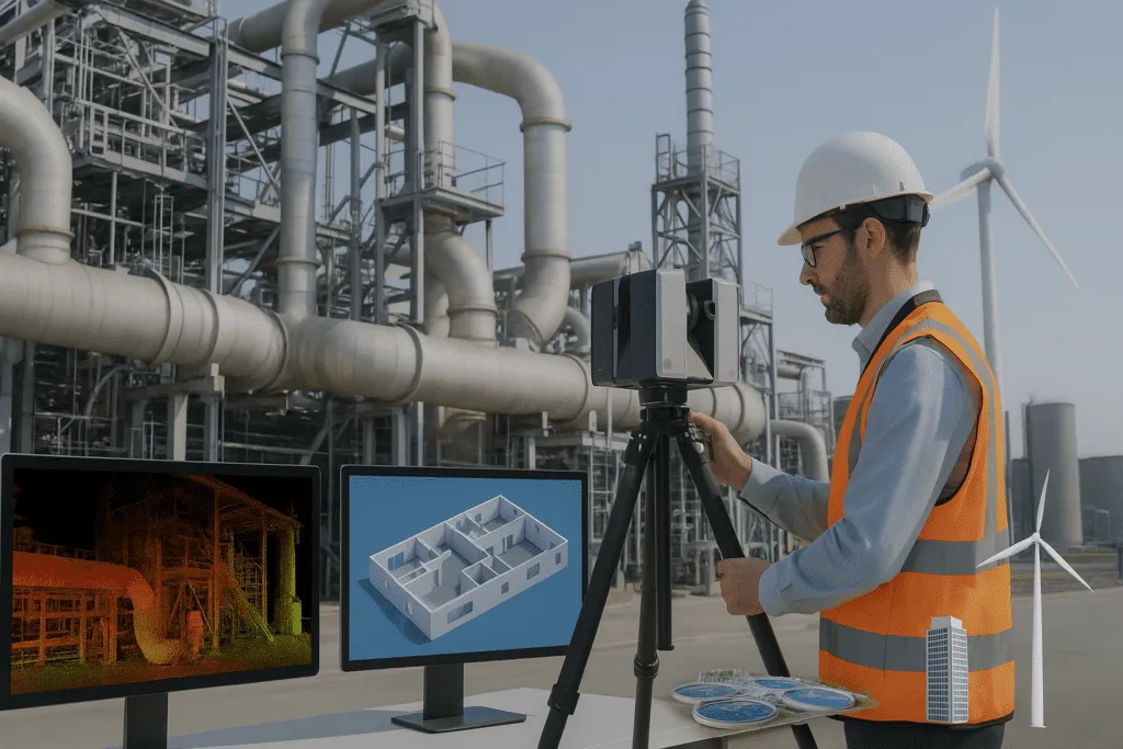
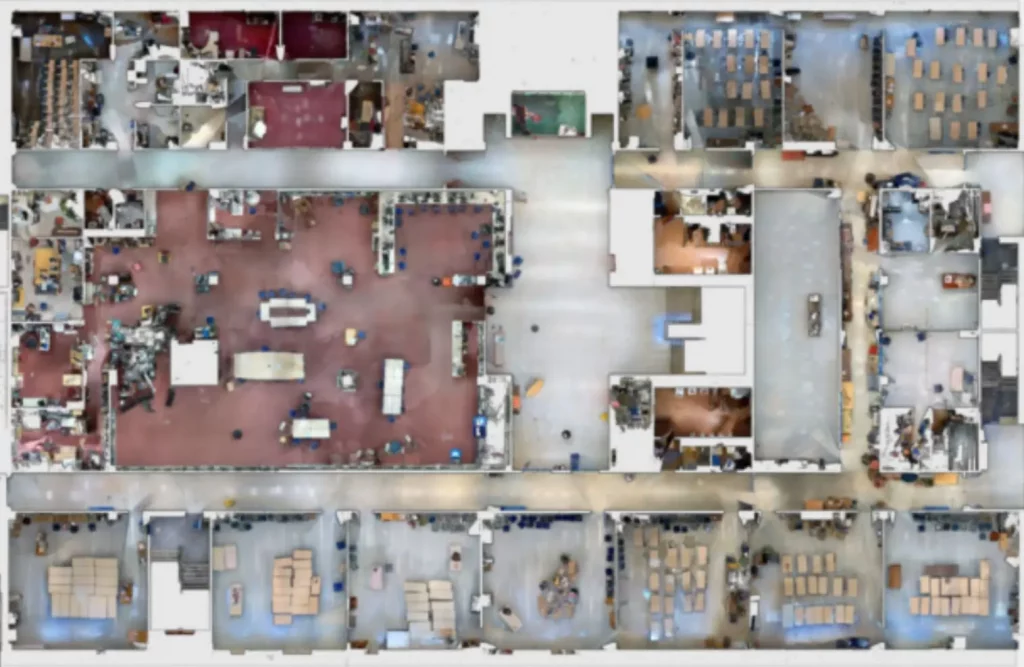
Arrival 3D uses terrestrial, mobile, and aerial LiDAR to provide full coverage of both indoor and outdoor environments.
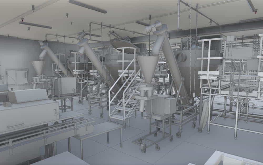
We provide on-site laser scanning that can capture large and complex buildings, industrial plants, or any kind of infrastructure. We complete high-resolution scans without touching.
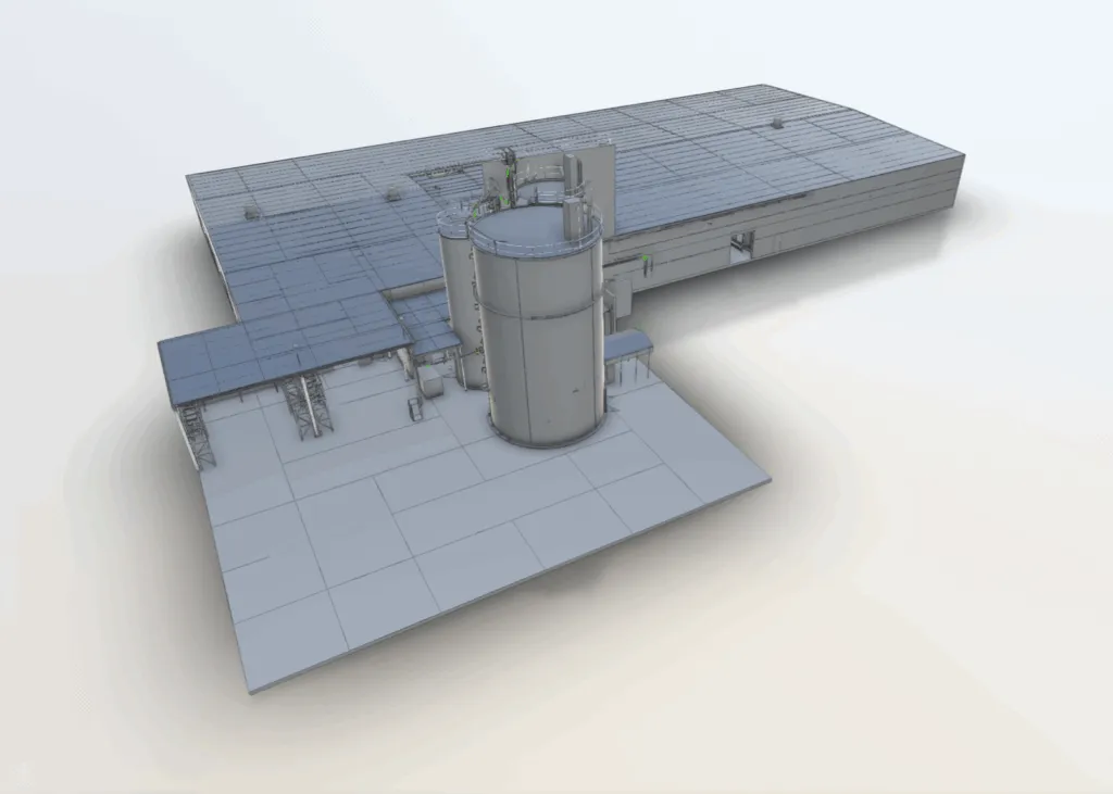
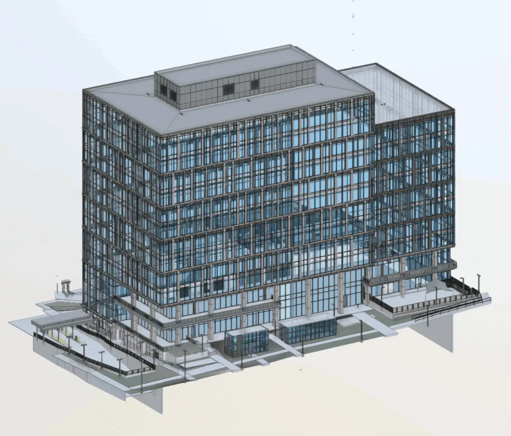
Our expert modelers convert your point cloud data into accurate 2D drawings and 3D BIM models. These models can be customized from LOD 100 to LOD 500 according to your project requirement.
Vehicle-mounted or backpack systems for rapid scanning of: Roadways, Parking lots, Walkways, Campus environments
Understanding 3D LiDAR Scanning
LiDAR means Light Detection and Ranging. It is an advanced technology that uses laser pulses to create an ultra-accurate 3D digital map of an object, structure or land.
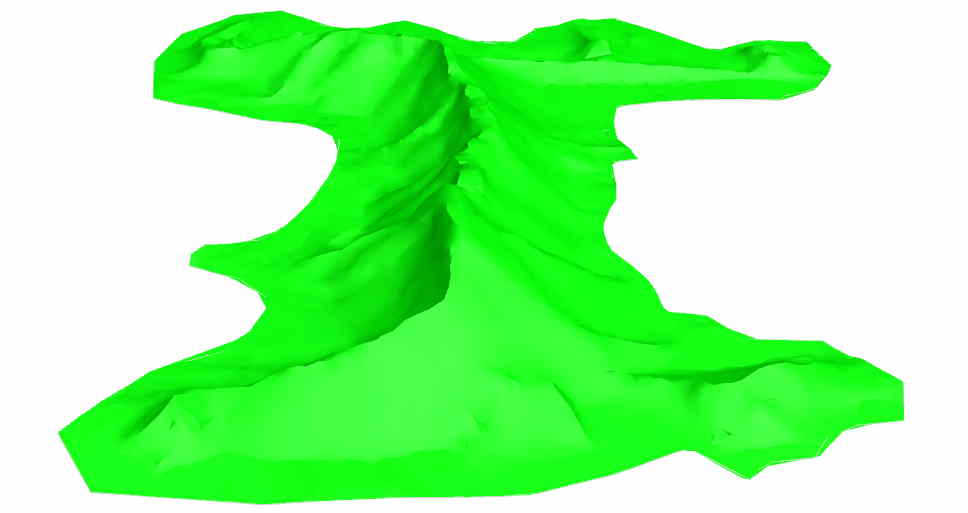
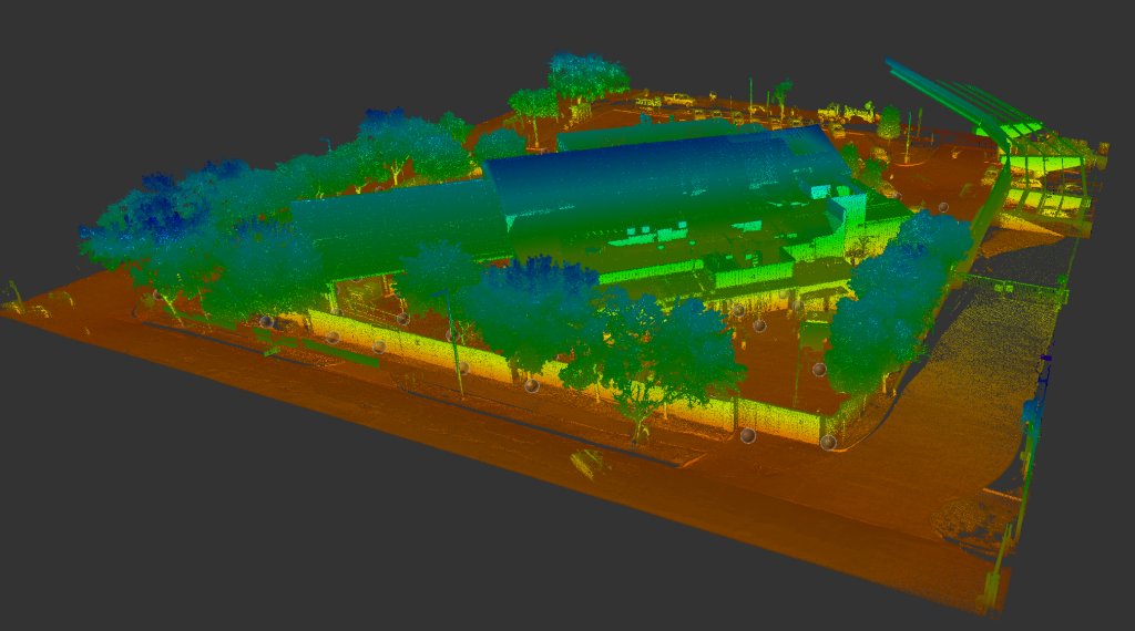
In this process, a laser beam emerges from the scanner, hitting the surface and coming back. After this process is repeated with every surface, millions of 3D points generates and collected to create a Point Cloud.
This Point Cloud is a type of digital asset that you can later convert into chalkboard CAD drawings, BIM models or 3D visualizations. The speciality of ARRIVAL3D 3D LiDAR scanners is that they are capable of scanning anything from simple to highly complex structures – indoor or outdoor.
Ready to Scan with ARRIVAL3D?
Whether your project is in the design phase, construction stage or preparation for renovation—ARRIVAL3D’s 3D LiDAR scanning services provide you with both clarity of the site and accuracy of the data.
Our scanning projects are divided into 3 core stages:
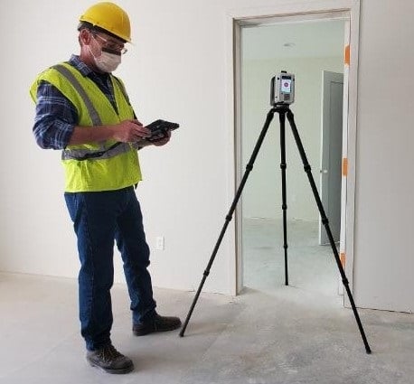
Site Scanning & Data Capture – First our expert team visits your site and does laser scanning. Every element—walls, beams, equipment, floors, ceilings—is captured with mm-level accuracy.
Data Registration & Point Cloud Generation – After scan is completed we process the collected data in specialized software. At this stage, the noise is cleaned and the scans are accurately aligned to produce a properly registered point cloud.
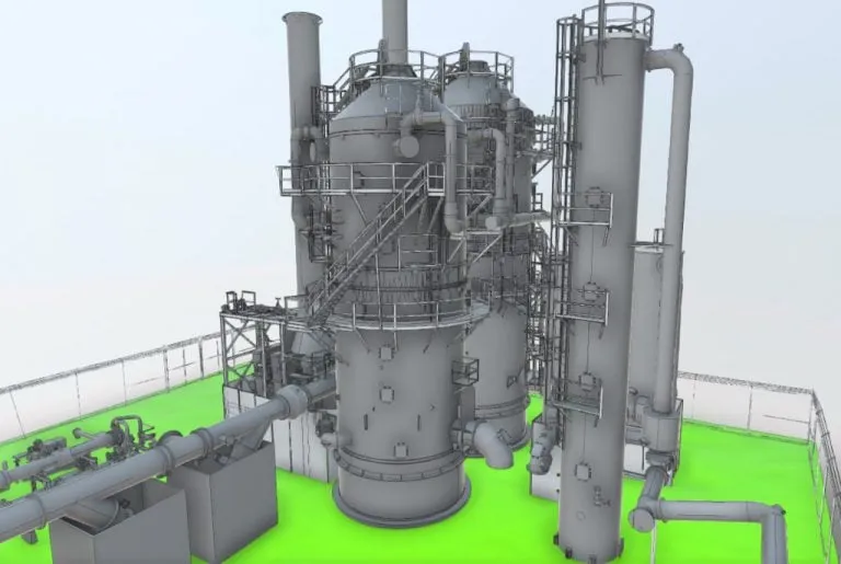
CAD/BIM Modeling & Deliverables – Then, based on your requirement, we create 2D CAD drawings, 3D Revit models or terrain maps—fully optimized for architecture, construction or industrial design.
Water Treatment Plant 3D Scan – We used 3D laser scanning to capture the current conditions. This helps us make an accurate model for renovation and planning. 📖 [Read Case Study]
Advantages
Why Choose ARRIVAL3D?
Cutting-Edge Equipment – Our terrestrial scanners are based on the latest technology ensuring high-speed data is captured with exceptional accuracy, without disruption on site.
Trained & Experienced Team – ARRIVAL3D engineers and technicians are well-trained professionals with hands-on experience of LiDAR projects.
Time-Bound Execution – From site scan to model delivery, our workflow is optimized to avoid delays.
Scalable Solutions – Whether it is a small retail store or a multi-acre industrial plant, ARRIVAL3D designs the ideal solution for every scale.
Post-Scan Support – Even after delivery, our team fully supports you in model understanding, data alignment and software integration.