Network Rail Puts the Technology to Good Use
Scanning real-world objects or environments to gather information about their shape and appearance is known as 3D scanning (e.g., color). It is possible to create digital 3D models using the data that has been acquired.
A wide range of applications can benefit from the 3D data that has been collected. For example, the entertainment business, including the virtual reality industry, makes substantial use of these gadgets in creating films and video games.
This technology can be used for augmented reality, motion capture, gesture recognition, robotic mapping, industrial design, orthotics and prosthetics, reverse engineering and prototyping, quality control/inspection, and digitization of cultural items.
3D Laser Scanning Services in Use
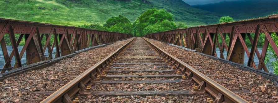
Using 3D laser scanning services has had a huge impact in recent years, and one of its uses is the restoration of the Victorian railway viaduct.
Using laser and drone technology that incorporates 3D scanning services, Network Rail has been able to schedule repairs for the renowned 19th-century bridge.
The historic Whalley railway viaduct in Lancashire has been meticulously mapped using laser scanners and drones to ensure its continued usage by both passengers and freight.
Network Rail is using a 3D laser scanning service to schedule needed maintenance over the next six to 18 months to ensure the 19th-century structure’s long-term viability.
A 3D scanning service on the Whalley viaduct may sound simple. But the closeness of other interests, such as a factory, public pathways, and domestic properties, has made this a more challenging endeavor.
The challenge has been locating spots to scan from, in attempting to capture all of the viaduct’s walls and features.
More than 300 images were taken of the 48-arch viaduct that spans the Ribble Valley, carrying the Blackburn to Clitheroe railway line 550 meters.
To create a digital blueprint for how the viaduct is currently functioning, the 3D laser scanning services used these scans of the 176-year-old construction to create a 3D computer model.
This makes it possible for workers to keep a close eye on the building’s structure and spot any issues with the beautiful Victorian brickwork that arise.
Additionally, it’s a lot safer for the workers, who formerly had to use abseilers or scaffolding towers to check the construction for flaws.
A drone and lasers are being used to maintain such a historic building, according to Network Rail’s North West Route Director, Phil James: “We’re always striving to innovate on the railway.”
For the following 18 months, Whalley viaduct’s engineers will be able to plan its vital maintenance using this 21st-century technology (3D scanning services).
“We’re taking great pains to ensure that our work is compatible with the area’s cultural heritage. To protect the Grade II listed structure for passengers, locals, and tourists, we use this 3D scanning service.”