Natural disaster recovery faster with 3D laser scanning
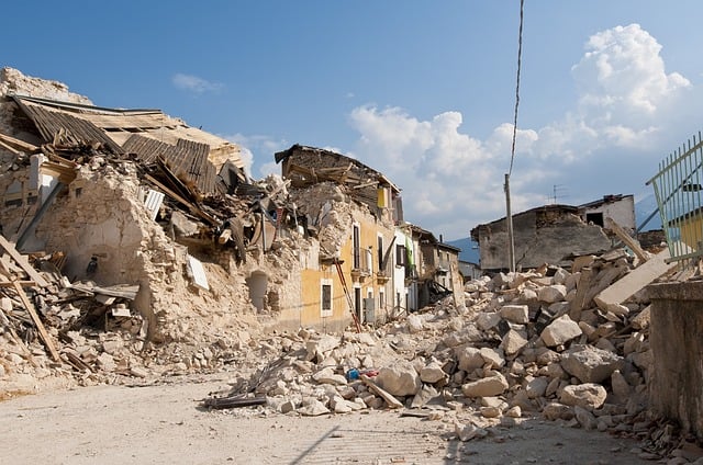
Earthquakes quakes are devastating , especially in cities that are in countries where building standards are low and are located on major fault lines. Consider the 2008 earthquake that happened in Sichuan, China, which took more than 68,000 lives in Sichuan province alone. It was a major 8.0 earthquake, and it was devastating to the local infrastructure. In such disasters, the first responders of course are the rescue workers. They must go in first to save as many lives as possible. It is a matter of life or death. All efforts are focused on them getting to those who need rescued. Once the rescue mission is complete, then it comes time to start rebuilding the disaster area from the rubble up. The clean-up starts by doing an assessment of the damage.
3D laser scanning helps assess, collect data on damages
In order to do this, engineers and surveyors must go in to assess the situation. They need to scope out how wide the area of the damage is, and how serious it is. And to do it, they must be quick. There is little time to waste. For this reason, reconnaissance teams will use 3D laser scanning services to get the job done faster. 3D laser scanning services allows for a quick collection of earthquake data, much faster than other commonly used methods for data collection. Using laser scanning for data collection can also allow for a quick comparison between a pre-data scan information to accurately determine when the damage has occurred. And all of this is done at high precision.
Not only does 3D laser scanning services help collect data on the damages of an earthquake quickly, but it also can help engineers, scientists, and reconnoissance teams to view the damaged area using a 3D virtual model, so that these people can examine the site even before traveling there. This gives them access to places that they may not have been able to access before due to physical restraints, time restraints, and safety restraints. 3D laser scanning services have made the work that needs to be done on the ground a lot easier and quicker. It won’t be long after the assessment has been made that workers will have to begin recreating and rebuilding the infrastructure that was destroyed by the quake.
The use of 3D laser scanning for infrastructure reconstruction was also used after the Japan earthquake and tsunami of 2011 that followed. 3D laser scanned images had been taken before the earthquake and tsunami. This was a great benefit to the reconnaissance and rebuilding efforts, and helped them do things in a more timely matter when it was critical to make fast and wise decisions. Although there is much more to reconnaissance and rebuilding effort than just having 3D laser scanned images. There needs also be proper planning, good team coordination, proper acquisition of data, and then processing and analyzing of the data.
Video: “seismic assessment of damaged…”
Being able to use our technologies to respond more quickly to natural disasters is a great thing. It would be even better though if there were a way to use 3D laser scanning services to detect when earthquakes will occur. Maybe we will find a way.