Monitoring From Afar
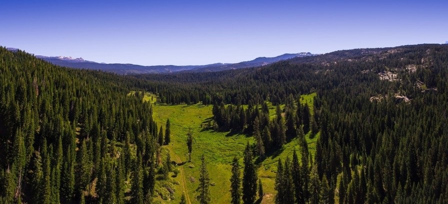
A group of researchers from Boston University set in motion a plan to use 3D laser scanning services to scan the Sierra National Forest. It’s a forest that is full of red fir, white fir, and several large sequoias. This NASA-supported research was to test if this technology could truly help researchers understand forest structure remotely.
This project used point cloud data for five LiDAR Scanners. It made the scans much more accurate because one scan is simply not enough. Trees are complicated and have limbs, branches, and leaves that are not always easy to view. So this team was using multiple scanners to access the most accurate information on the forest.
Once they received the scan, they would tag the points with crucial information on the forest to further develop the images. The scanning leads to accurate information that allows others to view the woods away from the physical location. At the same time, they were also developing shape and extraction software that would enable them to reconstruct the forest.
All of the information collected with 3D laser scanning services can be essential to monitor the forest. It will allow the researchers to see which trees are healthy, which are not, and perhaps why certain things are happening within a forest. This is especially useful because they can be anywhere in the world while still studying the forest, thanks to the digital reconstruction of the forest.
Why is forest reconstruction important?
We depend on every forest much more than we care to admit, and we should want to understand it better. One way to ensure the safety and future of each forest is by understanding how it grows and what the most significant impacts are. The first step is to study it, and one of the best tools for that is 3D laser scanning.
It allows a team to fully immerse in the forest without actually being there, causing further harm. The digital replica will enable researchers to study it without being invasive, and this can help them protect the forest. This technology is one of the most valuable tools for studying anything because it is so detailed. With the information plugged into the image, it can be incredibly accurate.
Why is studying the forest important?
As humans, we tend to neglect anything that isn’t human or a direct problem for us. What many of us do not realize is that the forest impacts all of us. From the wood we use for houses right down to the air we take for granted. By ensuring the survival of our forests, we ensure our own future.
Can we rely on 3D laser scanning to pick up the correct information?
The most remarkable thing about 3D laser scanning services is that they are incredibly accurate. They pick up hundreds and sometimes thousands of data points that are highly valuable. Once the information is captured, it gets sent to a partnering program or a computer-aided-design software where more information gets plugged in. It allows the image to be filled with information that can enable researchers to study the digital reconstruction as if they were there in person.