Predicting Global Climate Change
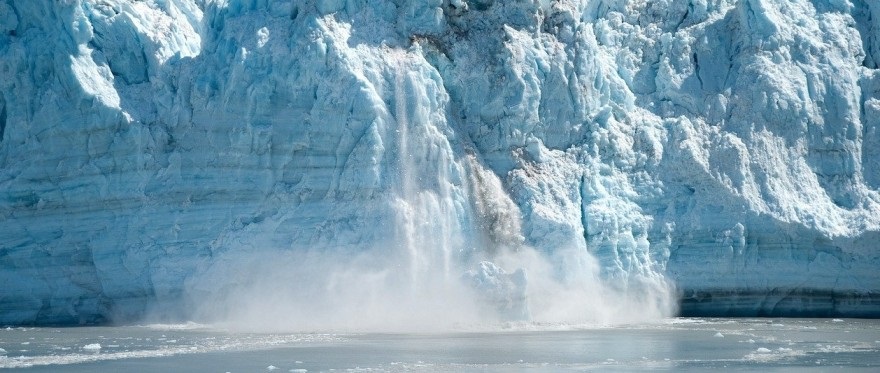
Glaciers are masses of ice which have been formed from compacted snow. They move very slowly as they are influenced by gravity, wind and other factors. Glaciers can be found all over the globe and 3D laser scanning services can help geologists to map them without disturbing their structure or harming their environment.
Glaciers are extremely sensitive to climate change, and they can be used as a measure of how fast the world is warming up. For example, glaciers in Antarctica and Greenland are melting at a much quicker rate than they used to. 3D scanners can help geologists to map the size of these glaciers as well as how fast they are moving, enabling them to make predictions about global climate change.
What 3D scanning services do geologists use?
Geologists use 3D scanning services to get a better sense of sites without damaging them. 3D scanners work by using a laser to send out a beam of energy and then detecting the energy that is reflected back to it. 3D scanners use this time to calculate distance, and then construct a model from all the points on an object’s surface. The scan can be rotated and manipulated as needed, making 3D scanning services a much faster way to gain information about glaciers. 3D scanners offer humans a clearer understanding of the world around them. 3D scanners have been used to scan many different types of objects, from ancient Egyptian pyramids to dinosaur bones.
3D scanners can be large or handheld. Geologists can choose 3D scanners according to the scale of the glacier they are mapping. 3D scanning a dinosaur bone would not be as complex as 3D scanning an entire glacier, so geologists should do some research on 3D scanners before purchasing one.
Benefits of 3D laser scanning services
3D scans can help geologists explore glaciers without disturbing them. 3D scans are much cheaper and faster than other methods used to make 3D models, such as 3D printing or sculpting. 3D laser scanning also reduces the need for human intervention in delicate study sites where it would be dangerous to do physical testing. 3D scanning services gather data about glaciers quickly and accurately because they do not require any direct measurements. 3D scanners have the ability to 3D measure not only 3D surfaces but also 3D volumes, so they are less likely to miss small bits of information. 3D scanning services are being used by geologists around the world for their accuracy and convenience in data collection.