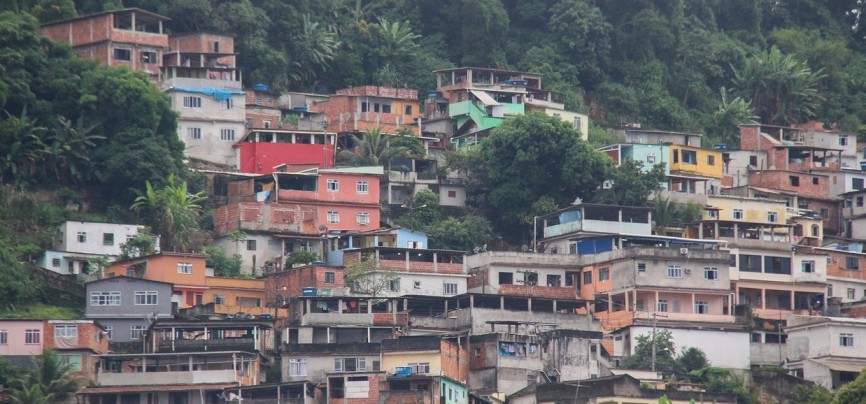
Favelas are Complex, Maze-Like Neighborhoods
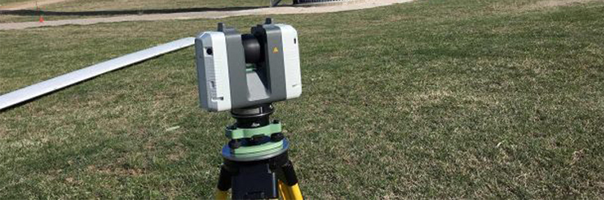
As seen in the one-minute video, 3D laser scanning services in Brazil have become a reality. MIT Senseable City Lab uses this technology to analyze and map Brazil’s Favelas.
In what is now dubbed Favelas 4D, this technology utilizes LiDAR, a 3D laser-scanning method that uses light from a firing laser to map out objects. 3D laser scanning services are now being used to record virtual maps of streets in Rocinha, one of Brazil’s largest favelas.
This project came as a collaboration between Brazil’s city planning commissioner of Rio, Washington Fajardo, and MIT Senseable City Lab, led by Carlo Ratti.
Rocinha features dense and layered infrastructure, which might limit traditional satellite maps’ effectiveness in capturing the details of such a complex maze-like neighborhood.
Mapping with 3D Laser Scanning Services
Researchers proceeded to use handheld scanners that use special laser sensors to calculate distances between various points. Data collected here is used in making 3D virtual maps of the region.
Such 3D scanning services allowed researchers to capture complex environment features in Brazil’s Favelas at incredibly high resolutions.
Details captured by the scans include street sizes (width and height), elevation, and building density. But most importantly, with the use of 3D scanning services the scans were able to capture the area’s trademark structures which traditional maps have missed in the past. However, these structures are integral to the overall architecture and aesthetic of the neighborhood.
The data collected makes it possible for MIT and Fajardo to evaluate the distinct features of Rocinha.
Results from the 3D scanning services make it possible to influence social policies in the area. Not only that but they can also be used to enhance security and the quality of services offered here.
Fajardo said that the findings of the project could help plan city strategies to develop more inclusive policies. He also noted that the results of the 3D laser scans could fuel research into other ways of building that make it affordable and accommodating for the expanding population.
Carlo Ratti, an Italian architect who leads the project at MIT, noted that the building and infrastructure at Rocinha were ingenious and a response to their circumstances. He also believed that the complex architectural forms coupled with bottom-up planning could challenge the accepted notion of designing urban cities.
This is not the first MIT project as the lab has been involved in a series of projects including space bubbles that were supposed to help with climate change as they reflect the sun’s rays and sewage-sampling robots which tracked disease outbreaks.