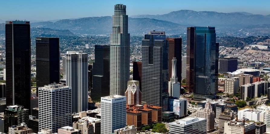
Create Intelligent Urban Spaces through Accurate Scanning
Urban development initiatives require accuracy, effectiveness, and innovative technology. From building intelligent infrastructure to upgrading transportation systems and rejuvenating urban environments, precise spatial data is essential for achieving success. At Arrival 3D, we focus on providing advanced long-range 3D laser scanning solutions that offer high-resolution, real-time insights tailored for intricate urban settings.
What exactly is long-range 3D laser scanning?
Long-range 3D laser scanning, often referred to as terrestrial LiDAR scanning, is a non-contact technique for gathering intricate spatial data over extensive regions. Accurate 3D scan of highways, tunnels, bridges, overpasses, public areas or any urban space.
Our tripod-mounted scanners collect millions of data points every second, creating a perfect 3D point cloud where every detail is captured clearly.
Even where manual access is difficult or unsafe, scanning is easy. These advanced scanners work with sub-centimeter accuracy from distances ranging from 100 meters to 1 kilometer. Data from every corner is available without touching the site.
Uses in City Planning
In city planning for building new roads, improving public safety, and conducting detailed infrastructure analysis, this technology is very useful. Along with this, we also provide customized laser scanning services tailored for urban planners, architects, civil engineers, transportation agencies, and municipal consultants.
We are here to assist you with the development of new infrastructure or the maintenance of existing assets.
- Detailed documentation can be created for the design and layout of roadways, overpasses, underpasses and utility infrastructure
- The full survey of construction sites can be done, including landscape details, elevation changes and topographical data
- Conflict detection and spatial analysis can be used to make transport networks more efficient
- Accurate volume calculations can be done for waste disposal, excavation and site preparation
- Realistic 3D digital models of urban areas can be created, which are useful in analysis, presentation and planning
- Heritage or cultural sites can be quietly documented without any damage
What Makes Arrival 3D the Ideal Choice for Urban Projects?
- High-level accuracy of LiDAR scanning. With our point cloud data, design decisions are precise, there is no need for guesswork.
- Safe scanning without disturbing the public. Our team scans from the door, so neither traffic is stopped nor city life is affected.
- Compatible with tools like AutoCAD, Revit and GIS. Our data is easily converted to whatever format is required.
- Fast processing for fast-paced projects. Speed is important in urban projects, we provide timely delivery along with quality.
- Visual tools like 2D layouts and 3D walkthroughs provide extra clarity for planning and approvals, all with realistic visuals.
- The project gets off to a strong start. No guesswork is required to make the design, but proper data is used, which makes things clear upfront.
- Chances of mistakes and delays are reduced. If there is an exact model of the site, there is no need for rework or last-minute changes.
- There is better coordination between teams. Architects, engineers and planning teams get data and visuals upfront, which makes planning smoother.
- Helps in environment-friendly planning. Scanning helps understand how the land is being used, what the flow of energy is, and where smart systems can fit.
Our Scanning Process is Easy and reliable.
Long-Range 3D Scanning for Urban Development
Smart cities are built with accurate data. Arrival 3D gives you real-time, high-resolution scans – detailed and error-free of everything, be it roads, bridges, tunnels, or public spaces. Tripod-mounted scanners collect millions of data points every second, making the scan safe and easy even where manual access is difficult. Sub-centimeter accuracy is achieved from distances of 100 meters to 1 km.
How does it work in city planning?
- Layout of new roads, flyovers and utilities
- Complete survey of construction sites + elevation and landscape details
- Anticipating any conflicts in transport networks
- Accurate calculation of the amount of waste or excavation
- Creating 3D city models for planning and presentation
- Documenting heritage sites without any damage
So, Are You Ready to Conduct an Urban Project Scan?
Allow us to assist you in navigating through the intricate details with ease. No matter if it’s a metro corridor, an urban highway, or a forward-thinking township, we gather the essential data you require swiftly, precisely, and securely. Get in touch for a quote or to set up a consultation today.