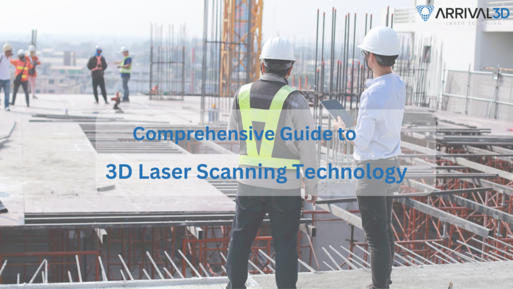
3D laser scanning technology is transforming the way we capture and interpret the world around us. It’s a powerful tool that creates precise, three-dimensional models of physical objects and environments. But what exactly is 3D laser scanning? How does it work, and why is it so revolutionary? This comprehensive guide will delve into these questions. We’ll explore the technology’s applications, from forensic analysis to 3D modeling tools, and discuss its impact across various industries. Whether you’re a professional in the field or simply curious about this cutting-edge technology, this guide is for you. Let’s dive in.
Understanding 3D Laser Scanning Technology
3D laser scanning technology is a method for capturing the shape and size of physical objects. It uses laser light to measure distances accurately and creates digital 3D representations. This technology captures detailed data of objects’ surfaces and surroundings quickly. The result is a collection of data points known as a “point cloud.” Point clouds are used to build precise models of objects and environments. These digital models can be manipulated, analyzed, and shared. 3D laser scanning technology is valued for its precision and versatility. It surpasses traditional measurement methods, offering unprecedented accuracy and efficiency. This technology has influenced numerous industries, paving the way for innovative applications and solutions.
How 3D Laser Scanners Work
3D laser scanners operate by emitting laser beams at objects. The scanner detects the reflected beams and measures their return times. This process determines the exact distance between the scanner and the object. Scanners then compile this data to form a point cloud. This collection allows for detailed 3D models. The entire procedure is rapid and ensures high accuracy.
To ensure accurate and efficient reality capture with 3D laser scanners, the building surveyor must ensure the following steps for the 3D laser scanning process:
-
Planning & Preparation
Project requirements and scanning objectives are defined and agreed upon between the surveyor and client before the scanning process. This includes the reason for documentation, 3D laser scanning equipment, best positions for scanning, and required density of point cloud data.
For example, a historical building might require high-density point cloud data for its documentation, because of the high detail of the building, while the documentation of simple room might not require that much point cloud density.
-
Data Capture
After the selection of a 3D laser scanner and the positions of scanning are determined, from the scanner, laser beams are emitted to capture point cloud data. Terrestrial, mobile, or aerial laser scanning techniques can be used for this process, depending on the requirement.
-
Data Processing & Point Cloud Optimization
Captured raw point cloud data is processed to align multiple scans into a single, cohesive point cloud model. A filtering-out process is carried out to refine the point cloud, ensuring a cleaner and more accurate point cloud model of the building.
-
Point Cloud to BIM Model Generation & Analysis
The optimized point cloud data is converted into a 3D model, which can be integrated into design or construction workflows using BIM software like Autodesk Revit, for building documentation, renovation, remodeling, and digital twin creation for facility management.
-
Final Documentation & Delivery
The final 3D BIM model is documented and delivered in required formats for use in architecture, engineering, construction, and other applications.
Want to explore how 3D laser scanning can revolutionize your project? Contact our experts today for a free consultation
Types of 3D Laser Scanners
3D laser scanners come in various forms, each suited to specific tasks. Handheld scanners are portable and ideal for scanning small objects or intricate details. Stationary scanners, often mounted on tripods, are used for larger scenes. Terrestrial scanners work well for surveying land and buildings. Aerial scanners, often attached to drones, capture data from above for vast areas. This diversity enables the use of laser scanning across multiple industries.
| Feature | Terrestrial Laser Scanning (TLS) | Mobile Laser Scanning (MLS) | Aerial Laser Scanning (ALS) |
|---|---|---|---|
| Definition | Uses ground-based stationary scanners to capture detailed 3D data of structures. | Uses vehicle-mounted or handheld scanners for rapid 3D data collection along a path. | Uses drones, helicopters, or planes to scan large areas from the air. |
| Data Collection Method | Stationary tripod-based scanning from multiple fixed points. | Scanners are mounted on moving vehicles such as cars, boats, or backpacks. | Laser scanners are attached to aerial platforms like UAVs (drones), helicopters, or planes. |
| Best Suited For | Buildings, industrial plants, historical monuments, and interiors. | Roads, railways, tunnels, bridges, and cityscapes. | Large-scale topographic mapping, forest monitoring, and infrastructure surveys. |
| Precision | Very high precision with millimetre accuracy. | High accuracy but slightly lower than TLS. | Moderate accuracy due to altitude variations. |
| Speed | Comparatively slower lower, requires multiple setups and scanning positions. | Faster data collection due to mobility. | Very fast, can scan large areas in a short time. |
| Limitations | Comparatively time-consuming, requires line-of-sight, limited to ground-level data. | Affected by vehicle movement, may have obstructions. | Weather-dependent, limited resolution for small objects. |
| Example Use Case | Documenting historical buildings, interior scans of factories, and other buildings. | Mapping road networks, railway monitoring, underground tunnel surveys. | Creating digital elevation models (DEMs), urban planning, and floodplain analysis. |
| Examples | Leica RTC360, Trimble X7, FARO Focus Premium, RIEGL VZ-400i | Leica Pegasus: Two Ultimate, Trimble MX50, Topcon IP-S3, NavVis VLX 3 | Leica ALS80, RIEGL VQ-1560 II-S, Teledyne Optech Galaxy PRIME, DJI Zenmuse L1 |
Applications of 3D Laser Scanning Technology
3D laser scanning technology finds diverse applications across multiple domains. Its precision and versatility make it indispensable. From forensic science to manufacturing, the benefits are widespread. In construction, it aids in creating accurate Building Information Models (BIMs). Surveyors use it for detailed site maps and analysis. This enhances project outcomes and reduces waste. Moreover, the technology is vital for preserving cultural heritage. It digitally documents historical sites, safeguarding them for future generations. Such documentation assists in restorative efforts and studies. In environmental studies, 3D scanning assesses terrain and habitats. This ensures sustainable practices and informed planning. The technology aids in monitoring changes over time. Lastly, the use in entertainment is noteworthy. Film and gaming industries leverage 3D models for realism. This enhances visual experiences, making them more engaging and lifelike.
Forensic Analysis and Crime Scene Investigation
3D laser scanning has revolutionized forensic analysis. It captures crime scenes with unprecedented detail and accuracy. Investigators can revisit scenes virtually, long after the event. This technology is particularly valuable in crime scene reconstruction. It provides comprehensive data quickly. Such efficiency saves time and preserves crucial evidence. In legal contexts, 3D scans offer compelling visual aids. They simplify complex data for juries and legal teams. Their use enhances understanding and aids justice.
Industrial and Manufacturing Uses
In industry 3D laser scanning is invaluable for quality control. It inspects parts with precise measurements, ensuring conformance. This reduces errors and boosts production efficiency. Manufacturers use it to reverse engineer existing parts. This allows for rapid prototyping and innovation. The process accelerates design iterations and shortens time to market. Additionally, it assists in facility management and equipment monitoring. By capturing up-to-date models, operations can be streamlined. This ensures safety, maintenance efficiency, and cost savings.
Cultural Heritage and Archaeology
The preservation of cultural heritage benefits greatly from 3D scanning. Accurate models of ancient artifacts and sites are created. These models serve as digital archives for research and restoration. In archaeology 3D scans record excavation details meticulously. This non-intrusive technique preserves site integrity. It allows for detailed analysis without physical alterations. Such documentation enriches educational opportunities worldwide. Students and researchers gain access to accurate representations. This fosters deeper understanding and appreciation of history and culture.
3D Laser Scanning and BIM
3D laser scanning and Building Information Modeling (BIM) work hand in hand to ensure that accurate as-built models of buildings are created. This helps in creating as-built models for renovation and remodeling, and digital twins for facility management. Laser scanning captures detailed as-built data in the form of a point cloud, which is integrated into BIM software like Autodesk Revit. BIM software converts this point cloud data into an as-built 3D BIM model that represents the building’s existing conditions.
As-built model created with the help of Revit BIM software can be used for the renovation and remodeling phase to ensure that the new elements that are created in the structure, fit perfectly. It also helps in clash detection of MEP (Mechanical, Electrical, Plumbing) as well as structural services between the new design and the as-built conditions. The BIM model created with the help of laser surveying enhances visualization, analysis, and documentation, making it a valuable asset for construction, renovation, and facility management.
3D Modeling Tools and Software Integration
Integrating 3D laser scanning with 3D modeling tools enhances data usability. These tools translate scanned data into actionable insights. This integration is crucial for achieving precise project outcomes. 3D modeling software enables the refinement of scanned models. Such software handles intricate details and complex structures. This capability is essential for industries aiming for high accuracy. Software compatibility is a major advantage. It ensures seamless data transfer between scanning devices and modeling platforms. This interoperability saves time and optimizes workflows. Ultimately, the synergy between scanning and modeling tools bolsters the technology’s effectiveness. This collaboration unlocks new possibilities across various sectors.
Popular 3D Modeling Software
The success of the 3D laser scanning in construction does not only depend on the scanner used but also on the software used for processing and analyzing the point cloud data received. Some of the most widely used software solutions include:
Autodesk Recap: Used for converting point cloud data into 3D models and integrating with BIM workflows.
FARO Scene: Designed for processing and managing scanned data from FARO laser scanners.
Leica Cyclone: A powerful solution for point cloud processing, visualization, and analysis.
Trimble RealWorks: Used for 3D laser scanning registration, modeling, and advanced analysis.
CloudCompare: An open-source software for point cloud visualization and analysis.
Integration with CAD and BIM
3D laser scanning integrates seamlessly with CAD and BIM systems. This combination enhances design accuracy and efficiency. CAD platforms use point cloud data for precise modeling. Building Information Modeling (BIM) harnesses scanned data for detailed site analysis. This integration streamlines construction management processes. It ensures projects adhere to specifications and timelines. Real-time data updates enhance decision-making in BIM applications. This dynamic approach adapts to project changes swiftly. It reduces errors and mitigates project risks efficiently.
Challenges and Future Trends in 3D Laser Scanning
Despite its advantages, 3D laser scanning faces challenges. Issues like high costs and data complexity persist. These hurdles can limit the technology’s accessibility. Another challenge is the handling of massive datasets. Managing and storing point cloud data requires robust systems. This necessitates ongoing investment in infrastructure. Some technical limitations remain unresolved. Reflective surfaces and environmental factors can affect scanning accuracy. These challenges necessitate continuous technical advancements. Nonetheless, the future appears promising. Advances in software and hardware aim to address these limitations. Anticipated improvements could expand its reach further.
Overcoming Limitations and Challenges
Efforts to overcome current challenges are underway. Technological advancements focus on reducing costs and complexity. Simplifying user interfaces also enhances accessibility. Innovations in data management are pivotal. Efficient data processing solutions are key. These innovations streamline the handling of complex datasets.
Emerging Trends and Future Outlook
One emerging trend is real-time data processing. This trend allows quicker decision-making. It’s transforming industries by increasing operational speed. Another trend involves integration with AI and machine learning. These tools enhance data interpretation. They improve the accuracy and functionality of the technology. Future trends are set to expand application scopes. Enhanced integration with virtual reality will open new avenues. This combination promises vast potential across various sectors.
Conclusion
3D laser scanning technology has revolutionized various fields. Its precision and efficiency set it apart from traditional methods. Despite challenges, advancements continue to evolve the landscape. The future holds great promise for 3D laser scanning. Continuous improvements will boost its adoption and impact. As technologies integrate, the possibilities are boundless for innovation and growth.
Choosing the Right 3D Laser Surveying Services for Buildings
According to the project requirements, accuracy, and budget, appropriate 3D laser scanning equipment for buildings should be selected. Following are the factors you should consider while selecting the best 3D laser scanning services for you:
• Scanning Range: Make sure that the scanner covers the required area efficiently.
• Point Cloud Density: Higher point cloud density scans offer more detailed 3D models.
• Portability: Lightweight and compact scanners are easier to use.
• Software Compatibility: Ensure seamless integration with existing design and BIM software.
Arrival 3D ensures accurate and best 3D laser scanning services with Scan to BIM integration and software compatibility. With cost-efficacy, time-efficacy, accuracy, and precision, our 3D scanning has ensured the documentation of various residential, commercial, industrial, and historical buildings in USA.
Arrival 3D Precision Scanning & Construction Solution Provider
Looking for high-accuracy 3D laser scanning and Scan to BIM for your next project? Discover how Arrival 3D can bring your vision to life contact us today!