Energized Substation Scanning · No Shutdown Required
Electrical substations are among the most challenging facilities to document accurately using conventional methods. Most substations were built using hand-drawn plans that have never been digitized. Over decades of operation, equipment has been replaced, upgraded, and repositioned often without consistent drawing updates. The result is a growing gap between what paper drawings show and what actually exists in the field.
When engineers begin designing a transformer replacement, bus extension, or protection upgrade, they are often working from drawings that are 20 or 30 years out of date. Clearances shown on paper may not reflect actual field conditions. Equipment positions, foundation locations, and structural dimensions may all be incorrect. Designing from inaccurate drawings leads to clearance violations discovered during construction, equipment that doesn’t fit, and expensive rework.
LiDAR scanning resolves this problem by capturing the true as-built state of the substation in a single field session, producing an accurate digital record that engineering teams can work from with confidence.
One utility engineer reduced substation expansion design time from 20 days to 1 day after switching to LiDAR-based as-built data. A typical distribution substation can be fully scanned in under five hours.

3D laser scanning also called LiDAR scanning or reality capture uses pulsed laser beams to measure millions of surface points per second without physically contacting any equipment. In the context of electrical substations, this means a scanner positioned on a tripod outside an energized bay captures the complete geometry of all equipment, structures, conductors, and foundations within its line of sight.
Arrival 3D’s Leica Scan Station P-Series and RTC360 scanners are positioned at multiple locations around and within the substation yard always maintaining safe approach distances from energized conductors as defined by NFPA 70E and IEEE Standard 1427. The scanner rotates 360° and captures up to 2 million data points per second, building a comprehensive point cloud of every visible surface at ±2mm positional accuracy.
The resulting point cloud is then processed into the deliverable your project requires: accurate as-built CAD drawings, a 3D BIM model for design coordination, a digital twin for remote operations, or a clearance analysis report for safety compliance verification. All of this is achieved without requiring a single piece of substation equipment to be switched, de-energized, or disturbed.
Arrival 3D has experience scanning every category of electrical substation and associated transmission and distribution infrastructure from compact urban distribution substations to large extra-high-voltage transmission facilities.
Large EHV and HV substations stepping down 115kV–765kV transmission voltages for regional distribution. Large footprints, complex bus configurations, and multiple transformer banks.
Substations that switch power flow between transmission lines without voltage transformation. Scanning documents bus configurations, breaker positions, and clearance geometry.
Step-down stations converting transmission voltage to distribution voltage (4kV–35kV) for local service. Common in urban and suburban environments often congested with limited access.
Wind farm and solar farm collector substations aggregating generation from multiple sources before stepping up to transmission voltage. Often installed in remote locations.
Customer-owned substations serving refineries, manufacturing plants, data centers, and large commercial facilities often with unique equipment configurations and tight clearance constraints.
Scanning of mobile substation layouts and temporary switching configurations for outage planning, emergency response documentation, and post-installation as-built verification.
LiDAR scanning supports the full lifecycle of electrical substation engineering from initial design and expansion planning through ongoing maintenance documentation and safety compliance verification.
When a substation transformer or switchgear needs replacement with a larger-capacity or higher-voltage unit, engineers must verify the new equipment fits within existing clearance envelopes. LiDAR scanning documents the precise position of all surrounding equipment, bus bars, structures, and foundations, allowing engineers to model the new equipment footprint directly into the point cloud and identify any clearance conflicts before construction crews mobilize eliminating the costly surprises that occur when working from inaccurate legacy drawings.
Adding new transformer banks, extending bus configurations, adding circuit breaker positions, or installing new protection and control equipment all require accurate spatial data of the existing substation layout. 3D laser scanning provides the complete existing-conditions dataset that designers need, including bus heights, equipment centerlines, foundation coordinates, and structural dimensions, enabling upgrade designs that work in the field the first time.
Many operating substations have never had their paper drawings digitized, or have drawings that are decades out of date. LiDAR scanning captures the true as-built state of the entire substation: every transformer, switch, bus bar, cable tray, control building, foundation, and structural element in a single field session. Arrival 3D processes this data into accurate 2D general arrangement drawings and equipment layout plans that replace outdated legacy documentation and become the authoritative record for all future engineering work.
Point cloud data enables engineers to measure phase-to-phase, phase-to-ground, and personnel safety clearances digitally against IEEE Standard 1427 and applicable NESC requirements without requiring anyone to enter the energized substation. This is particularly valuable for aging substations where equipment has settled, foundations have shifted, or structures have been modified in ways that may have introduced clearance violations that paper drawings would never reveal.
A 3D digital twin of the substation allows utility engineers and operations staff to virtually walk the facility from a desktop, measure equipment dimensions, plan maintenance activities, and assess site conditions, without requiring a physical site visit to an energized facility. Digital twins reduce the frequency and duration of substation site visits, improving safety and reducing operational costs over the lifetime of the facility.
Many urban and industrial substations operate in extremely tight spaces where equipment has been added incrementally over decades, leaving minimal clearance margins. For these sites, LiDAR scanning is often the only practical way to obtain accurate spatial data because conventional surveying would require extensive switching operations and personnel access that the congested layout and energized conditions make impractical or unsafe.
Point cloud data of the substation structure, equipment heights, and shield wire geometry is used to model lightning protection coverage using the rolling sphere method, verifying that all equipment falls within the protective zones defined by IEEE Standard 998 (Guide for Direct Lightning Stroke Shielding of Substations). This analysis can be performed entirely from the point cloud without requiring additional site access.
Above-grade grounding conductors, equipment pads, foundation locations, and structural anchor coordinates are all captured in the point cloud scan. This data supports grounding grid analysis, equipment pad sizing for replacement units, and structural foundation assessments for substation equipment that has been in service for decades without accurate dimensional records.
A complete Arrival 3D substation scan captures all physical assets in the substation yard, control buildings, and associated infrastructure producing a comprehensive point cloud that serves as the authoritative record of every element on site.

All substation deliverables are customized to your engineering platform, coordinate system, and drawing standard requirements. We deliver to your secure server or cloud platform on schedule.
Registered, georeferenced, color or grayscale. Ready for Revit, AutoCAD, Navisworks, MicroStation, and PDS.. E57, RCP, RCS, PTX
General arrangement plans, equipment layout drawings, elevation views, and site plans in your drawing standard. DWG, DXF, PDF
Interactive virtual walkthrough of the substation with embedded measurement tools for remote engineering. DWG 3D, RVT, IFC
Documented phase-to-phase, phase-to-ground, and safety clearance measurements vs. IEEE 1427 requirements. PDF Report, Excel
Interactive virtual walkthrough of the substation with embedded measurement tools for remote engineering.
Geolocated equipment inventory with positions, dimensions, and key parameters from the scan dataset. Excel, CSV, GIS
Every substation scanning project begins with a coordination call with your operations team. We establish voltage levels, access routes, required standoff distances, PPE requirements, and emergency procedures before any field work begins. Nothing is improvised on site at an energized facility.

We review voltage levels, site layout, access procedures, required approach distances, and PPE requirements with your substation operations team. A safe scanning plan is developed and approved before mobilization.
Our field crew arrives with Leica P-Series or RTC360 scanners, tripods, and targets. We establish control points using GNSS and/or total station to tie the scan data to your project coordinate system.
The scanner is positioned at multiple locations around the substation, capturing complete 360° point cloud data from each position while maintaining all required approach boundaries from energized equipment. The substation remains live throughout.
Individual scan positions are registered together into a single, unified point cloud using Leica Cyclone or similar software. The registered cloud is then cleaned, classified, and georeferenced to your project coordinate system.
The processed point cloud is used to produce your required deliverables - 2D as-built drawings, 3D CAD or BIM model, digital twin, clearance analysis report, or equipment inventory. Delivered in your specified formats on schedule.
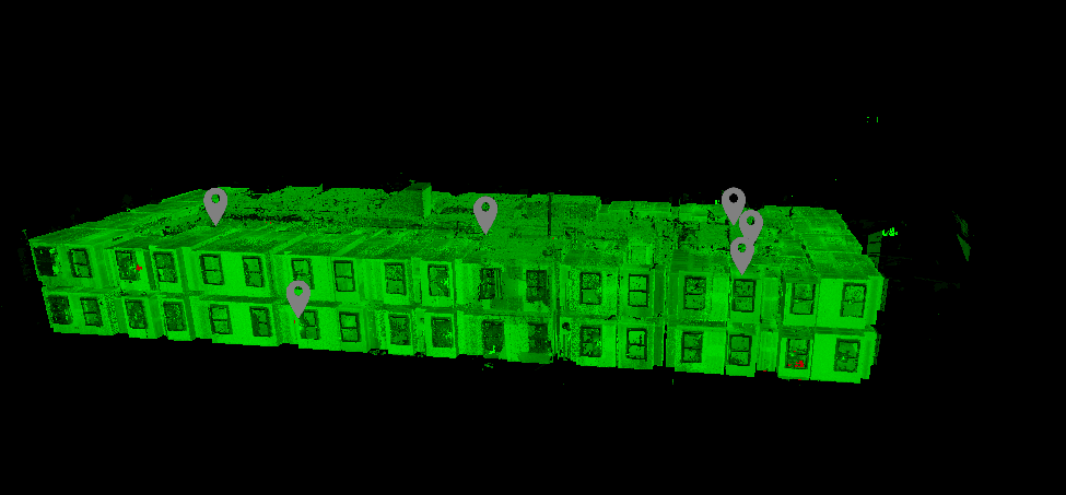
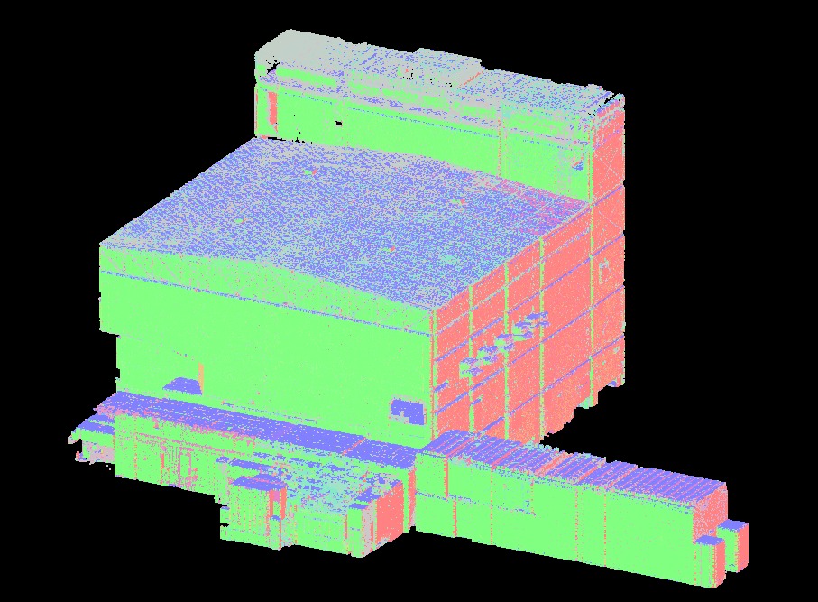


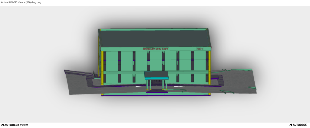

Substation scanning is not the same as building scanning. It requires electrical safety training, protocol-based field procedures, and an understanding of the equipment being documented. Arrival 3D brings all three to every project.
Every Arrival 3D substation project is executed under a documented electrical safety plan coordinated with the utility’s operations team. Approach distances, PPE requirements, and emergency procedures are established before any scanner leaves the vehicle.
Arrival 3D uses Leica P-Series and RTC360 scanners the industry standard for high-accuracy LiDAR capture. These instruments deliver ±2mm accuracy at ranges sufficient to capture all equipment from safe standoff distances in any substation configuration.
Arrival 3D has completed scanning projects at power plants, substations, transmission infrastructure, and industrial energy facilities across the United States. We understand the operational constraints, safety culture, and documentation requirements of the utility industry.
Every substation project receives a fixed-fee estimate before work begins. Scope, deliverables, timeline, and cost are documented in writing so your engineering team and procurement department both know exactly what they’re getting.
Our substation deliverables are produced specifically to be usable in your engineering workflow whether that’s AutoCAD, Revit, MicroStation, PDS, or a GIS platform. We coordinate with your engineering team on format requirements before starting data processing.
Arrival 3D mobilizes to substation projects anywhere in the United States. Whether your facility is in a major metro or a remote rural location, we have the logistics and field resources to execute your project on your schedule.
Arrival 3D serves the full spectrum of power generation and transmission infrastructure from individual substation scanning to complete plant documentation programs.
Arrival 3D’s Leica LiDAR systems achieve ±2mm positional accuracy sufficient for verifying electrical safety clearances against IEEE Standard 1427 phase-to-phase, phase-to-ground, and personnel approach boundaries. This accuracy level allows engineers to measure actual clearances from the office using the point cloud, without requiring anyone to enter the energized zone with a tape measure or measuring pole. Results can be directly compared to minimum clearance tables for the facility’s voltage level and BIL.
Yes. Terrestrial LiDAR scanning can be performed on fully energized, live substations without requiring lockout/tagout procedures or service interruption. Because the scanner operates from a safe standoff distance and does not physically contact any equipment, it avoids the need to de-energize the substation. Arrival 3D’s project managers follow all NFPA 70E and OSHA electrical safety protocols, maintaining all required approach distances from energized conductors at the facility’s specific voltage level throughout the scanning operation.
A typical distribution substation (1–5 acres, 69kV or below) can be fully scanned in 4–8 hours of field time. Larger transmission substations (115kV–500kV) with multiple transformer banks and complex bus configurations may require one to two field days depending on site size and number of required scan positions. Extra-large or multi-bay EHV facilities may require additional time. Data processing and deliverable production takes 5–15 business days depending on the scope and type of deliverables required. Scanning can be scheduled around peak load periods or planned outage windows.
A complete substation 3D scan documents all physically visible assets including power transformers, autotransformers, circuit breakers, disconnect switches, bus bars, insulators, capacitor banks, reactors, potential transformers (PTs), current transformers (CTs), surge arresters, station service transformers, control buildings, cable trays, conduit runs, equipment foundations and pads, structural steel, shield wires, security fencing, access roads, and above-grade grounding conductors. Equipment mounted inside enclosed switchgear cubicles that are not accessible during a live scan would require a separate de-energized session for interior documentation.
Most electrical substations were originally constructed using hand-drawn paper plans that were never digitized. Over decades of operation, equipment has been replaced, upgraded, and repositioned transformer banks swapped for larger units, protection systems upgraded, bus configurations extended, and new equipment added without consistent updates to the original drawings. The cumulative effect over 20 to 50 years is a significant divergence between what paper drawings show and what actually exists in the field. For many utilities, the most accurate record of an aging substation’s current configuration is what can be seen by looking at it which is exactly what LiDAR scanning captures.
When a power transformer needs replacement with a larger-capacity unit, engineers must verify the new transformer fits within existing clearance envelopes. If the substation is congested a common situation in urban substations this means verifying phase-to-phase clearances with adjacent equipment, checking that the new transformer’s radiator bank doesn’t encroach on adjacent bus bars, confirming foundation dimensions accommodate the new unit, and ensuring adequate clearance for oil containment equipment. LiDAR scanning documents the precise position of all surrounding equipment and structures, allowing engineers to model the new transformer’s footprint and height directly into the point cloud or 3D model, identifying any clearance conflicts digitally before the new unit is procured or before construction crews are mobilized.
Terrestrial LiDAR scanning uses a tripod-mounted scanner positioned at multiple locations around the substation yard to capture detailed close-range data of equipment, structures, and spatial relationships at ±2mm accuracy. It excels at capturing equipment geometry, bus bar heights, foundation dimensions, and clearance-critical dimensions. Drone (UAV) LiDAR is deployed for large transmission substations, site surveys covering the complete property including perimeter fencing and access roads, aerial orthomosaics, and capturing transmission lines and their span geometry approaching the station. For most substation engineering applications, terrestrial LiDAR is the primary method because it captures the equipment-level detail that designers and engineers need. Arrival 3D uses both technologies and selects the optimal approach or a combined method based on substation size, complexity, and project data requirements.


