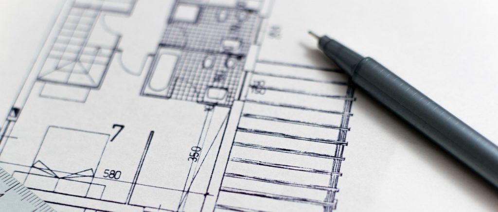
Tape measures are used from generations for capturing distances and dimensions on construction sites. They had been one the staples in the tool kit of multiple professionals like construction workers, architects, engineers, surveyors, and even DIY enthusiasts. A tape measure is one of the simplest, inexpensive, and portable methods used to measure manufacturing facilities and renovation projects.
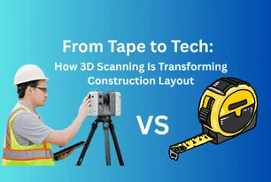
However, with the growth in complexity and increase in demand for accuracy & speed, traditional measurement tools are struggling to cope. This delay creates a huge gap which is being filled by the use of advanced technologies like 3D Laser scanners. These 3D scanners are much superior to the age-old technique of Tape measuring. They produce images by using LiDAR technology which uses lasers, reflections, and refraction to achieve millimeter accuracy.
Multiple professionals like Engineers and fabricators have faced the dilemma where they measured some space for hours using Tape and designed space accordingly, but then it just didn’t fit. Countless designers have fallen into this trap and ended up spending extra time and money while making field adjustments to fit everything up.
The Evolution of measurement
The measurement tools have evolved a lot in past decades which shows the growth in complexity of our built environments. This evolution marks a fundamental shift in the measuring methods from linear to fully spatial. The innovations have changed the way we work to a better, richer, and more detailed data. But we should also always remember that no matter how much advancement these tools bring, the surveyor’s experience, judgment, and intuition are non-replaceable.
Tape Measures

Tape measures have been one of the default tools used for measuring physical spaces. This tool is very simple in design and easy to use, even for a beginner. They work by physically extending a metal or fabric strip between two points to determine a straight-line distance. Using tape measure is effective only for basic tasks like checking the width of a door or the height of a ceiling, tape measures offer only one dimension of information at a time.
This method does not work well when we have to lay out bigger or more detailed spaces. Having collections of angled or irregular walls, plus columns, beams, and other architectural parts in a room, means dozens or even hundreds of different points need to be measured. This poses a problem of time wastage as well as a risk of individual errors. It only takes one error to produce inaccurate results throughout a project.
Tape measuring also requires us to be present at every point which can be tough if we are dealing with ladders, climbing scaffolding, or squeezing into spaces that are hard to reach. This process becomes more complicated whenever the building is in an unsafe, sensitive, or structurally deficient spot.
3D Laser Scanning

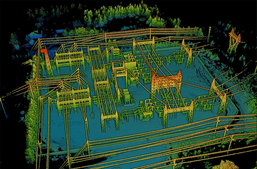
3D Laser scanning is now a regularly used technology for surveying complex structures and spaces that are difficult or dangerous. Using 3D Laser Scanning or 3D LiDAR scanning, we can collect much more information about the space than tape measures, ladders, or blueprints. We can take so many measurements in one scan that we can build a perfect digital twin of the area. There are various types of 3D scanning technologies such as LiDAR, terrestrial laser scanning, and structured light scanners. All these scanners share the same goal of digitizing reality with exceptional precision.
But scanning is only a small part of the work to be done. Interpreting point clouds and transforming them into useful models or decisions takes practice and actual application. It’s possible that a scan would indicate a small wall or floor irregularity but it’s the job of the surveyor to tell if these are common problems or real concerns.
One of the major benefits of using 3D laser scanning is that it can help find problems that the human eye might overlook until they become serious. But deviation is not always a problem to worry about as materials can shift, buildings settle over the years and nothing built is completely regular. That is why it is so important to understand how a building was built, how long it has stood, the conditions in the surrounding area, and what the client wants before concluding. If we don’t have that insight, it’s easy to misunderstand the data.
The need for human element
Scanning technology is advancing as we speak of it, developing into faster, easier-to-carry, and AI or BIM-integrated scanning equipment. We can measure and model more information than was thought possible in the past. The reality is that data alone doesn’t reveal anything. With a laser scanner alone, we won’t learn if the warped beam is an important issue or just an aesthetic one. They won’t bother you with more questions and they won’t look surprised at things that seem awkward. It’s here that the knowledge of a person who has experience from numerous projects guides us to turn the data into workable recommendations.
Drones
Drones offer a new perspective to us in the form of a bird’s-eye view of the site. They capture high-resolution images of places we would be able to see easily with additional effort. Using drones efficiently requires proper training and knowledge about the context to understand the images from above. For instance, a drone could identify a bad chimney stack, but it depends on the professional to decide if it’s serious and what led to it. It is then that the experience comes in, for looking at things and understanding their significance for the property and the buyer.
Thermal imaging
Thermal imaging allows us to identify problems that just aren’t visible to the naked eye like damp spots, areas without insulation, or unexpected cold bridges. Thermal cameras detect even small temperature changes and not all of them point to an issue. As always, reading these photographs is a skill gained with practice. The professionals need to consider the building materials, recent weather, and what the property is used for each day. If we don’t have evidence, it is simple to reach the wrong judgment.
The Shift in Thinking
The advanced technique of 3D Laser scanning turns the measurements into a data-rich experience that is not only about dimensions but also about the context and accuracy. This technology is changing the mindset from “collecting data to create a model” to “capturing the entire space as a model”. This change of perspective allows professionals like architects, engineers, and contractors to get a better understanding of the interplay between the spatial elements and make more informed decisions. Thus, 3D Laser scanning didn’t just replace tape measures but it redefined what it means to measure.
In the specific context of the AEC industry, this shift is monumental as when the teams are working on a 3D scan, they are no longer designing or building from incomplete data. Now the teams are working with real-life conditions with millimetre accuracy.
Future of the Construction Industry
The future of the construction industry is transforming by the global adoption of 3D Laser scanning with its precision, efficiency, and digital integration. While traditional methods with their reliance on manual tools are useful for basic measurements, 3D laser scanning directly captures the entire environment and converts them into usable digital twin models. This technology allows architects, engineers, and contractors to work with real-world data from the very start of a project, minimizing errors and reducing costly rework.
Using 3D laser scanning helps to finish the design and planning process more quickly. With this information, engineers and architects can make accurate BIM models to keep the project lines up with real features at the construction site. It allows teams to work together smoothly and find likely problems ahead of starting the actual construction.
Technology like this will be useful for renovating buildings and doing retrofits. Using laser scanning, experts can measure existing structures accurately which will help them design new changes and updates without running into problems later.
Conclusion
These advanced technologies have transformed the way we work towards bridging the gap between raw data and real-world decisions. This involves knowing the industry, understanding how buildings are built, and presenting the findings clearly to clients, contractors, and all stakeholders. Effective use of these tools depends on the skills of the people involved. What works best is when advanced technology and real expert knowledge work together.