
For most of its history, 3D laser scanning had one job. Capture what exists, hand over a point cloud, move to the next project. That’s still valuable work, and it will stay valuable. But the ceiling on what a single scan can produce has risen considerably.
The shift is happening because digital twins, IoT sensors, simulation software, and industrial AI are no longer experimental. They’re showing up in production facilities across the country, and every one of them needs the same thing underneath: accurate spatial data about the physical world. Reality capture is quietly becoming the layer everything else gets built on.
What Changes When One Scan Feeds Multiple Outcomes?
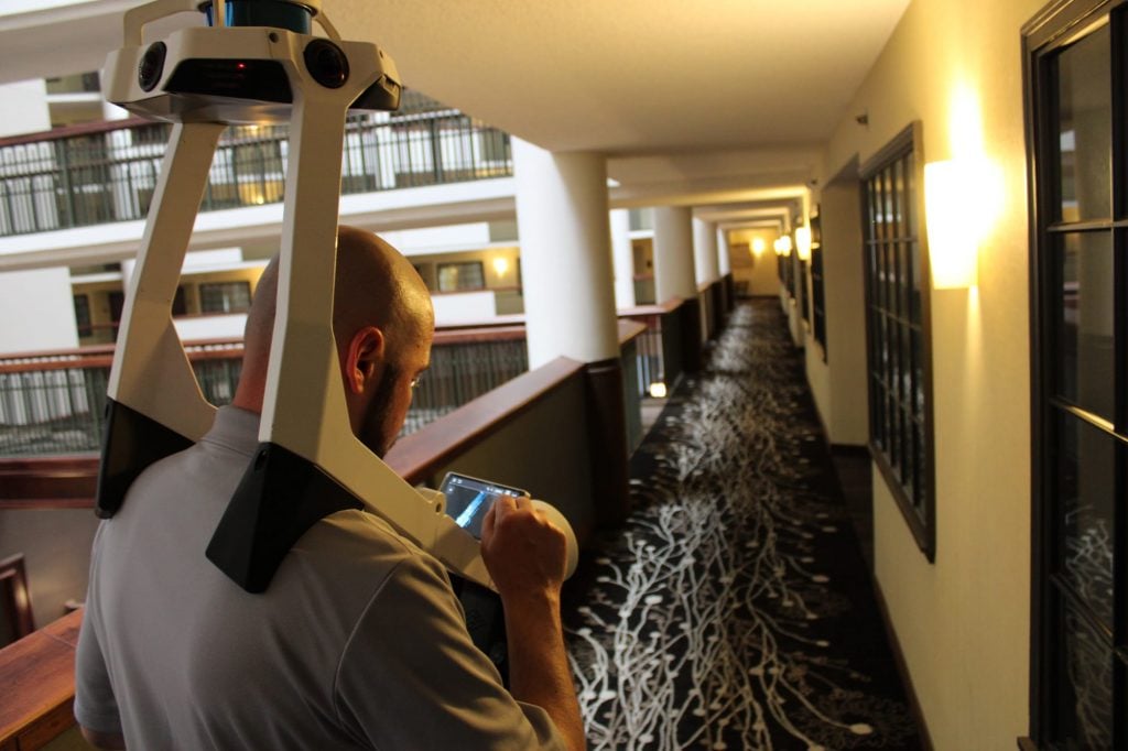
A single comprehensive scan of a manufacturing plant, a data center, or a processing facility captures structural elements, piping, MEP systems, and equipment in one pass. That dataset doesn’t have to stop at a 2D drawing or a BIM model.
The same point cloud can become 2D drawings for permitting, a Revit BIM model for coordination, an asset register for facility management, and eventually the geometric foundation for a full digital twin. None of these have to be separate projects with separate scans. They can all trace back to one accurate capture of the facility as it actually exists.
That’s a real change in how the economics work. A Houston refinery that scans a process unit for turnaround planning isn’t just buying a planning tool. It’s buying a dataset that can also support asset management, emergency response documentation, and eventually a live operational model, all from the same field time.
How Does a Digital Twin Change What a Facility Can Answer?
A BIM model answers a fairly narrow question well: what does this facility look like, and what does it contain? That’s genuinely useful for design, construction, and coordination.
A digital twin pushes past that. Once a model connects to equipment data, maintenance records, and live sensor feeds, the question stops being purely descriptive. It becomes operational. What’s happening in this facility right now. What’s likely to happen next. Where’s the actual opportunity to improve something before it becomes a problem?
That’s the difference between a static reference and a working tool. Facility teams that have both tend to use the BIM model during a project and the digital twin every day after.
Where Does Industrial AI Actually Fit Into This?
AI needs clean, structured data to do anything useful, and a lot of the industrial world simply doesn’t have it. Engineering drawings that don’t match field conditions, asset records that live in three different systems, and maintenance history nobody trusts. AI applied to bad spatial data just produces confident wrong answers faster.
Reality capture solves the input problem. A verified point cloud provides simulation and AI tools with an accurate starting point rather than an assumed one. Picture a plant considering a new production line. Instead of working from decades-old drawings and a handful of field measurements, engineers can start from an accurate scan, check clearances against real geometry, run clash detection before anything gets fabricated, and test a few configurations digitally before committing budget to any of them.
None of that requires exotic technology. It requires the industry to stop treating a scan as the finish line and start treating it as the starting point for everything downstream.
Why Should Continuous Scanning Replace One-Time Capture?
Facilities don’t hold still. Equipment gets replaced, piping gets rerouted, production lines move, and every one of those changes quietly widens the gap between the model and reality. A digital twin that never gets refreshed eventually stops being a digital twin. It’s just an old drawing with better graphics.
The workflow that makes more sense looks less like scan, deliver, done, and more like scan, build, operate, update, rescan the areas that changed, and keep the model current. That’s a genuine shift from project-based scanning toward an ongoing facility data strategy, and it’s the direction data center operators and large industrial clients are already moving, since their environments change too fast for a one-time snapshot to stay relevant for long.
Who Actually Benefits From a Single Reality Capture Dataset?
This is where the value compounds. A well-executed scan doesn’t just serve the engineering team that requested it. The same spatial dataset can support architecture and design, construction verification and progress tracking, facility management’s asset location needs, maintenance planning, operations and workflow optimization, safety and site access planning, and eventually the digital twin and AI teams building on top of all of it.
Most organizations still scan once and hand the data to one department. The facilities getting the most out of reality capture are the ones treating that same dataset as shared infrastructure across every team that touches the building.
What Should Facility Owners Ask Their Scanning Partner Now?
The honest question isn’t just how accurately a company can scan a facility anymore. It’s how much long-term value can actually be built from the data once it’s captured. A vendor that hands over a point cloud and disappears is solving yesterday’s problem.
The better question to ask: does this partner build BIM models from the same scan, maintain the data long-term, support asset tagging, and understand how the dataset needs to evolve if a digital twin becomes part of the roadmap. That’s a different relationship than a one-time site visit, and it’s the direction the industry is heading whether individual vendors adapt to it or not.
Frequently Asked Questions
What is the difference between a point cloud and a digital twin?
A point cloud is the raw captured data, millions of measured points representing a facility’s geometry. A digital twin is a connected, ongoing model built from that data, linked to real-time information like sensor feeds, equipment status, and maintenance records.
Can one laser scan support multiple departments in a facility?
Yes. A single comprehensive scan can serve engineering, facility management, maintenance, operations, and safety teams simultaneously, since each group can pull different deliverables, drawings, BIM models, and asset registers from the same underlying dataset.
Why does a digital twin need to be updated after the initial scan?
Facilities never really sit still. Equipment gets swapped out, renovations happen, systems get modified, and every one of those changes quietly pulls the twin further from reality. Skip the refresh cycle long enough, and it’s not really a digital twin anymore, just an old model with good graphics.
How does AI use data from 3D laser scanning?
AI and simulation tools are only as good as what’s feeding them. Hand them a verified point cloud, and they can model existing conditions, test proposed changes, and catch conflicts before anyone breaks ground. Hand them outdated drawings or a best guess, and that’s exactly what comes back out the other side.
Is continuous scanning more expensive than a one-time scan?
Not usually, no. Rescanning just the areas that actually changed costs a fraction of redoing the whole facility. Nobody needs to recapture a building that hasn’t moved just to update the one wing that did.
The Scan Is the Starting Point, Not the Deliverable
The facilities getting the most value out of reality capture aren’t the ones asking for a faster scan. They’re the ones asking what else that data can become. BIM, asset intelligence, a digital twin, and eventually AI-driven operations all of it traces back to the same accurate spatial foundation.
Arrival 3D builds that foundation first, then works with clients on where it goes next, with a fixed-price quote returned within 48 hours of scoping the project.