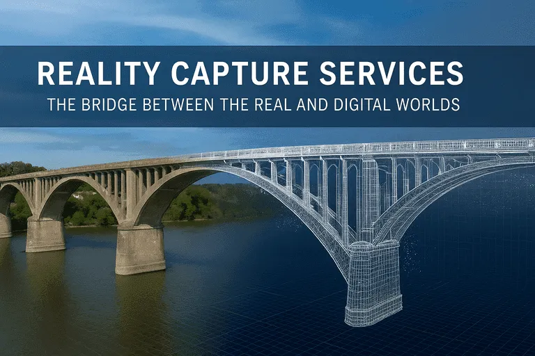
We live in a world full of buildings, roads, and open spaces where these places keep changing with the passage of time. However, we can’t plan or build effectively unless we know what is already there. That’s where reality capture services make a difference for us.
These services scan real places and turn them into digital data which in turn, helps people design, plan, and build more efficiently. Whether it’s one room or an entire neighborhood, reality capture provides a clear view of every corner.
We explore what these services are, and what problems they solve for the users by detailing reality capture services below:
Reality Capture Basics: Definition, Process, and Real-World Benefits
Reality capture means using tech tools to scan a place and create a 3D digital copy. These services are analogous to taking photos, but much more as the scan includes shapes, sizes, and surface details accurately. This digital version helps improve designs and fix older structures simultaneously.
The main tools used include 3D laser scanners, LiDAR, drones, cameras, and mobile scanning apps with some of these tools using light reflection and others simply capturing photos. The goal of these tools is to turn the real world into digital formats that support smart planning and effective implementation.
These tools record details such as ceiling heights, pipes, and wires, as well as ducts, stairs, roof slopes, and even surface cracks. Moreover, everything from terrain to machinery can be captured efficiently without hassle.
How 3D Laser Scanning Works: Turning Real Spaces into Digital Data
3D laser scanning is one of the most trusted ways to capture space as it shoots out light, waits for it to bounce back, and records that time. Every point it scans becomes part of a digital map.
This result is called a point cloud, which is a cluster of millions of dots that form a 3D view of the scanned space. It’s highly accurate and works well both indoors and outdoors, keeping workers safe, since scans can be done from a distance.
The scanner either moves from room to room or sweeps across large sites ensuring users get a full visual of the area like never before.
Top LiDAR, Drone, and Mapping Tools for Reality Capture
Drones help scan places where people can’t reach, making it quick and lowering the risk. They utilize photos or LiDAR to gather data which is especially useful for scanning bridges, towers, roofs, and large open spaces.
LiDAR, often used from the air, works like sonar, but with light by bouncing light off a surface. This helps map roads, railways, forests, and changes in terrain as it also supports flood risk analysis.
How to Convert Point Clouds to BIM Models
A point cloud is like a 3D dot drawing with dots combining together to show the full scene. These dots hold no lines or shapes but when processed, they turn into drawings and 3D models.
Point clouds help make BIM models, CAD files, floor plans, elevations, and even virtual tours. BIM, which is short for Building Information Modeling, goes beyond 3D shapes as It includes information like wall type, glass type, pipe layouts, and electrical systems. These models allow teams to detect issues early, plan smarter, and avoid clashes later during construction.
From Scan to CAD
CAD, which means Computer-Aided Design helps make drawings from a point cloud as It’s used to make simple 2D drawings from scan data. In cases where full 3D models are not needed, CAD is quicker and easier to share.
Uses include:
- Planning layout changes
- Checking for clearance
- Getting permits
- Small design jobs
Why As-Built Drawings Matter
These drawings are critical for relevant repairs, system upgrades, lease checks, and making safety plans. Construction plans help in showing what should be built but reality often changes as workers may shift pipes or updates could be missed.
That’s why as-built drawings from scans are useful as they show what’s really there and not just what the plan says arbitrarily. These drawings offer exact dimensions, hidden systems, and the current placement of doors and beams. They are useful for repairs, system upgrades, lease documents, and safety checks to make sure that nothing is left to guesswork.
They help in identifying:
- Verified dimensions
- Hidden pipe locations
- Real door and beam placement
- Clarity before renovation
How Digital Twins Are Transforming Building Visualization
A digital twin is more than just a model that acts like a real place and uses live data that comes from sensors, cameras, or meters. It shows real-time updates about what’s happening without any unnecessary delay.
Digital twin creation uses scanned data to build this system as it’s a growing need for large campuses, airports, malls, and factories.
Uses include:
- Energy use tracking
- Air quality checks
- Staff flow patterns
- Safety checks
Common Challenges in Reality Capture Projects And How to Avoid Them
Even smart tech has its vast array of challenges such as people forgetting to plan, using the wrong scanner, scanning in poor light, or missing certain spots. Also, scanned files can be large and hard to manage.
To avoid these problems, teams must walk through the site before scanning. They should use the right tools and scan in daylight or with extra lights. Capturing multiple angles improves accuracy as It’s also wise to review the point cloud on-site before leaving. Keeping files clean and organized is key as simple training for the team also helps avoid repeat errors.
From Big Sites to Small Spaces: What Reality Capture Can Do
Reality capture isn’t just for big buildings as It helps small spaces too. Firms that offer all of these under one roof help avoid errors and delays strengthening their place in the market. One doesn’t need to go back and forth between vendors as one team handles it all, saving time and avoiding errors between vendors.
The top services include:
- Scan to 2D drawing
- Scan to BIM Services
- Topographic surveys
- Architectural modeling
- Construction 3D modeling
- Structural 3D scanning
Handheld and Mobile Scanning
For tight spaces like kitchens or small shops, phones or tablets with mobile scanners do the job in minutes as It’s fast and doesn’t cost much unlike large equipment gear. Mobile 3D scanning is perfect for designers, home projects, and small renovations. One can get accurate results without extra time or high cost.
3D Scanning for Existing vs. New Buildings: Use Cases & Methods
Old buildings may have no updated drawings and new ones may have incorrect blueprints. This ensures that In both cases, reality capture services help create a clear picture as the scan removes the guesswork and saves time.
This helps architects, builders, property owners, and inspectors work better and even city planners use these tools for quicker results.
Different industries use reality capture in their own way such as:
- Retail: to change store layouts.
- Hospitals: to scan for upgrades.
- Schools: for safety checks.
- Power plants: for equipment layouts.
- Hotels: for room redesigns.
- Real estate: for virtual property tours.
Choosing The Right Reality Capture Provider
Not every firm does the job well; rather only the best ones offer full services from scanning to final files in a detailed and quality-oriented manner. When choosing a provider, ask about scan accuracy, past work samples, file formats, and BIM or CAD services.
Also, enquiring about their delivery speed is important since it avoids delays in the projects. A competent provider will convert scan data into actionable files immediately leading to an enormous competitive edge.
Long-Term Value
Scanned files aren’t just useful once as they can be reused for years. Over time, this data helps run emergency drills, check systems behind walls, train new staff, and create digital records.
Conclusion: Trends, Tech & Future of Reality Capture
The future of this field is changing faster by the day as new trends emerge that clean and organize scan data. Soon, scans will turn into BIM models instantly and this will reduce the time between capture and use. As tools improve, we’ll see fewer errors and smoother planning ensuring the gap between scan and model shrinks for the better.
Reality Capture Services aren’t just a tool, rather It’s how we build smarter in an unprecedented manner. Reality capture helps with everything, may it be small homes or even large airports. Its use will shape how we build tomorrow and that future starts today for Reality Capture Services.